Mount Maines
| Mount Maines | |
|---|---|
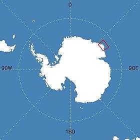 Map of Antarctica indicating location of Mount Maines | |
| Highest point | |
| Elevation | 2,190 m (7,190 ft) |
| Coordinates | 66°39′S 53°54′E / 66.650°S 53.900°ECoordinates: 66°39′S 53°54′E / 66.650°S 53.900°E |
| Geography | |
| Location | Enderby Land, Australian Antarctic Territory, East Antarctica |
| Parent range | Napier Mountains |
| Geology | |
| Age of rock | 2837 million years (Archaean eon) |
| Mountain type | Metamorphic |
| Climbing | |
| Easiest route | basic snow/ice climb |
Mount Maines, also known as Stornuten, is a mountain, 2,190 metres (7,190 ft), standing roughly 13 kilometres (8.1 mi) SE of Stor Hånakken Mountain and 10 kilometres (6.2 mi) W of Mount Elkins in the Napier Mountains, Enderby Land.[1]
Discovery and naming
Mount Maines was mapped by Norwegian cartographers from air photos taken by the Lars Christensen Expedition, 1936–37, and named Stornuten (the big peak). Rephotographed by ANARE in 1956 and renamed by ANCA for R.L. Maines, cook at Wilkes Station in 1961.[1]
See also
References
- 1 2 "Mount Maines". Geographic Names Information System. United States Geological Survey. Retrieved 2011-11-30.
External links
- United States Geological Survey, Geographic Names Information System (GNIS)
- Scientific Committee on Antarctic Research (SCAR)
- Composite Gazetteer of Antarctica
![]() This article incorporates public domain material from the United States Geological Survey document "Mount Maines" (content from the Geographic Names Information System).
This article incorporates public domain material from the United States Geological Survey document "Mount Maines" (content from the Geographic Names Information System).
| General | .svg.png) | |
|---|---|---|
| Geographic regions | ||
| Waterways | ||
| Famous explorers | ||
This article is issued from Wikipedia - version of the 3/30/2016. The text is available under the Creative Commons Attribution/Share Alike but additional terms may apply for the media files.