Mount Mahawu
| Mount Mahawu | |
|---|---|
 Mount Mahawu Sulawesi, Indonesia | |
| Highest point | |
| Elevation | 1,324 m (4,344 ft) [1] |
| Coordinates | 1°21′29″N 124°51′29″E / 1.358°N 124.858°ECoordinates: 1°21′29″N 124°51′29″E / 1.358°N 124.858°E [1] |
| Geography | |
| Location | Sulawesi, Indonesia |
| Geology | |
| Mountain type | Stratovolcano |
| Last eruption | November 1977 |
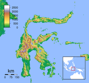
Mount Mahawu is a stratovolcano located immediately east from Lokon-Empung volcano in North Sulawesi, Indonesia. The volcano is capped with 180 m wide and 140 m deep crater with two pyroclastic cones in the northern flanks. A small explosive eruption was recorded in 1789. In 1994, fumaroles, mudpots and small geysers actitivies were observed along the greenish shore of a crater lake.[1]
See also
References
- 1 2 3 "Mahawu". Global Volcanism Program. Smithsonian Institution. Retrieved 2006-12-31.
External links
This article is issued from Wikipedia - version of the 2/16/2016. The text is available under the Creative Commons Attribution/Share Alike but additional terms may apply for the media files.