Mount Leuser
| Mount Leuser | |
|---|---|
| Highest point | |
| Elevation | 3,466 m (11,371 ft) |
| Prominence | 2,941 m (9,649 ft) |
| Isolation | 756 kilometres (470 mi) |
| Coordinates | 3°44′29″N 97°9′18″E / 3.74139°N 97.15500°ECoordinates: 3°44′29″N 97°9′18″E / 3.74139°N 97.15500°E |
| Geography | |
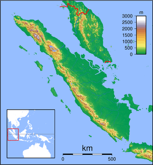
| Location | Sumatra, Indonesia |
| Parent range | Leuser Range, Aceh |
Mount Leuser is one of three prominent peaks on the Leuser Range in the Indonesian province of Aceh. The range lies to the south and west of the Alas River that flows east from the Gayo highlands of central Aceh before turning south through Karo Batak country in North Sumatra province. The Leuser region is of ancient uplifted formations - it is non-volcanic. The region is billed as the largest wilderness area in South-East Asia. This entry establishes the names, altitudes, locations and prominence of the three peaks, 'Tanpa Nama', Loser and Leuser, on the Leuser Range. It is often assumed, incorrectly, that the highest peak is Mount Leuser when in fact it is Mount 'Tanpa Nama'. Mount Leuser is the lowest of the three peaks.
Peaks on the Leuser Range
BAKOSURTANAL, the Indonesian Survey and Mapping Agency, provides the names and locations of Loser and Leuser on their topographical maps.[1] The Gunung Leuser National Park (GLNP) authorities have adopted these names and locations.[2] In addition, GLNP identifies the general location of Mount 'Tanpa Nama'.
The altitude, coordinates and prominence of the three summits[3] are:
- 'Tanpa Nama' (true summit)): 3,466 m (11,317 ft); 3.7976 N (3°47'51"N), 97.1218 E (97°13’9”E); prominence 2,940 m (9,646 ft)
- Loser: 3,404 m (11,178 ft); 3.7567 N (3°45'24"N), 97.173 E (97°10’24”E); prominence 319 m (1,047 ft)
- Leuser: 3,119 m (10,348 ft); 3.7413 N (3°44'29"N), 97.1551 E (97°9’18”E); prominence 107 m (351 ft)
Mount 'Tanpa Nama'
Mount 'Tanpa Nama' is the second highest peak in Sumatra after Mount Kerinci (3,805 m, 12,484 ft).[4] The peak lies inland from the escarpment, is easy to climb and offers spectacular views in all directions. The mountain has two knolls: a painted sign on the lower knoll (3,455 m, 11,335 ft) reads “Puncak Tanpa Nama” (summit of Mount 'Tanpa Nama'). On the higher, more prominent knoll to the north-east, the true summit (3,466 m, 11,371), a plague embedded in a cement block reads, “Prof Dr Syamsuddin Mahmud, Governor Aceh, 1997 ...”.
The name, Gunung 'Tanpa Nama' (Indonesian), literally means mountain 'without a name’, and is used locally in the absence of a formally recognised name. BAKOSURTANAL does not attribute a name to this peak on its 1977 map series; only the altitude of the lower knoll is indicated. A formal name may appear if and when BASKOSURTANAL issues new topographical maps of Sumatra.
Mounts Loser and Leuser
Mounts Loser and Leuser, by comparison with Mount 'Tanpa Nama', rise from the east with precipitous drop-offs on their western faces over the rugged escarpment towards the west coast of Aceh. Most trekkers set Mount Loser as their objective being the higher and more accessible of the two peaks. Both offer spectacular views.
The origin of the names, Loser and Leuser, are obscure. One source[5] informs that Leuser is a Gayo word meaning, “place where animals go to die”. Local folk lore[6] provides a not-unrelated story: a Dutch officer was hunting deer on the Leuser Range in colonial times and accidentally shot his hunting partner on the Loser peak. The porters, accompanying the party, used the Gayo word, los, meaning “dead” to describe the fate of the partner; Mount Loser thus acquired its name. But how Leuser acquired its so-closely-related name remains unclear.
References
- ↑ BAKOSURTANAL topographical map series 50-0-ed, 0519-63, scale 1:50,000, 1977 (to be checked)
- ↑ Brochure: Pendakian Gunung Leuser 3,119 MDPL (Climbing Mount Leuser 3,119 m ASL), Bali Besar Taman National Gunung Leuser (Mount Leuser National Park Headquarters), www.gunung leuser.or.id
- ↑ BAKOSURTANAL data where available; otherwise GPS recordings; details subject to correction.
- ↑ http://www.gunungbagging.com/ - Climbing the Mountains of Indonesia
- ↑ The Ecology of Sumatra. Periplus. 2000. p. 310.
- ↑ Pers Com., Mr. Rajajalli, guide/operator, Rain Forest Lodge, Kedah, www.gunung-leuser-trek.net