Mount Lawit
| Mount Lawit | |
|---|---|
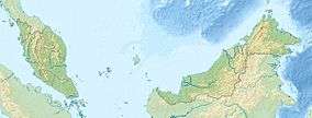 Mount Lawit Location on Indonesia–Malaysia border | |
| Highest point | |
| Elevation | 1,767 m (5,797 ft) |
| Coordinates | 1°24′N 112°58′E / 1.400°N 112.967°ECoordinates: 1°24′N 112°58′E / 1.400°N 112.967°E |
| Geography | |
| Location | Indonesia – Malaysia border |
Mount Lawit (Gunung Lawit) is a mountain on the island of Borneo. It is 1767 metres tall and sits on the international border between Indonesia and Malaysia. On the Indonesian side of the border, the mountain is within the Betung Kerihun National Park.
This article is issued from Wikipedia - version of the 7/29/2015. The text is available under the Creative Commons Attribution/Share Alike but additional terms may apply for the media files.