Mount Kit Carson
| Mount Kit Carson | |
|---|---|
 Mount Kit Carson | |
| Highest point | |
| Elevation | 5,286 ft (1,611 m) NAVD 88[1] |
| Prominence | 322 ft (98 m) [1] |
| Coordinates | 47°55′02″N 117°08′31″W / 47.9171207°N 117.1418732°WCoordinates: 47°55′02″N 117°08′31″W / 47.9171207°N 117.1418732°W [2] |
| Geography | |
| Location | Spokane County, Washington, U.S. |
| Topo map | USGS Mount Kit Carson |
| Climbing | |
| Easiest route | Trail hike |
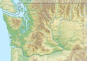
Mount Kit Carson is a mountain located northeast of Spokane, Washington with and elevation of 5,286 feet (1,611 m)). It is in Mount Spokane State Park, the largest of Washington's State Parks at 13,919 acres (5,633 ha).
On September 10, 1962, a KC-135 was descending in for a landing at Fairchild Air Force Base when it flew into a fog shrouded ravine on Mount Kit Carson. Forty-four people were killed in the accident. It was the worst aviation accident in U.S. history (at the time) and as of October 2012, remains the 3rd worst accident (currently) involving a KC-135.[3][4]
References
- 1 2 "Mount Kit Carson, Washington". Peakbagger.com. Retrieved February 20, 2014.
- ↑ "Mount Kit Carson". Geographic Names Information System. United States Geological Survey. Retrieved February 20, 2014.
- ↑ Camden, Jim (September 9, 2012). "50 years ago, 44 men died when KC-135 crashed before landing". The Spokesman-Review. Retrieved November 1, 2012.
- ↑ Accident description for Boeing KC-135A-BN Stratotanker 60-0352 Spokane, WA at the Aviation Safety Network. Retrieved on November 1, 2012.
External links
- "Mount Kit Carson". SummitPost.org.
This article is issued from Wikipedia - version of the 1/2/2016. The text is available under the Creative Commons Attribution/Share Alike but additional terms may apply for the media files.