Mount Grace State Forest
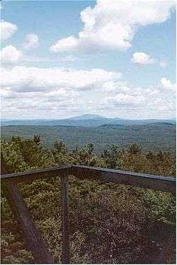
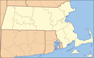
Mount Grace State Forest is a state forest with facilities for public recreation located in the town of Warwick, Massachusetts, managed by the Massachusetts Department of Conservation and Recreation. The forest is highlighted by 1,621-foot (494 m) Mount Grace,[3] the third highest point in the Commonwealth east of the Connecticut River after Mount Wachusett and Mount Watatic. It is bordered by portions of Warwick State Forest to the east and west.[4]
History
Mount Grace is said to have been named after the baby daughter of Mary Rowlandson, a woman captured by Wompanoag warriors during King Philip's War, who according to legend buried her deceased infant at the foot of the mountain during the march to Canada.[3]
By the turn of the 20th century, the mountain had been largely deforested, and conservationists, including former Warwick resident Dr. Paul W. Goldsbury, promoted the idea of having the state purchase it to create a state forest. Picnic and skiing facilities were built beginning in 1930,[5] after legislation for the purchase passed in 1920.[6]
The summit's 68-foot (21 m) fire lookout tower was built in 1939. It is the third tower to have been constructed on Mount Grace.[7]
Activities and amenities
Forest trails used for hiking, horseback riding, mountain biking, and cross-country skiing include a portion of the long-distance Metacomet-Monadnock Trail. The forest also offers picnicking and restricted hunting.[3]
References
- 1 2 "Mount Grace". Geographic Names Information System. United States Geological Survey.
- 1 2 "2012 Acreage Listing" (PDF). Department of Conservation and Recreation. April 2012. Retrieved January 19, 2014.
- 1 2 3 "Mount Grace State Forest". MassParks. Executive Office of Energy and Environmental Affairs. Retrieved January 24, 2014.
- ↑ "Mount Grace State Forest Map" (PDF). MassParks. Executive Office of Energy and Environmental Affairs. Retrieved January 24, 2014.
- ↑ Charles Morse, Warwick, Massachusetts: Biography of a Town (Cambridge: Dresser, Chapman, and Grimes, 1963), p. 179
- ↑ Massachusetts (June 4, 1920). "Chapter 606. An Act to Establish Mount Grace as a State Forest" (PDF). Acts, 1920. Retrieved September 8, 2015.
- ↑ "Warwick Fire Tower". National Historic Lookout Register. American Resources, Inc. and Forest Fire Lookout Association. Retrieved September 8, 2015.
External links
|
|---|
|
|
|
|
|
|
|
| Wildlife Management Areas |
|---|
| Wildlife
Management Areas | |
|---|
| Wildlife
Sanctuaries |
- Billingsgate Island
- Carr Island
- E. Howe Forbush
- Egg Rock
- Grace A. Robson
- J.C. Phillips
- Knight
- Penikese Island
- Ram Island (Salisbury)
- Ram Island (Mattapoisett)
- Susan B. Minns
- Tarpaulin Cove
- Watatic Mountain
|
|---|
|
|
|
| |
|---|
|
- Black Pond Bog
- Boat Meadow
- Francis Newhall Woods
- Grassy Pond
- Greene Swamp
- Halfway Pond Island
- Hawley Bog
- Hockomock Swamp
- Hoft Farm
- Homer-Watcha Preserve
- Katama Plains
- McElwain-Olsen
- Miacomet Moors
- Reed Brook
- Drury
- Sandy Neck
- David H. Smith Preserve and Fire Trail
- Stacy Mountain
- Tatkon
|
|
|
|
|
|
|
|
|
|