Mount Finlayson
| Mount Finlayson | |
|---|---|
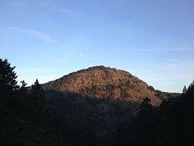 The west face of Mount Finlayson | |
| Highest point | |
| Elevation | 419 m (1,375 ft) |
| Prominence | 249 m (817 ft) |
| Coordinates | 48°28′58.1″N 123°32′18.9″W / 48.482806°N 123.538583°W |
| Geography | |
| Location | Vancouver Island, British Columbia, Canada |
| Parent range | Gowlland Range |
| Topo map | NTS 92B/05 |
Mount Finlayson is a 419 m (1,375 ft) mountain located on the border of Highlands and Langford, British Columbia, about 14 km northwest of Victoria. It is located within the Gowlland Range (part of the Vancouver Island Ranges). It is bordered by Goldstream Provincial Park and Gowlland Tod Provincial Park and forms an imposing feature looming above Saanich Inlet for those travelling south on the Malahat Drive portion of Highway 1. A steep trail leading up to the summit is easily accessible from Goldstream Park. There are also trails that link up to the summit from Bear Mountain.
From the top of the mountain there are views of the Greater Victoria area, Strait of Juan de Fuca, Olympic Mountain range and Mount Baker.
External links
- "Mount Finlayson". BC Geographical Names.
- Information from the Canadian Mountain Encyclopedia
- Photos of and from the mountain
This article is issued from Wikipedia - version of the 2/8/2015. The text is available under the Creative Commons Attribution/Share Alike but additional terms may apply for the media files.