Mount Aso
| Mount Aso | |
|---|---|
|
阿蘇山 あそさん Aso-san | |
 Central cone group of Aso caldera | |
| Highest point | |
| Elevation | 1,592 m (5,223 ft) |
| Coordinates | 32°53′04″N 131°06′14″E / 32.88444°N 131.10389°ECoordinates: 32°53′04″N 131°06′14″E / 32.88444°N 131.10389°E |
| Geography | |
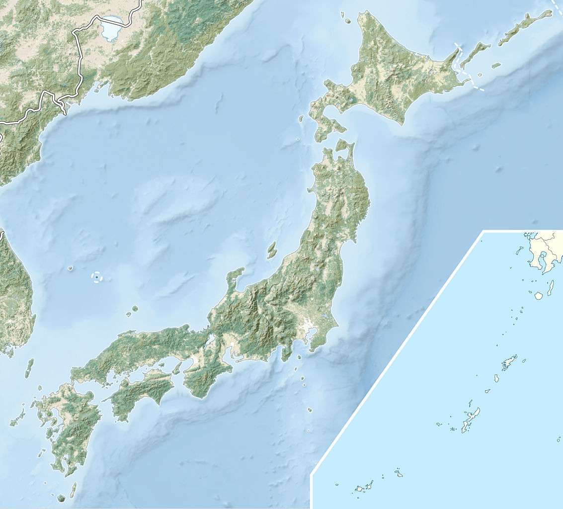 Mount Aso Kyushu, Japan | |
| Geology | |
| Mountain type | Caldera complex |
| Last eruption | October 2016 - Present |

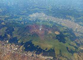
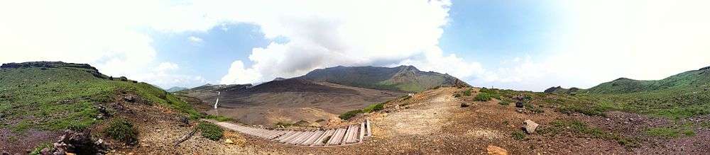
Mount Aso (阿蘇山 Aso-san) is the largest active volcano in Japan, and is among the largest in the world. It stands in Aso Kujū National Park in Kumamoto Prefecture, on the island of Kyushu. Its peak is 1,592 metres (5,223 ft) above sea level. Mt. Aso has a fairly large caldera (25 kilometres (16 miles) north-south and 18 km (11 mi) east-west) with a circumference of around 120 km (75 mi), although sources vary on the exact distance.
Geology

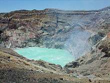
The central cone group of Aso consists of five peaks: Mt. Neko, Mt. Taka, Mt. Naka (also called Nakadake or Naka-Dake), Mt. Eboshi, and Mt. Kishima. The highest point is the summit of Mt. Taka, at 1592 m above sea level. The crater of Mt. Naka, the west side of which is accessible by road, contains an active volcano which continuously emits smoke and has occasional eruptions. Only the northernmost crater (the first crater) has been active for the last 70 years—1974, 1979, 1984–1985, 1989–1991,[1] 2009, 2011, 2015[2] and 2016.[3][4]
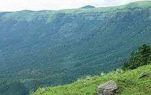
The present Aso caldera formed as a result of four huge caldera eruptions occurring over a range of 90,000–300,000 years ago. The caldera, one of the largest in the world, contains the city of Aso as well as Aso Takamori-cho and South Aso-mura. The somma enclosing the caldera extends about 18 km east to west and about 25 km north to south. Viewpoints from the somma overlooking the caldera are perched upon lava formed before the volcanic activity which created the present caldera. Ejecta from the huge caldera eruption 90,800 years ago covers more than 600 km3 and roughly equals the volume of Mount Fuji; it is presumed that the pyroclastic flow plateau covered half of Kyushu.
History
The eruption which formed the present somma occurred approximately 300,000 years ago. Four large-scale eruptions (Aso 1 – 4) occurred during a period extending from 300,000 to 90,000 years ago. As large amounts of pyroclastic flow and volcanic ash were emitted from the volcanic chamber, a huge depression (caldera) was formed as the chamber collapsed. The fourth eruption (Aso 4) was the largest, with volcanic ash covering the entire Kyushu region and even extending to Yamaguchi Prefecture.
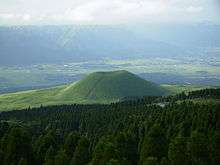
Mt. Taka, Mt. Naka, Mt. Eboshi, and Mt. Kishima are cones formed following the fourth above-mentioned huge caldera eruption. Mt. Naka remains active today. It is presumed that Mt. Neko is older than the fourth huge caldera eruption. Aso's pyroclastic flow deposits (welded tuff) were utilized for bridge construction in the region. There are approximately 320 arched stone bridges in Kumamoto Prefecture, including the Tsujun-kyo and Reitai-kyo bridges on the Midorikawa River, which are important national cultural properties.[1]
Climate
Mount Aso's climate data was taken at an elevation of 1,143 metres (3,750 ft).[5] At this elevation there is a transition between a humid subtropical climate and a humid continental climate (Köppen climate classification Cfb/Dfb) with warm summers and cold winters. Precipitation is high throughout the year, and is extremely heavy in June and July with over 500 millimetres (20 in) of rain falling in each month.
| Climate data for Mount Aso | |||||||||||||
|---|---|---|---|---|---|---|---|---|---|---|---|---|---|
| Month | Jan | Feb | Mar | Apr | May | Jun | Jul | Aug | Sep | Oct | Nov | Dec | Year |
| Average high °C (°F) | 0.9 (33.6) |
2.3 (36.1) |
6.6 (43.9) |
12.8 (55) |
16.6 (61.9) |
19.3 (66.7) |
22.3 (72.1) |
23.3 (73.9) |
20.2 (68.4) |
15.1 (59.2) |
9.1 (48.4) |
3.8 (38.8) |
12.69 (54.83) |
| Daily mean °C (°F) | −2.1 (28.2) |
−1.0 (30.2) |
2.7 (36.9) |
8.8 (47.8) |
13.0 (55.4) |
16.3 (61.3) |
19.7 (67.5) |
20.2 (68.4) |
17.1 (62.8) |
11.6 (52.9) |
6.3 (43.3) |
0.7 (33.3) |
9.44 (49) |
| Average low °C (°F) | −5.0 (23) |
−4.2 (24.4) |
−0.8 (30.6) |
5.2 (41.4) |
9.5 (49.1) |
13.6 (56.5) |
17.5 (63.5) |
18.0 (64.4) |
14.5 (58.1) |
8.5 (47.3) |
3.1 (37.6) |
−2.3 (27.9) |
6.47 (43.65) |
| Average precipitation mm (inches) | 106.1 (4.177) |
132.1 (5.201) |
205.2 (8.079) |
268.7 (10.579) |
314.9 (12.398) |
584.9 (23.028) |
670.3 (26.39) |
389.4 (15.331) |
250.3 (9.854) |
148.1 (5.831) |
111.6 (4.394) |
78.3 (3.083) |
3,259.9 (128.345) |
| Average snowfall cm (inches) | 36 (14.2) |
28 (11) |
12 (4.7) |
1 (0.4) |
0 (0) |
0 (0) |
0 (0) |
0 (0) |
0 (0) |
0 (0) |
1 (0.4) |
13 (5.1) |
91 (35.8) |
| Average relative humidity (%) | 84 | 84 | 79 | 77 | 77 | 85 | 90 | 88 | 86 | 80 | 80 | 83 | 82.8 |
| Mean monthly sunshine hours | 87.3 | 95.0 | 134.7 | 146.7 | 156.6 | 109.2 | 113.5 | 138.4 | 119.1 | 146.8 | 121.2 | 101.3 | 1,469.8 |
| Source: NOAA (1961-1990) [5] | |||||||||||||
Tourism
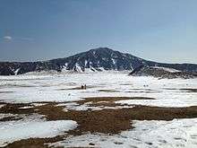
Recently, the number of tourists visiting the area from Asian countries has been increasing. Previously, visitors could not drive their own vehicles up to the crater, but recently a car park was built a minute's walk away. The Mount Aso Ropeway also provides access. At the foot of the mountain there are also various campsites, and horse riding at Kusasenrigahama. Modern poetry has been written about the beautiful scenery at Kusasenrigahama, which has been designated a place of scenic beauty, or natural monument.
Hot springs
Because Mount Aso is a volcano, there are many onsen hot springs in the area. There are two hot springs within the crater that are associated with Aso Kujū National Park.
See also
References
- 1 2 "Cities on Volcanoes 5". u-tokyo.ac.jp.
- ↑ "Small volcanic eruption recorded from Mount Aso in Kumamoto Prefecture". The Japan Times.
- ↑ "Small eruption seen on Mount Aso after latest quakes". The Japan Times Online. 2016-04-16. ISSN 0447-5763. Retrieved 2016-04-23.
- ↑ "Japan's Mount Aso erupts, no reports of injuries". Reuters. 2016-10-07.
- 1 2 "Asosan Climate Normals 1961-1990". National Oceanic and Atmospheric Administration. Retrieved January 6, 2013.
External links
| Wikimedia Commons has media related to Mount Aso. |
| Wikivoyage has a travel guide for Mount Aso. |
- Asosan - Japan Meteorological Agency (Japanese)
- "Asosan: National catalogue of the active volcanoes in Japan" (PDF). - Japan Meteorological Agency
- Aso Volcano - Geological Survey of Japan
- Asosan - Smithsonian Institution: Global Volcanism Program
- Mount Aso - A Small Town Inside the Crater