Motupe River
Motupe River (Río Motupe) is a river of Lambayeque Region in northwestern Peru.[1] The Motupe River Basin, which includes its major tributary the La Leche River, is bounded by the Chancay-Lambayeque River Basin to the south, by the Olmos River Basin to the north, by the river basins of the Chotano and Huancabamba to the east, and on the west by the Pacific Ocean.[2] The river receives its name from the village of Motupe, nearby where the Motupe River is formed.
The Motupe arises in the foothills of the Andes at an elevation of about 150 metres (492 ft) at the confluence of the Chiniama River[3] and the Chóchope River, at 06°08′35″S 079°41′27″W / 6.14306°S 79.69083°W. Shortly thereafter it is joined by the Chotoque River from the right and the Salas River from the left.[2] It flows basically south and then southwest. It is joined by the La Leche at 06°26′08″S 079°56′02″W / 6.43556°S 79.93389°W. The river eventually disappears into the saline Sechura Desert before reaching the Pacific Ocean.[4] It currently flows about five kilometers north of the village of Morrope.[4] During the rainy season, mid November to mid April, but especially during El Niño events,[5] the Motupe can experience severe flooding, and in some years by the end of the dry season can almost disappear. Traditionally stone levees were used to try to control the flooding,[6] but in the 21st century upland dams are being used.
The valley of the Motupe is variously forested, grassland and agricultural.
Notes and references
- ↑ Río Motupe (Approved - N) at GEOnet Names Server, United States National Geospatial-Intelligence Agency
- 1 2 "Diagnostico de Gestión de la Oferta de Agua: Cuenca Chancay – Lambayeque: Part V Efectos del uso del agua en el medio ambiante" (PDF) (in Spanish). National Development Institute (INADE). 2001. Archived (PDF) from the original on 23 April 2014.
- ↑ Río Chiñama (Approved - N) at GEOnet Names Server, United States National Geospatial-Intelligence Agency
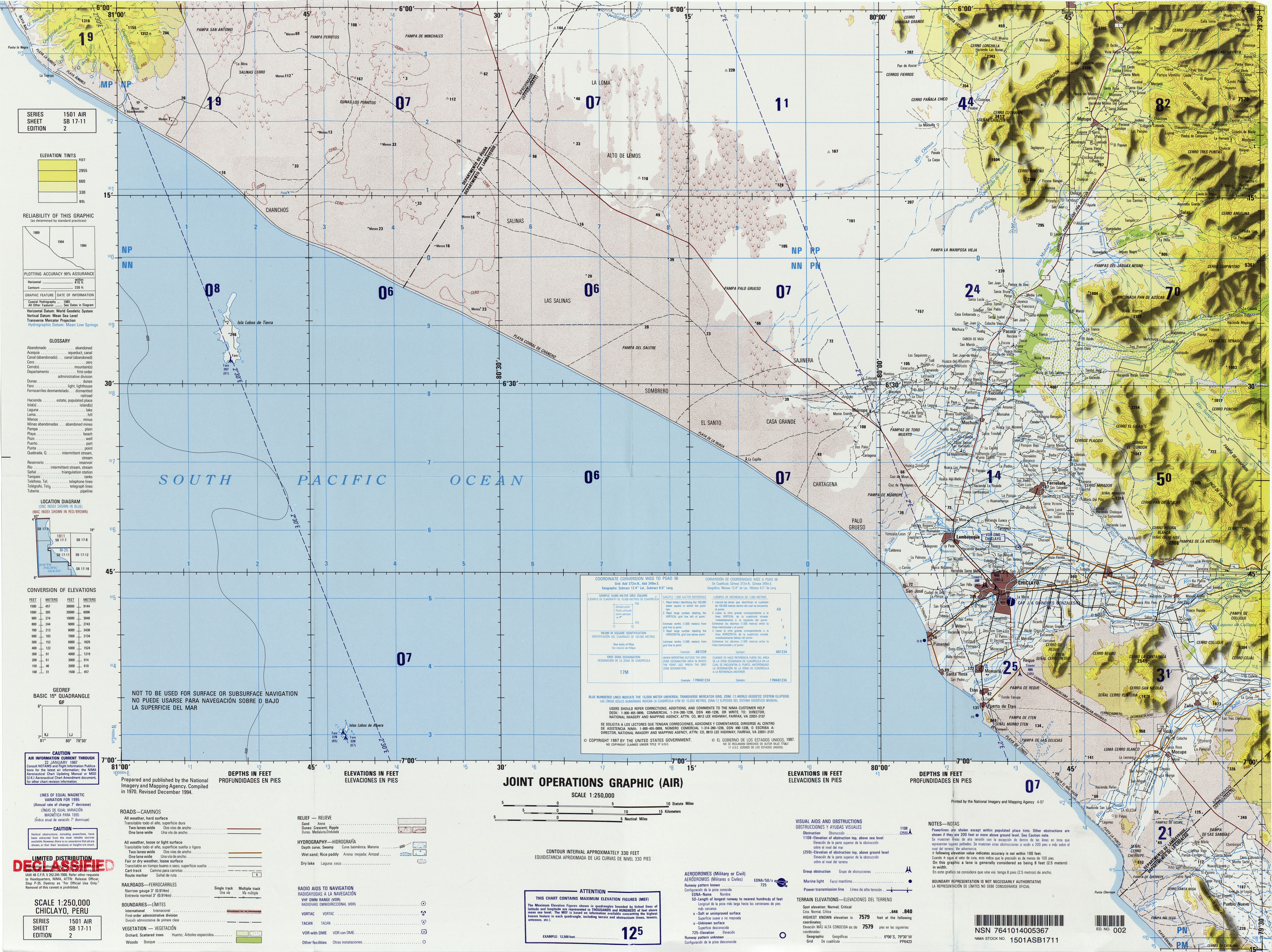
- 1 2 Chiclayo, Peru, SB 17-11 (Map). 1:250,000. Joint Operations Graphic (Air), Series 1501 Air. United States National Imagery and Mapping Agency. 1994.
- ↑ Ponce, Victor M. & Shetty, Amper V. (2008). "The facts about El Niño". Archived from the original on 11 November 2014.
- ↑ Shimada, Izumi (1982). "Horizontal Archipelago and Coast-Highland Interaction in North Peru: Archaeological Models in El Hombre y su Ambiente en los Andes Centrales". Senri Ethnological Studies Osaka. 10: 137–210, page 177.
Coordinates: 06°31′27″S 080°07′16″W / 6.52417°S 80.12111°W