Mosquera, Cundinamarca
| Mosquera | |||
|---|---|---|---|
| Municipality and town | |||
|
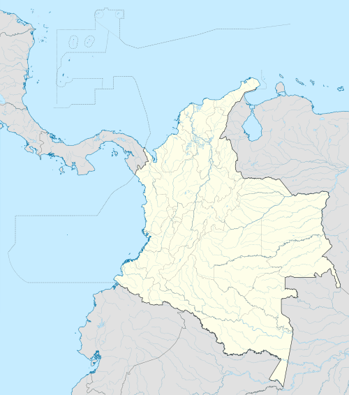
Central square of Mosquera | |||
| |||
 Location of the municipality and town of Mosquera in the Cundinamarca Department of Colombia | |||
 Mosquera Location in Colombia | |||
| Coordinates: 4°42′28″N 74°13′58″W / 4.70778°N 74.23278°W | |||
| Country |
| ||
| Department |
| ||
| Province | Western Savanna Province | ||
| Founded | 27 September 1861 | ||
| Government | |||
| • Mayor |
Raul Emilio Casallas1 (2016-2019) | ||
| Area | |||
| • Municipality and town | 107 km2 (41 sq mi) | ||
| • Urban | 7.67 km2 (2.96 sq mi) | ||
| Elevation | 2,516 m (8,255 ft) | ||
| Population (2015) | |||
| • Municipality and town | 82,750 | ||
| • Density | 770/km2 (2,000/sq mi) | ||
| • Urban | 79,316 | ||
| Demonym(s) | Mosqueruno | ||
| Time zone | Colombia Standard Time (UTC-5) | ||
| Area code(s) | +1 | ||
| Website | Official website | ||
.svg.png)
.svg.png)
Mosquera is a municipality of Colombia in the Western Savanna Province, part of the department of Cundinamarca. Mosquera is close to the capital Bogotá and is part of its metropolitan area. The urban centre of Mosquera is situated at an altitude of 2,516 metres (8,255 ft) on the Bogotá savanna. The municipality borders the localities Bosa and Fontibón of Bogotá in the east, Soacha in the south, Madrid and Funza in the north and Bojacá in the west.[1]
Etymology
Mosquera is named after its founder, former president of Colombia Tomás Cipriano de Mosquera, who in 1861 separated Mosquera from Funza.[1]
History
Mosquera is close to Lake Herrera, a remnant lake of the large Pleistocene Lake Humboldt that existed on the Bogotá savanna until approximately 30,000 years BP. The archaeological findings around Lake Herrera date to the preceramic period, predating the Herrera Period, named after the lake.
The Muisca established their civilisation typically as of 800 AD. They were an advanced culture and performed agriculture on the high plains of the savanna. In the Muisca times maize, potatoes, arracacha, quinoa, sweet potatoes, yuca, peppers, tomatoes, beans and pumpkins were cultivated in Mosquera. The Muisca were predominantly farmers and traders and their economy was based on the extraction of salt from the northern parts of the Bogotá savanna. Fruits and other agricultural products growing in different climates were traded on the frequent markets of the Muisca. In Mosquera pineapples, avocadoes, guanabanas, ice-cream beans, pitahayas and guayabas were the fruits traded with warmer climates. Tobacco also came from more tropical regions while cotton was traded with the colder climate Lache.[1]
Funza, of which Mosquera formed the southern part until 1861, was founded by conquistador Gonzalo Jiménez de Quesada who arrived in the region on April 20, 1537.
Presently, Mosquera is a satellite town of the capital Bogotá and has grown significantly in recent years.[1]
Born in Mosquera
- Olimpo López (1918–2015), pastry chef and creator of the Chocoramo (Productos Ramo)[2]
Gallery

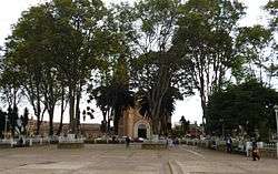
 Church of Mosquera
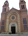 Church
 Bustes of Tomás Cipriano de Mosquera and Simón Bolívar
 Train station
 Cultural centre
References
- 1 2 3 4 (Spanish) Official website Mosquera
- ↑ "A los 97 años muere Olimpo López, creador del chocorramo". El País (Cali). 2015-10-16. Retrieved 2015-11-14.
| Wikimedia Commons has media related to Mosquera, Cundinamarca. |
Coordinates: 04°42′28″N 74°13′58″W / 4.70778°N 74.23278°W