Morris, Oklahoma
| Morris, Oklahoma | |
|---|---|
| City | |
| Motto: The Little City With a Big Welcome | |
 Location of Morris, Oklahoma | |
| Coordinates: 35°36′36″N 95°51′40″W / 35.61000°N 95.86111°WCoordinates: 35°36′36″N 95°51′40″W / 35.61000°N 95.86111°W | |
| Country | United States |
| State | Oklahoma |
| County | Okmulgee |
| Area | |
| • Total | 1.2 sq mi (3.0 km2) |
| • Land | 1.1 sq mi (2.9 km2) |
| • Water | 0.1 sq mi (0.1 km2) |
| Elevation | 722 ft (220 m) |
| Population (2010) | |
| • Total | 1,479 |
| • Density | 1,344.5/sq mi (510.0/km2) |
| Time zone | Central (CST) (UTC-6) |
| • Summer (DST) | CDT (UTC-5) |
| ZIP code | 74445 |
| Area code(s) | 539/918 |
| FIPS code | 40-49400[1] |
| GNIS feature ID | 1095519[2] |
Morris is a city in Okmulgee County, Oklahoma, United States. The population was 1,494 at the 2010 census, an increase of 14.3 percent from 1,294 at the 2000 census.[3]
History
The community began as a cattle stop on the Ozark and Cherokee Central Railway (later the St. Louis and San Francisco Railway) which ran between Muskogee and Okmulgee. The post office was established here on January 4, 1904. The origin of the town name is not known.[4]
The townsite was platted in 1904 by L. R. Kershaw, who was an attorney and was also an Immigration Agent for the Frisco (St. Louis–San Francisco Railway) Railroad. He named the town after H. E. Morris, a Frisco Railroad executive. Many of the street names in Morris are named after towns which were familiar to Kershaw from his home state of Illinois. Kershaw was also the founder of two of the earliest banks in Morris, Indian Territory: The Farmer's State Bank of Morris in 1905 and the First National Bank of Morris in 1907.

The Morris News, a newspaper founded in 1910 has continued publication into the 20th Century.[4]
A tornado struck Morris on April 26, 1984. It killed nine people and destroyed the entire business section, as well as about one half of the housing.[4]
Geography
Morris is located at 35°36′36″N 95°51′40″W / 35.61000°N 95.86111°W (35.610041, -95.861038).[5] It is 8 miles (13 km) east of Okmulgee, at the intersection of U. S. Highway 62 and State Highway 52.[4]
According to the United States Census Bureau, the city has a total area of 1.2 square miles (3.1 km2), of which, 1.1 square miles (2.8 km2) of it is land and 0.1 square miles (0.26 km2) of it (5.17%) is water.
Demographics
| Historical population | |||
|---|---|---|---|
| Census | Pop. | %± | |
| 1920 | 1,926 | — | |
| 1930 | 1,706 | −11.4% | |
| 1940 | 1,197 | −29.8% | |
| 1950 | 1,122 | −6.3% | |
| 1960 | 982 | −12.5% | |
| 1970 | 1,119 | 14.0% | |
| 1980 | 1,288 | 15.1% | |
| 1990 | 1,216 | −5.6% | |
| 2000 | 1,294 | 6.4% | |
| 2010 | 1,479 | 14.3% | |
| Est. 2015 | 1,462 | [6] | −1.1% |
As of the census[1] of 2000, there were 1,294 people, 475 households, and 351 families residing in the city. The population density was 1,174.3 people per square mile (454.2/km²). There were 531 housing units at an average density of 481.9 per square mile (186.4/km²). The racial makeup of the city was 72.87% White, 0.70% African American, 19.55% Native American, 0.08% Asian, 0.31% from other races, and 6.49% from two or more races. Hispanic or Latino of any race were 1.62% of the population.
There were 475 households out of which 39.8% had children under the age of 18 living with them, 56.4% were married couples living together, 13.1% had a female householder with no husband present, and 25.9% were non-families. 24.2% of all households were made up of individuals and 12.0% had someone living alone who was 65 years of age or older. The average household size was 2.72 and the average family size was 3.24.
In the city the population was spread out with 31.0% under the age of 18, 8.8% from 18 to 24, 27.4% from 25 to 44, 19.4% from 45 to 64, and 13.4% who were 65 years of age or older. The median age was 34 years. For every 100 females there were 88.6 males. For every 100 females age 18 and over, there were 85.3 males.
The median income for a household in the city was $29,917, and the median income for a family was $34,943. Males had a median income of $28,295 versus $20,938 for females. The per capita income for the city was $12,904. About 11.2% of families and 15.3% of the population were below the poverty line, including 22.0% of those under age 18 and 9.1% of those age 65 or over.
References
- 1 2 "American FactFinder". United States Census Bureau. Retrieved 2008-01-31.
- ↑ "US Board on Geographic Names". United States Geological Survey. 2007-10-25. Retrieved 2008-01-31.
- ↑ CensusViewer:Morris, Oklahoma Population
- 1 2 3 4 Layman, Marvin V. Encyclopedia of Oklahoma History and Culture. "Morris." Retrieved January 21, 2013.
- ↑ "US Gazetteer files: 2010, 2000, and 1990". United States Census Bureau. 2011-02-12. Retrieved 2011-04-23.
- ↑ "Annual Estimates of the Resident Population for Incorporated Places: April 1, 2010 to July 1, 2015". Retrieved July 2, 2016.
- ↑ "Census of Population and Housing". Census.gov. Retrieved June 4, 2015.
| Counties |  | |
|---|---|---|
| Principal city | ||
| Cities over 20k | ||
| Cities 10k-20k | ||
| Cities 5k-10k | ||
| Cities and towns 1k-5k | ||
Municipalities and communities of Okmulgee County, Oklahoma, United States | ||
|---|---|---|
| Cities | 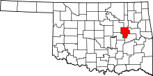 | |
| Towns | ||
| Unincorporated communities |
| |
| Footnotes | ‡This populated place also has portions in an adjacent county or counties | |