Morganfield, Kentucky
| Morganfield, Kentucky | |
|---|---|
| City | |
|
Main Street downtown | |
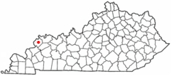 Location of Morganfield within Kentucky. | |
| Coordinates: 37°41′4″N 87°54′43″W / 37.68444°N 87.91194°WCoordinates: 37°41′4″N 87°54′43″W / 37.68444°N 87.91194°W | |
| Country | United States |
| State | Kentucky |
| County | Union |
| Established | January 6, 1812[1] |
| Incorporated | March 16, 1870[1] |
| Named for | Daniel Morgan[2] |
| Government | |
| • Mayor | Jerry R. Freer |
| Area | |
| • Total | 2.1 sq mi (5.5 km2) |
| • Land | 2.1 sq mi (5.4 km2) |
| • Water | 0.0 sq mi (0.1 km2) |
| Elevation | 437 ft (134 m) |
| Population (2010) | |
| • Total | 3,285 |
| Time zone | CST (UTC-6) |
| • Summer (DST) | CDT (UTC-5) |
| ZIP Code | 42437 |
| Area code(s) | 270 & 364 |
| FIPS code | 21-53472 |
| GNIS feature ID | 0498597 |
| Website | www.morganfieldkentucky.com |

Morganfield is a home rule-class city[3] in Union County, Kentucky, in the United States. It is the seat of its county.[4] The population was 3,285 as of the year 2010 U.S. census.
Name
The city was named for Revolutionary War General Daniel Morgan, who received the land the city now sits on in return for his military service.[2]
Geography
Morganfield is located at 37°41′04″N 87°54′43″W / 37.684502°N 87.911893°W.[5] According to the United States Census Bureau, the city has a total area of 2.1 square miles (5.5 km²), of which 2.1 square miles (5.4 km²) is land and 0.04 square mile (0.1 km²) (1.42%) is water.
Demographics
| Historical population | |||
|---|---|---|---|
| Census | Pop. | %± | |
| 1830 | 295 | — | |
| 1840 | 360 | 22.0% | |
| 1860 | 460 | — | |
| 1870 | 300 | −34.8% | |
| 1880 | 744 | 148.0% | |
| 1890 | 1,094 | 47.0% | |
| 1900 | 2,046 | 87.0% | |
| 1910 | 2,725 | 33.2% | |
| 1920 | 2,651 | −2.7% | |
| 1930 | 2,551 | −3.8% | |
| 1940 | 3,079 | 20.7% | |
| 1950 | 3,257 | 5.8% | |
| 1960 | 3,741 | 14.9% | |
| 1970 | 3,563 | −4.8% | |
| 1980 | 3,781 | 6.1% | |
| 1990 | 3,776 | −0.1% | |
| 2000 | 3,494 | −7.5% | |
| 2010 | 3,285 | −6.0% | |
| Est. 2015 | 3,578 | [6] | 8.9% |
As of the census[8] of 2000, there were 3,494 people, 1,434 households, and 926 families residing in the city. The population density was 1,671.5 people per square mile (645.5/km²). There were 1,581 housing units at an average density of 756.3 per square mile (292.1/km²). The racial makeup of the city was 82.34% White, 16.23% African American, 0.03% Native American, 0.17% Asian, 0.17% from other races, and 1.06% from two or more races. Hispanic or Latino of any race were 0.86% of the population.
There were 1,434 households out of which 28.0% had children under the age of 18 living with them, 47.6% were married couples living together, 14.1% had a female householder with no husband present, and 35.4% were non-families. 32.4% of all households were made up of individuals and 15.1% had someone living alone who was 65 years of age or older. The average household size was 2.37 and the average family size was 3.01.
In the city the population was spread out with 24.5% under the age of 18, 9.3% from 18 to 24, 24.8% from 25 to 44, 24.7% from 45 to 64, and 16.7% who were 65 years of age or older. The median age was 39 years. For every 100 females there were 84.9 males. For every 100 females age 18 and over, there were 81.7 males.
The median income for a household in the city was $38,676, and the median income for a family was $52,864. Males had a median income of $32,831 versus $22,736 for females. The per capita income for the city was $19,251. About 9.9% of families and 12.3% of the population were below the poverty line, including 19.2% of those under age 18 and 15.1% of those age 65 or over.
Notable people
- Dwane Casey – Currently the Head Coach for the NBA's Toronto Raptors. Former College Basketball player and assistant coach for the Kentucky Wildcats, and former Minnesota Timberwolves head coach
- Earle C. Clements – Former U.S. Senator, Former Governor of Kentucky and Former U.S. Representative
- Kassie DePaiva – Soap opera actress known for her roles on Guiding Light as Chelsea Reardon and best known for One Life to Live and General Hospital as Blair Cramer Manning
- Mallory Ervin – Miss Kentucky 2009 and 4th Runner-up at Miss America 2010
- Ed Johnson – Former Baseball Player
- Larry Johnson – Former Basketball Player
- Jerry Wayne Parrish – Former United States Army Corporal; died in Pyongyang, North Korea
- Dottie Rambo – Gospel singer/songwriter
- John Selby Townsend – Iowa jurist and legislator
- John W. Munford, SR. - Former Publisher of The Union County Advocate
Camp Breckinridge
Morganfield is located near Camp Breckinridge, a World War II prisoner of war camp. During the Korean War, Camp Breckinridge was the headquarters of the 506th Regiment of the 101st Airborne Division and was used for the conduct of basic training of newly inducted U.S. Army recruits. The Associated Press reported on May 22, 2007, a continuing dispute regarding the families of displaced residents of the area that became Camp Breckenridge and the U.S. government. Former U.S. Supreme Court Justice Sandra Day O'Connor was named as a mediator in the dispute in February 2007.
About 40,000 soldiers preparing for the war stayed at the camp. The camp also held about 3,000 German prisoners of war before being deactivated in 1949.
It was re-opened in 1965 as the "Breckinridge Job Corps Center", and the name was later changed to the "Earle C. Clements Job Corps Center" in 1980 to honor Earle C. Clements, a former Kentucky governor and U.S. senator.
Schools
Morganfield is served by the Union County Public Schools, Kentucky. Elementary students attend Morganfield Elementary. Middle and High School students attend Union County Middle School & Union County High School located outside Morganfield. A parochial school, St Ann is located in Morganfield. The Earle C. Clements Job Corps facility is also located in Morganfield.
Climate
The climate in this area is characterized by hot, humid summers and generally mild to cool winters. According to the Köppen Climate Classification system, Morganfield has a humid subtropical climate, abbreviated "Cfa" on climate maps.[9]
References
- 1 2 Commonwealth of Kentucky. Office of the Secretary of State. Land Office. "Morganfield, Kentucky". Accessed 26 Aug 2013.
- 1 2 "Dictionary of Places: Morganfield". Encyclopedia of Kentucky. New York, New York: Somerset Publishers. 1987. ISBN 0-403-09981-1.
- ↑ "Summary and Reference Guide to House Bill 331 City Classification Reform" (PDF). Kentucky League of Cities. Retrieved December 30, 2014.
- ↑ "Find a County". National Association of Counties. Retrieved 2011-06-07.
- ↑ "US Gazetteer files: 2010, 2000, and 1990". United States Census Bureau. 2011-02-12. Retrieved 2011-04-23.
- ↑ "Annual Estimates of the Resident Population for Incorporated Places: April 1, 2010 to July 1, 2015". Retrieved July 2, 2016.
- ↑ "Census of Population and Housing". Census.gov. Retrieved June 4, 2015.
- ↑ "American FactFinder". United States Census Bureau. Retrieved 2011-05-14.
- ↑ Climate Summary for Morganfield, Kentucky
External links
| Wikimedia Commons has media related to Morganfield, Kentucky. |
- City of Morganfield Home Page
- [ Morganfield Chamber of Commerce]
- Union County Schools
Municipalities and communities of Union County, Kentucky, United States | ||
|---|---|---|
| Cities | 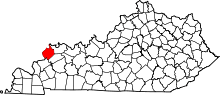 | |
| CDP | ||
| Unincoporated communities |
| |