Morewood massacre
The Morewood massacre was an armed labor-union conflict in Morewood, Pennsylvania, in Westmoreland County, west of the present-day borough Mount Pleasant in 1891. Nine coal miners were shot and killed by sheriff’s deputies during a strike for higher wages and an eight-hour work day.[1][2]
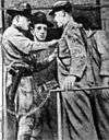
The United Mine Workers union, formed only the previous year, organized the strike against the local coke works owned by industrialist Henry Clay Frick. After a work stoppage beginning on February 2, weeks of increasing unrest, and evictions of mining families from company-controlled property, a crowd of about a thousand strikers accompanied by a brass band marched on the company store in the early morning hours of Friday, April 3.[3] Deputized members of the 10th regiment of the National Guard under the command of Captain Loar fired several volleys [4] into the crowd, killing six strikers outright and fatally wounding three more.[3] Thousands attended their funeral.
A Pennsylvania state historical marker describing the event was erected in 2000 at the Route 119 overpass on Route 981 (Morewood Road).[5]
See also
References
- ↑ Washlaski, Raymond A.; Ryan P. Washlaski, Peter E. Starry, Jr. (2006-11-12). "Massacre at Morewood Mine & Coke Works, (Coal Miners Strike of 1891)". Virtual Museum of Coal Mining in Western Pennsylvania. Retrieved 2008-05-10. Cite uses deprecated parameter
|coauthors=(help) - ↑ "Morewood Massacre". ExplorePAhistory.com. WITF, Inc. (Harrisburg, Pennsylvania) and Pennsylvania Historical and Museum Commission. Retrieved 2008-05-10.
- 1 2 "Massacre at Morewood Mine & Coke Works, Morewood, East Huntingdon Twp.,Westmoreland Co., PA, USA". Patheoldminer.rootsweb.ancestry.com. 2008-10-19. Retrieved 2016-05-26.
- ↑ Official Documents, Comprising the Department and Other Reports Made to the Governor, Senate and House of Representatives of Pennsylvania, Volume 4. State of Pennsylvania. 1892. p. D - 8.
- ↑ http://explorepahistory.com/hmarker.php?markerId=1-A-2CB
Major armed conflicts in American labor union history | ||
|---|---|---|
| 19th century |
|  |
| 20th century |
| |
Coordinates: 40°08′54″N 79°33′47″W / 40.148323°N 79.563137°W