Moreton Bay Marine Park
| Moreton Bay Marine Park Queensland | |
|---|---|
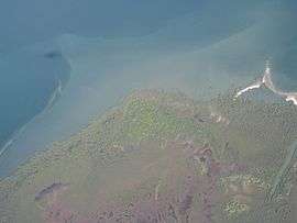 Aerial photo of Mud Island, 2009 | |
 The coastline at Point Lookout is zoned as a conservation park | |
 Moreton Bay Marine Park | |
| Nearest town or city | Brisbane |
| Coordinates | 27°25′48″S 153°23′47″E / 27.43000°S 153.39639°ECoordinates: 27°25′48″S 153°23′47″E / 27.43000°S 153.39639°E |
| Established | 1992 |
| Area | 3,400 km2 (1,312.7 sq mi) |
| Region | South East Queensland |
| Managing authorities | Environmental Protection Agency |
| Website | Moreton Bay Marine Park |
The Moreton Bay Marine Park was established in 1992 to protect ecologically significant habitats in Moreton Bay.[1] The park extends from Caloundra south to the southern tip of South Stradbroke Island.[2] The park's border extends up to the highest tidal mark and covers a total of 3,400 km2.[3]
The park provides protection to sensitive reef sites near Tangalooma and Flinders Reef. It includes waterways such as Coombabah Lake, mangrove forests, swamps, marshes, tidal mudflats, sandflats and seagrass beds.[4] It is a temporary home to migrating shorebirds that inhabit wetlands.[1] Dugongs, whales and turtles swim in the waters of the bay.[4]
The park is managed by the Environmental Protection Agency.
Marine Park Zoning Plan
From 1 March 2009, activities in the park are designated under the Marine Park Zoning Plan. 16% of the bay is protected in green zones or marine national park zones.[5] This leaves 84% of the park available to anglers.
The Queensland Government has spent AU2$ million to create three artificial reefs within the marine park.[6] A free user guide is widely available in bait and boat shops in the region as well as online.[7]
Zones

There are four zones in Moreton Bay Marine Park.[3] These are the Marine national park zone (green) which contain areas of high conservation value, Conservation park zone (yellow) allowing limited fishing and crabbing, Habitat protection (dark blue) zone for sensitive habitats with no trawling allowed and General use zone (light blue) allow activities such as trawling.[3] The zones are patrolled by rangers. Fines of up to A$500 for fishing in the green zone have been issued.[8]
Designated areas
There are nine types of designated areas in the marine park.[3] These areas have been set aside so that specific issues that occur at specific locations can be properly managed. Examples of designated areas include Go slow areas to protect dugongs and turtles, No anchoring areas to protect sensitive reefs and Grey nurse shark areas designed to conserve the endangered shark species.[3]
See also
References
- 1 2 Reid, Greg (2004). Australia's National and Marine Parks: Queensland. South Yarra, Victoria: Macmillan Education Australia. p. 7. ISBN 0-7329-9053-X.
- ↑ Department of National Parks, Recreation, Sport and Racing. "Moreton Bay Marine Park Zoning and Designated Areas Map" (pdf). The State of Queensland. Retrieved 12 June 2014.
- 1 2 3 4 5 Department of National Parks, Recreation, Sport and Racing (12 June 2014). "Moreton Bay Marine Park". The State of Queensland. Retrieved 5 January 2010.
- 1 2 Department of National Parks, Recreation, Sport and Racing (12 June 2014). "Moreton Bay Marine Park — Nature, culture and history". The State of Queensland. Retrieved 6 January 2010.
- ↑ Leah Fineran (19 July 2009). "Big fines for anglers in green zone". goldcoast.com.au. News Limited. Retrieved 5 January 2010.
- ↑ Andrew McNamara (16 December 2008). "Work begins on Moreton Bay's artificial reefs". Outdoors Queensland. Queensland Outdoor Recreation Federation. Retrieved 5 January 2010.
- ↑ Department of National Parks, Recreation, Sport and Racing. "Moreton Bay Marine Park User Guides". The State of Queensland. Retrieved 12 June 2014.
- ↑ "Crackdown on Moreton Bay green zones". ABC News Online. Australian Broadcasting Corporation. 30 September 2009. Retrieved 6 January 2010.