Morecambe Bay

Morecambe Bay is a large estuary in northwest England, just to the south of the Lake District National Park. It is the largest expanse of intertidal mudflats and sand in the United Kingdom, covering a total area of 310 km2 (120 sq mi). In 1974, the second largest gas field in the UK was discovered 25 miles (40 km) west of Blackpool, with original reserves of over 7 trillion cubic feet (tcf) (200 billion cubic metres). At its peak, 15% of Britain's gas supply came from the bay but production is now in decline.
Natural features

The rivers Leven, Kent, Keer, Lune and Wyre drain into the Bay, with their various estuaries making a number of peninsulas within the bay. Much of the land around the bay is reclaimed, forming salt marshes used in agriculture. Morecambe Bay is also an important wildlife site, with abundant bird life and varied marine habitats, and there is a bird observatory at Walney Island. The bay has rich cockle beds, which have been fished by locals for generations.
There are seven main islands in the bay, all to the north; Walney, Barrow, Sheep, Piel, Chapel, Foulney and Roa. Walney is substantially larger than the others, with its southern tip marking the north-western corner of the Bay. Sheep, Piel, Chapel and Foulney Islands are tidal and can be walked to at low tide with appropriate care. Local guidance should be sought if walking to Chapel or Piel islands as fast tides and quicksand can be extremely dangerous. Roa Island is linked to the mainland by a causeway, while Barrow Island has been connected to the mainland as part of the docks system at Barrow-in-Furness.[1]
History
There have been royally appointed local guides (holding the post of Queen's Guide to the Sands) for crossing the bay for centuries. This difficulty of crossing the bay added to the isolation of the land to its north which, due to the presence of the mountains of the Lake District, could only be reached by crossing these sands or by ferry, until the Furness Railway was built in 1857. This skirts the edge of the bay, crossing the various estuaries. The London-Glasgow railway also briefly runs alongside the bay - the only place where the West Coast Main Line actually runs alongside the coast.

The bay is notorious for its quicksand and fast moving tides (it is said that the tide can come in "as fast as a horse can run"). On the night of 5 February 2004, 23 Chinese immigrant cockle pickers drowned after being cut off by the tides.[2][3] This tragedy led some commentators to suggest that the cockle beds should be closed until improved safety measures could be introduced.
Morecambe Bay was featured on the television programme Seven Natural Wonders (BBC) as one of the wonders of the North.
Morecambe Bay is so called because historian John Whitaker suggested in 1771 that it was the Morikámbē tidal flat described by Greek geographer Claudius Ptolemy (died c170 AD).[4]
Settlements
Some 319,100 people live along the coastline of Morecambe Bay,[5] with many of these people residing in the towns listed in the table below. The largest town on the bay is Barrow-in-Furness located to the north-west of it, whilst the town which adopted its name from the bay (Morecambe was previously called Poulton-le-Sands) closely follows. Morecambe relied on the bay for many years, as a popular seaside holiday destination, whilst Barrow still relies on the seas for a large percentage of its economy - Ship and Submarine building.
| Town | County | Population |
|---|---|---|
| Barrow-in-Furness | Cumbria | 59,256 |
| Morecambe | Lancashire | 45,000 |
| Fleetwood | Lancashire | 26,840 |
| Ulverston | Cumbria | 11,210 |
| Heysham | Lancashire | 6,500 |
| Grange-Over-Sands | Cumbria | 4,000 |
Natural gas


The bay has Britain's second-largest natural gas field,[6] in the Triassic Sherwood Sandstone with a seal of Mercian Mudstone[7] and a Carboniferous source.[6] The South Morecambe Field, covering an area of 32 square miles (83 km2), was discovered in 1974 and the first gas came ashore in 1985.[8] The North Morecambe Field, found in 1976 8 miles (13 km) to the north, is 11 square miles (28 km2) and started production in 1994.[8] Both are operated by Centrica Energy.[8] They are 25 miles (40 km) west of Blackpool in 30 metres of water;[8] the top of the gas reservoir is at a depth of just 900 metres (3,000 ft), necessitating slant drilling for the first time in European waters.[7] The combined gas reserves on discovery were estimated at 179 billion cubic meters (6.45 tcf).[8] A further 0.65tcf is recognised in the satellite fields of Bains, Calder (Rivers), Dalton, Millom East and Millom West, and a number of smaller fields have been identified.[8]
The gas is landed at three terminals at Westfield Point in Barrow-in-Furness, collectively referred to as the Rampside Gas Terminal.[8] The South Morecambe Central Processing Complex is connected via a 36-inch pipeline to the South Morecambe terminal.[8] North Morecambe gas has a different composition so the unmanned Drilling and Production Platform is linked by a separate 36" wet sealine to the North Morecambe Terminal, where it is stripped of water, CO2 and nitrogen.[8] The Rivers Terminal has a dedicated pipeline for sour gas from the Calder field, which must be stripped of hydrogen sulphide before processing by the North Morecambe Terminal.[8] The hydrogen sulphide is converted to sulphuric acid which is sold for industrial use. In 1991 a 229MW CCGT power plant was opened near the terminals, on the site of the former coal-fired Roosecote Power Station. There is a support base at Heysham Port and personnel are typically moved by helicopter from Blackpool International Airport.[8] Five rig workers and the two pilots of a Eurocopter AS365 Dauphin were lost when it crashed in sight of the platform on 27 December 2006.[9]
At peak production 15% of UK supply came from the two main fields.[8] As of 2006 Centrica reckoned there was about 1.2tcf of economic gas remaining in them, and they planned to operate the fields for another 10–15 years.[8] In June 2011 they announced the South Morecambe field would be suspended as a result of tax increases in the 2011 Budget which meant South Morecambe would be paying a rate of 81% tax; North Morecambe and Rivers would continue in production[10] as they are taxed at 62%.[11] Production resumed from the South Morecambe field in July 2011.[12]
Bridge proposal
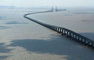
Discussions as to whether to build a road bridge over the bay have been ongoing for decades, particularly in the more isolated north of the bay. The most recent suggestion was of a "green bridge", flanked by wind turbines and using tidal power to mitigate the environmental damage of its construction.[13] The bridge would be 12 miles (19 km) long making it the longest bridge in Europe. It would stretch from Heysham to Barrow-in-Furness, at the bay's mouth. Feasibility studies are ongoing, though over two years since this version of the bridge was proposed, little progress has been made. In the 2005 general election, Timothy Bell polled just 1.1% of the votes in the Barrow and Furness constituency for the Build Duddon and Morecambe Bay Bridges Party.
A lease has been granted for developing two wind turbine sites in the bay, one at Walney Island and the other at Cleveleys. Together these will have around 50 turbines.
The bridge could produce 200 MW of renewable energy from a tidal stream system, enough to power over 400,000 homes. The results of turbine tests in the Bay, promised for the summer of 2009, have yet to appear in the local press. The marine environment of the Bay is notoriously volatile, and some local opinion has doubted whether turbines could function effectively in such a setting.
Members of Parliament in West Cumbria have hailed the bridge as a saviour for local industry. The project's backers, Bridge Across the Bay Ltd., have compared the proposed bridge's importance to that of the Øresundsbron (the Øresund Bridge) near Copenhagen and the Angel of the North. Bridge Across the Bay Ltd. intends to seek planning permission in 2010. Subject to approval and the problematic provision of finance, construction could begin around 2011, and the company estimates the bridge could be completed in 2015.[14][15][16]
Further reading
- A brief article on the Morecambe Bay tidal crossing appeared in 2005: Cawley, David [2005]: Time & Tide: Morecambe Bay, hidden europe magazine, 4 (Sept 2005), pp. 40–44.
References

- ↑ "No Boat Required – Exploring Tidal Islands", Peter Caton, 2011, Troubador Publishing, ISBN 978-1848767-010
- ↑ Channel 4 documentary-drama 'Ghosts'
- ↑ "Coroner records unlawful killing verdict on Morecambe Bay cockler (From The Westmorland Gazette)". Thewestmorlandgazette.co.uk. Retrieved 2011-11-07.
- ↑ Eilert Ekwall, Concise Oxford Dictionary of English Place Names, Oxford University Press.
- ↑ "Check Browser Settings". statistics.gov.uk.
- 1 2 "Oil and Gas from the Western Basins". United Kingdom Offshore Oil and Gas Industry Association. 2012.
- 1 2 Stuart, I. A.; Cowan, G. (1 January 1991), "The South Morecambe Field, Blocks 110/2a, 110/3a, 110/8a, UK East Irish Sea", Memoirs of the Geological Society, London, 14: 527–541, doi:10.1144/GSL.MEM.1991.014.01.66
- 1 2 3 4 5 6 7 8 9 10 11 12 13 "Hydrocarbon Resources Limited Morecambe Bay Environmental Statement 2006" (pdf). Department for Energy and Climate Change.
- ↑ "Six dead in rig helicopter crash". BBC News. 28 December 2006.
- ↑ "Centrica mothballs Morecambe Bay gas field". Lancaster Guardian. 2 June 2011.
- ↑ Wachman, Richard (1 May 2011). "Centrica threatens to shut down Morecambe Bay gas field". The Guardian.
- ↑ "Centrica restarts mothballed Morecambe Bay gas field". www.thevisitor.co.uk. Retrieved 2015-10-21.
- ↑
- ↑ http://www.nwemail.co.uk/news/viewarticle.aspx?id=509561&imageindex=0 nwemail.co.uk
- ↑ http://news.bbc.co.uk/1/hi/england/cumbria/3723779.stm news.bbc.co.uk
- ↑ http://www.nwemail.co.uk/news/viewarticle.aspx?id=584104 nwemail.co.uk
External links
| Wikimedia Commons has media related to Morecambe Bay. |
- Morecambe Bay partnership - local conservation charity
- Walney bird observatory
- ITV footage of Morecambe Bay Half Marathon 2008
- The Cross Bay Challenge on Morecambe Bay by Keith Wilkinson (reporter)
Coordinates: 54°07′N 3°00′W / 54.117°N 3.000°W
- Morecambe Bay ARS - Local Amateur Radio Society and Training
- Sands Amateur Radio Contest Group -Amateur Radio Group in Morecambe
- - Walks in the Morecambe Bay area
- Morecambe Bay Visitor Information site - Lancaster City Council Tourism website
- - Morecambe Bay Local Information Site