Moores Peak
Location of Hurd Peninsula on Livingston Island in the South Shetland Islands.

Moores Peak (in the centre, slightly to the left) from Mount Friesland.

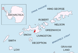
Topographic map of Livingston Island, Greenwich, Robert, Snow and Smith Islands.
Moores Peak is the prominent rocky peak rising to 407 m on Hurd Peninsula, Livingston Island in the South Shetland Islands, Antarctica and surmounting False Bay to the southeast.
The feature is named after Captain Prince Moores, Master of the American sealing ship George Porter that visited the South Shetlands in 1821-22.
Location
The peak is located at 62°41′21″S 60°20′37″W / 62.68917°S 60.34361°W which is 880 m south by west of Mirador Hill, 2.2 km south-southwest of Napier Peak, 4.47 km west by north of Kikish Crag and 2.21 km east-northeast of Castellvi Peak (British mapping in 1968, Spanish in 1991, and Bulgarian in 2005 and 2009).
Maps
- Isla Livingston: Península Hurd. Mapa topográfico de escala 1:25 000. Madrid: Servicio Geográfico del Ejército, 1991.
- L.L. Ivanov et al. Antarctica: Livingston Island and Greenwich Island, South Shetland Islands. Scale 1:100000 topographic map. Sofia: Antarctic Place-names Commission of Bulgaria, 2005.
- L.L. Ivanov. Antarctica: Livingston Island and Greenwich, Robert, Snow and Smith Islands. Scale 1:120000 topographic map. Troyan: Manfred Wörner Foundation, 2009. ISBN 978-954-92032-6-4
References
This article is issued from Wikipedia - version of the 8/19/2016. The text is available under the Creative Commons Attribution/Share Alike but additional terms may apply for the media files.