Moorabool, Victoria
| Moorabool Victoria | |||||||||||||
|---|---|---|---|---|---|---|---|---|---|---|---|---|---|
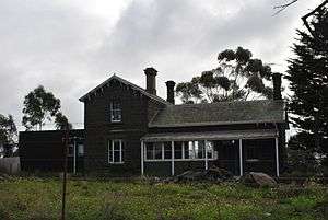 The former railway station | |||||||||||||
 Moorabool | |||||||||||||
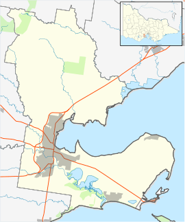
| Coordinates | 38°04′S 144°18′E / 38.067°S 144.300°ECoordinates: 38°04′S 144°18′E / 38.067°S 144.300°E | ||||||||||||
| Postcode(s) | 3221 | ||||||||||||
| LGA(s) | City of Greater Geelong | ||||||||||||
| State electorate(s) | Lara | ||||||||||||
| Federal Division(s) | Corio | ||||||||||||
| |||||||||||||
Moorabool is a bounded rural locality of the City of Greater Geelong local government area in Victoria, Australia.
History
Moorabool Post Office opened on 1 October 1861 and closed in 1960.[1]
Heritage listed sites
Moorabool contains a number of heritage listed sites, including:
- Geelong-Ballarat railway line, Cowies Creek Rail Bridge No. 2 [2]
- 275 Ballan Road, Moorabool railway station [3]
- Geelong-Ballarat railway line, Moorabool River Railway Viaduct [4]
References
- ↑ Premier Postal History, Post Office List, retrieved 11 April 2008
- ↑ "Cowies Creek Rail Bridge No. 2 (H2241)". Victorian Heritage Register. Heritage Victoria. Retrieved 4 July 2014.
- ↑ "Former Moorabool Railway Station (H1579)". Victorian Heritage Register. Heritage Victoria. Retrieved 4 July 2014.
- ↑ "Railway Viaduct (H1105)". Victorian Heritage Register. Heritage Victoria. Retrieved 4 July 2014.
External links
![]() Media related to Moorabool, Victoria at Wikimedia Commons
Media related to Moorabool, Victoria at Wikimedia Commons
This article is issued from Wikipedia - version of the 5/8/2016. The text is available under the Creative Commons Attribution/Share Alike but additional terms may apply for the media files.