Monticello, Kentucky
| Monticello, Kentucky | |
|---|---|
| City | |
|
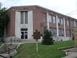
Wayne County courthouse in Monticello | |
| Nickname(s): "Houseboat Manufacturing Capital of the World" | |
 Location of Monticello, Kentucky | |
| Coordinates: 36°50′17″N 84°51′0″W / 36.83806°N 84.85000°WCoordinates: 36°50′17″N 84°51′0″W / 36.83806°N 84.85000°W | |
| Country | United States |
| State | Kentucky |
| County | Wayne |
| Incorporated | 1801[1] |
| Named for | Pres. Thomas Jefferson's Virginia home |
| Area | |
| • Total | 6.1 sq mi (15.7 km2) |
| • Land | 6.1 sq mi (15.7 km2) |
| • Water | 0.0 sq mi (0.0 km2) |
| Elevation | 922 ft (281 m) |
| Population (2000) | |
| • Total | 5,981 |
| • Density | 984.3/sq mi (380.0/km2) |
| Time zone | Eastern (EST) (UTC-5) |
| • Summer (DST) | EDT (UTC-4) |
| ZIP code | 42633 |
| Area code(s) | 606 |
| FIPS code | 21-53130 |
| GNIS feature ID | 0498514 |
| Website | www.monticelloky.com |
Monticello is a home rule-class city[2] in Wayne County, Kentucky, in the United States. It is the seat of its county.[3] The population was 6,188 at the time of the 2010 U.S. census.
Monticello advertises itself as "The Houseboat Capital of the World" due to the large number of houseboat manufacturers in the city. The city sits next to Lake Cumberland, and much of its economy is built on serving the recreational and tourist traffic to the lake.
Monticello attorney Sara Beth Gregory is the current District 16 member of the Kentucky State Senate, representing Wayne, Adair, Clinton, Cumberland, McCreary, Russell, and Taylor counties. She is a former member of the Kentucky House of Representatives. The District 52 House seat is again held by Ken Upchurch of Monticello.[4]
Geography
Monticello is located at 36°50′17″N 84°51′0″W / 36.83806°N 84.85000°W (36.838194, -84.850022).[5] According to the United States Census Bureau, the city has a total area of 6.1 square miles (16 km2), all land.
Demographics
| Historical population | |||
|---|---|---|---|
| Census | Pop. | %± | |
| 1810 | 37 | — | |
| 1830 | 205 | — | |
| 1840 | 142 | −30.7% | |
| 1880 | 354 | — | |
| 1890 | 413 | 16.7% | |
| 1900 | 546 | 32.2% | |
| 1910 | 1,338 | 145.1% | |
| 1920 | 1,514 | 13.2% | |
| 1930 | 1,503 | −0.7% | |
| 1940 | 1,733 | 15.3% | |
| 1950 | 2,934 | 69.3% | |
| 1960 | 2,940 | 0.2% | |
| 1970 | 3,618 | 23.1% | |
| 1980 | 5,677 | 56.9% | |
| 1990 | 5,357 | −5.6% | |
| 2000 | 5,981 | 11.6% | |
| 2010 | 6,188 | 3.5% | |
| Est. 2015 | 6,090 | [6] | −1.6% |
As of the census[8] of 2000, there were 5,981 people, 2,508 households, and 1,635 families residing in the city. The population density was 984.3 people per square mile (379.8/km²). There were 2,730 housing units at an average density of 449.3 per square mile (173.4/km²). The racial makeup of the city was 94.63% White, 2.42% African American, 0.40% Native American, 0.28% Asian, 1.34% from other races, and 0.92% from two or more races. Hispanic or Latino of any race were 2.96% of the population.
There were 2,508 households out of which 31.3% had children under the age of 18 living with them, 46.7% were married couples living together, 14.9% had a female householder with no husband present, and 34.8% were non-families. 31.7% of all households were made up of individuals and 16.0% had someone living alone who was 65 years of age or older. The average household size was 2.33 and the average family size was 2.91.
In the city the population was spread out with 25.0% under the age of 18, 9.7% from 18 to 24, 25.9% from 25 to 44, 21.9% from 45 to 64, and 17.4% who were 65 years of age or older. The median age was 36 years. For every 100 females there were 88.9 males. For every 100 females age 18 and over, there were 84.5 males.
The median income for a household in the city was $17,423, and the median income for a family was $24,460. Males had a median income of $28,638 versus $19,259 for females. The per capita income for the city was $11,855. About 29.2% of families and 34.1% of the population were below the poverty line, including 39.9% of those under age 18 and 35.4% of those age 65 or over.
Notable people
- Louise Slaughter, US Congresswoman
References
- ↑ Commonwealth of Kentucky. Office of the Secretary of State. Land Office. "Monticello, Kentucky". Accessed 26 Aug 2013.
- ↑ "Summary and Reference Guide to House Bill 331 City Classification Reform" (PDF). Kentucky League of Cities. Retrieved December 30, 2014.
- ↑ "Find a County". National Association of Counties. Retrieved 2011-06-07.
- ↑ "Gregory is county's new senator: Higdon no longer represents Taylor County". Central Kentucky News-Journal. Retrieved August 27, 2013.
- ↑ "US Gazetteer files: 2010, 2000, and 1990". United States Census Bureau. 2011-02-12. Retrieved 2011-04-23.
- ↑ "Annual Estimates of the Resident Population for Incorporated Places: April 1, 2010 to July 1, 2015". Retrieved July 2, 2016.
- ↑ "Census of Population and Housing". Census.gov. Retrieved June 4, 2015.
- ↑ "American FactFinder". United States Census Bureau. Retrieved 2008-01-31.
External links
| Wikivoyage has a travel guide for Monticello (Kentucky). |
Municipalities and communities of Wayne County, Kentucky, United States | ||
|---|---|---|
| City | 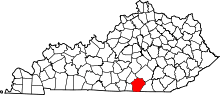 | |
| Unincorporated communities | ||
| Ghost town | ||
