Montgomery, New York
| Montgomery | |
| Town | |
 Town Hall, on Bracken Road | |
| Name origin: For Richard Montgomery | |
| Nickname: Transportation Hub of the Northeast | |
| Country | United States |
|---|---|
| State | New York |
| Region | Hudson Valley |
| County | Orange |
| River | Wallkill |
| Center | Scotts Corner (jct of NY 17K/208) |
| - elevation | 410 ft (125 m) |
| - coordinates | 41°31′32″N 74°12′1″W / 41.52556°N 74.20028°WCoordinates: 41°31′32″N 74°12′1″W / 41.52556°N 74.20028°W |
| Highest point | USGS BM Garrison, Kings Hill |
| - elevation | 820 ft (250 m) |
| - coordinates | 41°34′56″N 74°7′35″W / 41.58222°N 74.12639°W |
| Lowest point | Wallkill River at N town line |
| - elevation | 240 ft (73 m) |
| - coordinates | 41°35′37″N 74°11′5″W / 41.59361°N 74.18472°W |
| Area | 51.1 sq mi (132 km2) |
| - land | 50.4 sq mi (131 km2) |
| - water | 0.6 sq mi (2 km2) |
| Population | 22,606 (2010) |
| Density | 442.4/sq mi (171/km2) |
| Founded | 1772 |
| Government | Town Hall |
| - location | 110 Bracken Road |
| - elevation | 420 ft (128 m) |
| - coordinates | 41°31′18″N 74°11′57″W / 41.52167°N 74.19917°W |
| Supervisor | Michael Hayes |
| Timezone | EST (UTC-5) |
| - summer (DST) | EDT (UTC-4) |
| ZIP Codes | 12534, 12549, 12550, 12561, 12586, 12589 |
| Area code | 845 |
| Exchanges | 361, 427, 457, 561–569, 778, 895 |
_highlighted.svg.png) Location in Orange County and the state of New York. | |
| Wikimedia Commons: Town of Montgomery, New York | |
| Website: Home | |
Montgomery is a town in Orange County, New York, United States. The population was 22,606 at the 2010 census. It was named in honor of Richard Montgomery, an American Revolutionary War general killed in 1775 at the Battle of Quebec.
The Town of Montgomery is in the northern part of the county at the county line shared by Ulster County. Montgomery is immediately west of the Town of Newburgh. It contains three villages, one also called Montgomery, as well as Walden and most of Maybrook.
History
The early town began as a patent to Henry Wileman in 1710, who was the first settler. He was the first of a group of Palatine Germans to emigrate and settle land around what is now the village of Montgomery.
The town was originally established as "Hanover" in 1772, but became the Town of Montgomery in 1782.
The community of Montgomery set itself off by incorporating as a village in 1810, and in 1855, the community of Walden incorporated also. Maybrook was the last village to incorporate, in 1926.
Geography
Montgomery is bordered on the east by the Town of Newburgh and on the north by the Town of Shawangunk in Ulster County.The Town of Crawford is to the west. The towns of Wallkill, Hamptonburgh and New Windsor, from west to east, border on the south.
The village of Walden is located in the north central portion of town. Montgomery is close to the center, and Maybrook is in the southeast corner. There are no significant year-round settlements outside of the villages; there is a summer colony around Lake Osiris in the northern section of town. Some inhabitants of Lake Osiris have made it their permanent residence.
The town's topography is generally level and low, except along parts of its eastern and western boundaries, reflecting the passage of the Wallkill River through it from north to west. There are large swamps in the south portion of town, some of them draining into the Otter Kill. Further north, the land becomes drier and more arable. It is mostly farmed, used for small residential subdivisions or left as undeveloped open space. There are a few exceptions: the business parks along Bracken, Neelytown and Stone Castle roads and NY 208, several of the Valley Central schools, the large Shop Rite plaza on Goodwill Road and Orange County Airport.
Two areas along the river have been set aside as parks. The county's Winding Hills Park is partially within Montgomery, as are portions of two larger state-level protected areas: Highland Lakes State Park and Stewart State Forest.
The Wallkill River is the town's major watercourse, flowing through it from south to north past both the villages Montgomery and Walden, also partially serving as its border with Hamptonburgh. Two of its tributaries flow through Montgomery as well. The Muddy Kill, located entirely within the town, drains the area below the Comfort Hills in west central Montgomery. Tin Brook, the Wallkill's only major eastern tributary, rises just southeast of the town and flows north, then west, through Walden to drain into the river just north of the village.
According to the United States Census Bureau, the town has a total area of 51.1 square miles (132.3 km²), of which, 50.4 square miles (130.6 km²) of it is land and 0.6 square miles (1.7 km²) of it (1.25%) is water. The highest point in the town is the U.S. Geological Survey's Garrison benchmark at a corner of the Ulster County line on Kings Hill, at 820 feet (250 m) above sea level; this is also the highest point in the neighboring Town of Newburgh as well. The lowest elevation is 240 feet (73 m), where the Wallkill River flows across the northern town and county line.
Transportation
Montgomery calls itself "The Transportation Hub of the Northeast" from the days when the New York, New Haven and Hartford Railroad (later part of Penn Central) had a major presence north of Maybrook, and the Wallkill Valley Railroad (later absorbed into the New York Central) ran through Montgomery and Walden, connecting to the Erie Railroad mainline at Goshen. Nowadays the rail lines have been reduced to freight spurs or the Walden–Wallkill Rail Trail, and roads have taken over their role.
Demographics
| Historical population | |||
|---|---|---|---|
| Census | Pop. | %± | |
| 1790 | 3,563 | — | |
| 1820 | 5,541 | — | |
| 1830 | 3,887 | −29.9% | |
| 1840 | 4,100 | 5.5% | |
| 1850 | 3,933 | −4.1% | |
| 1860 | 3,973 | 1.0% | |
| 1870 | 4,536 | 14.2% | |
| 1880 | 4,795 | 5.7% | |
| 1890 | 5,061 | 5.5% | |
| 1900 | 5,939 | 17.3% | |
| 1910 | 7,439 | 25.3% | |
| 1920 | 8,351 | 12.3% | |
| 1930 | 8,082 | −3.2% | |
| 1940 | 8,418 | 4.2% | |
| 1950 | 9,868 | 17.2% | |
| 1960 | 11,672 | 18.3% | |
| 1970 | 13,995 | 19.9% | |
| 1980 | 16,576 | 18.4% | |
| 1990 | 18,501 | 11.6% | |
| 2000 | 20,891 | 12.9% | |
| 2010 | 22,606 | 8.2% | |
| Est. 2014 | 23,523 | [1] | 4.1% |
As of the census[3] of 2000, there were 20,891 people, 7,273 households, and 5,447 families residing in the town. The population density was 414.2 people per square mile (159.9/km²). There were 7,643 housing units at an average density of 151.5 per square mile (58.5/km²). The racial makeup of the town was 91.28% White, 3.69% Black or African American, 0.25% Native American, 0.68% Asian, 0.01% Pacific Islander, 2.35% from other races, and 1.73% from two or more races. Hispanic or Latino of any race were 7.75% of the population.
There were 7,273 households out of which 40.4% had children under the age of 18 living with them, 58.3% were married couples living together, 11.6% had a female householder with no husband present, and 25.1% were non-families. 20.0% of all households were made up of individuals and 8.2% had someone living alone who was 65 years of age or older. The average household size was 2.84 and the average family size was 3.28.
In the town the population was spread out with 29.3% under the age of 18, 7.2% from 18 to 24, 31.1% from 25 to 44, 21.9% from 45 to 64, and 10.5% who were 65 years of age or older. The median age was 35 years. For every 100 females there were 95.8 males. For every 100 females age 18 and over, there were 92.6 males.
The median income for a household in the town was $49,422, and the median income for a family was $56,376. Males had a median income of $40,881 versus $29,163 for females. The per capita income for the town was $20,222. About 4.6% of families and 7.7% of the population were below the poverty line, including 9.2% of those under age 18 and 10.3% of those age 65 or over.
Communities and locations in the Town of Montgomery
| Wikimedia Commons has media related to Town of Montgomery, New York. |
- Allards (formerly "Allards Corners") – A hamlet near the north town line.
- Berea – A hamlet east of Montgomery village on NY-17K, west of Coldenham.
- Coldenham – A hamlet east of Montgomery village on NY-17K.
- Maybrook – Most of the Village of Maybrook is located in the southern part of the town on NY-208.
- Montgomery – The Village of Montgomery is located near the center of the town at the intersection of NY-17K and NY-211.
- Morrison Heights – A hamlet north of Maybrook by Interstate 84.
- Scotts Corners – A hamlet immediately east of Montgomery village, located at the intersection of NY-17K and NY-208.
- Walden – The Village of Walden is in the northern part of the town by the Wallkill River and NY-208.
References
- ↑ "Annual Estimates of the Resident Population for Incorporated Places: April 1, 2010 to July 1, 2014". Retrieved June 4, 2015.
- ↑ "Census of Population and Housing". Census.gov. Retrieved June 4, 2015.
- ↑ "American FactFinder". United States Census Bureau. Retrieved 2008-01-31.
External links
Municipalities and communities of Orange County, New York, United States | ||
|---|---|---|
| Cities | 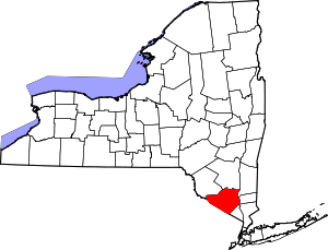 | |
| Towns | ||
| Villages | ||
| CDPs | ||
| Other hamlets | ||