Montfiquet
| Montfiquet | |
|---|---|
|
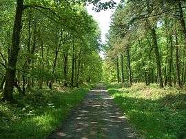
Royal forest of Cerisy | |
 Montfiquet | |
|
Location within Normandy region  Montfiquet | |
| Coordinates: 49°10′23″N 0°53′00″W / 49.1731°N 0.8833°WCoordinates: 49°10′23″N 0°53′00″W / 49.1731°N 0.8833°W | |
| Country | France |
| Region | Normandy |
| Department | Calvados |
| Arrondissement | Bayeux |
| Canton | Balleroy |
| Intercommunality | Intercom Balleroy Le Molay-Littry |
| Government | |
| • Mayor (2008–2014) | Albert Courchant |
| Area1 | 19.54 km2 (7.54 sq mi) |
| Population (2008)2 | 91 |
| • Density | 4.7/km2 (12/sq mi) |
| Time zone | CET (UTC+1) |
| • Summer (DST) | CEST (UTC+2) |
| INSEE/Postal code | 14445 / 14490 |
| Elevation |
55–146 m (180–479 ft) (avg. 110 m or 360 ft) |
|
1 French Land Register data, which excludes lakes, ponds, glaciers > 1 km² (0.386 sq mi or 247 acres) and river estuaries. 2 Population without double counting: residents of multiple communes (e.g., students and military personnel) only counted once. | |
Montfiquet is a commune in the Calvados department in the Normandy region in northwestern France.
Population
| Historical population | ||
|---|---|---|
| Year | Pop. | ±% |
| 1962 | 118 | — |
| 1968 | 95 | −19.5% |
| 1975 | 94 | −1.1% |
| 1982 | 80 | −14.9% |
| 1990 | 87 | +8.7% |
| 1999 | 90 | +3.4% |
| 2008 | 91 | +1.1% |
See also
References
| Wikimedia Commons has media related to Montfiquet. |
This article is issued from Wikipedia - version of the 3/16/2016. The text is available under the Creative Commons Attribution/Share Alike but additional terms may apply for the media files.