Monte Pruno
| Monte Pruno | |
|---|---|
 | |
| Highest point | |
| Elevation | 879 m (2,884 ft) |
| Coordinates | 40°24′N 15°21′E / 40.400°N 15.350°ECoordinates: 40°24′N 15°21′E / 40.400°N 15.350°E |
| Geography | |
 Monte Pruno Italy | |
| Location | Cilento, Province of Salerno, Campania, Italy |
| Parent range | Lucan Apennines, of the Apennine Mountains |
Monte Pruno is a mountain in the southern Cilento region of the Province of Salerno, in the Campania region, of southern Italy. It is 879 metres (2,884 ft) above sea level.
Geography
The mountain is in the Lucan Apennines mountain range of the Apennine Mountains system. It is located in the Pruno forest area, in the municipality of Roscigno.
Monte Pruno is protected within Cilento and Vallo di Diano National Park.
History
On the mountain outside the town of Roscigno is the archaeological site of Monte Pruno, a settlement of the Oenotrians and the Lucani (7th-3rd centuries BCE).
See also
External links
![]() Media related to Monte Pruno at Wikimedia Commons
Media related to Monte Pruno at Wikimedia Commons
Archaeological sites in Campania | ||
|---|---|---|
| Province of Avellino | 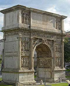  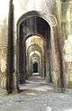 | |
| Province of Benevento | ||
| Province of Caserta | ||
| Province of Naples | ||
| Province of Salerno | ||
This article is issued from Wikipedia - version of the 1/26/2016. The text is available under the Creative Commons Attribution/Share Alike but additional terms may apply for the media files.