Montclair, New Jersey
| Montclair, New Jersey | ||
|---|---|---|
| Township | ||
| Township of Montclair | ||
|
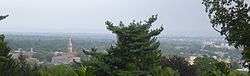
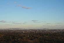
Panoramic view of Montclair, New Jersey | ||
| ||
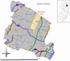 Map of Montclair in Essex County. Inset: Location of Essex County in the State of New Jersey. | ||
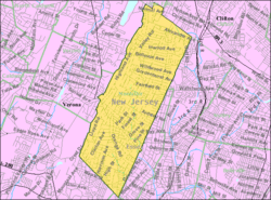 Census Bureau map of Montclair, New Jersey | ||
| Coordinates: 40°49′28″N 74°12′44″W / 40.824415°N 74.212352°WCoordinates: 40°49′28″N 74°12′44″W / 40.824415°N 74.212352°W[1][2] | ||
| Country |
| |
| State |
| |
| County | Essex | |
| Incorporated | April 15, 1868 (as township) | |
| Reincorporated | February 24, 1894 (as town) | |
| Government[3] | ||
| • Type | Faulkner Act (Council-Manager) | |
| • Body | Township Council | |
| • Mayor | Robert D. Jackson (term ends June 30, 2020)[4][5] | |
| • Township Manager | Timothy F. Stafford (acting)[6] | |
| • Clerk | Linda S. Wanat[7] | |
| Area[1] | ||
| • Total | 6.315 sq mi (16.357 km2) | |
| • Land | 6.308 sq mi (16.339 km2) | |
| • Water | 0.007 sq mi (0.018 km2) 0.11% | |
| Area rank |
250th of 566 in state 6th of 22 in county[1] | |
| Elevation[8] | 299 ft (91 m) | |
| Population (2010 Census)[9][10][11] | ||
| • Total | 37,669 | |
| • Estimate (2015)[12] | 38,202 | |
| • Rank |
60th of 566 in state 6th of 22 in county[13] | |
| • Density | 5,971.2/sq mi (2,305.5/km2) | |
| • Density rank |
85th of 566 in state 10th of 22 in county[13]" | |
| Demonym(s) | Montclarian, Montclairite | |
| Time zone | Eastern (EST) (UTC-5) | |
| • Summer (DST) | Eastern (EDT) (UTC-4) | |
| ZIP codes | 07042, 07043[14][15] | |
| Area code(s) | 973[16] | |
| FIPS code | 3401347500[1][17][18] | |
| GNIS feature ID | 1729720[1][19] | |
| Website |
www | |
Montclair (/mɒntˈklɛər/ or /mɒŋˈklɛər/) is a township in Essex County, New Jersey, United States. As of the 2010 United States Census, the township's population was 37,669,[9][10][11] reflecting a decline of 1,308 (-3.4%) from the 38,977 counted in the 2000 Census, which had in turn increased by 1,248 (+3.3%) from the 37,729 counted in the 1990 Census.[20] As of 2010, it was the 60th-most-populous municipality in New Jersey.[21]
Montclair was first formed as a township on April 15, 1868, from portions of Bloomfield Township,[22] so that a second railroad could be built to Montclair. After a referendum held on February 21, 1894, Montclair was reincorporated as a town, effective February 24, 1894.[23] It derives its name from the French mont clair, meaning "clear mountain" or "bright mountain."[24][25]
In 1980, after multiple protests filed by Montclair officials regarding the inequities built into the federal revenue sharing system,[26] Montclair passed a referendum changing its name to the "Township of Montclair," becoming the third of more than a dozen Essex County municipalities to reclassify themselves as townships to take advantage of federal revenue sharing policies that allocated townships a greater share of government aid to municipalities on a per capita basis.[27][28][29]
Geography
According to the United States Census Bureau, the township has a total area of 6.315 square miles (16.357 km2), including 6.308 square miles (16.339 km2) of land and 0.007 square mile (0.018 km2) of water (0.11%).[1][2]
Montclair is on the east side of the First Mountain of the Watchung Mountains. Some higher locations in the township provide excellent views of the surrounding area and of the New York City skyline about 12 miles (19 km) away.
Named localities in the township include Frog Hollow, Montclair Heights, South End, Upper Montclair and Watchung Plaza.
Montclair citizens use two main ZIP codes. The central and southern parts of the township are designated 07042. Upper Montclair lies north of Watchung Avenue and has a separate ZIP code, 07043. Because the ZIP codes do not exactly match municipal boundaries, a few homes near the borders with neighboring towns fall into the ZIP codes for those communities. A few homes in some adjoining municipalities use one of the two ZIP codes assigned to Montclair, as does HackensackUMC Mountainside (07042, formerly known as Mountainside Hospital), whose campus straddles the border with Glen Ridge.[30][31] Small areas in the southeast of the township fall into the Glen Ridge ZIP code 07028.
Several streams flow eastward through Montclair: Toney's Brook in the center, Nishuane Brook in the southeast, the Wigwam Brook in the southwest, Pearl Brook in the northwest, and Yantacaw Brook in the northeast - all in the Passaic River watershed. Yantacaw and Toney's brooks are dammed in parks to create ponds. Wigwam, Nishuane, and Toney's brooks flow into the Second River, and the others flow into the Third River. Montclair lies just north of the northernmost extent of the Rahway River watershed.
The southern border of Montclair is a straight line between Eagle Rock, on the ridge of the First Watchung Mountain, and the point where Orange Road crosses Nishuane Brook. The eastern border is roughly a straight line between that point and a point just southwest of where Broad Street crosses the Third River. The western border runs roughly along the ridge of the First Watchung Mountain between Eagle Rock and the Essex County/Passaic County border. The northern border is the border between those two counties.
Climate
Montclair has a temperate climate, with warm-to-hot, humid summers and cool to cold winters, as is characteristic of the Köppen climate classification humid continental climate. January tends to be the coldest month, with average high temperatures in the upper 30s Fahrenheit and lows averaging 21. July, the warmest month, features high temperatures in the mid-80s and lows in the 70s, with an average high of 86 degrees. From April to June and from September to early November, Montclair experiences temperatures from the lower 60s to the lower 70s.
Montclair gets approximately 50 inches (1,270 mm) of rain per year, above the United States average of 39 inches (990 mm) (weather.com, weatherdb.com). Snowfall is common from December to early March, and totals about 30 inches (760 mm) annually. The number of days each year in Montclair with any measurable precipitation is 90; the area has an average of 202 sunny days.
Montclair is one or two degrees warmer than the neighboring towns of Verona and Cedar Grove because of the mountain between them, which sometimes blocks winds and clouds, including warmer air from the ocean to the east.
Demographics
| Historical population | |||
|---|---|---|---|
| Census | Pop. | %± | |
| 1870 | 2,853 | — | |
| 1880 | 5,147 | 80.4% | |
| 1890 | 8,636 | 67.8% | |
| 1900 | 13,962 | 61.7% | |
| 1910 | 21,550 | 54.3% | |
| 1920 | 28,810 | 33.7% | |
| 1930 | 42,017 | 45.8% | |
| 1940 | 39,807 | −5.3% | |
| 1950 | 43,927 | 10.3% | |
| 1960 | 43,129 | −1.8% | |
| 1970 | 44,043 | 2.1% | |
| 1980 | 38,321 | −13.0% | |
| 1990 | 37,729 | −1.5% | |
| 2000 | 38,977 | 3.3% | |
| 2010 | 37,669 | −3.4% | |
| Est. 2015 | 38,202 | [12][32] | 1.4% |
| Population sources: 1870-1920[33] 1870-1910[34] 1870[35][36] 1880-1890[37] 1890-1910[38] 1900-1930[39] 1930-1990[40] 2000[41][42] 2010[9][10][11] | |||
Montclair has long highlighted its diversity, a feature that has attracted many to the community.[43] The African American population has been stable at around 30% for decades, although it fell from 32% in 2000 to 27% in 2010 (U.S. Census).
As of 2012, 32.6% of the population were Catholic, 8.4% were Jewish and 2.4% were Muslim, with a small percentage of other denominations.[44] Proportionally, Montclair has more Muslims, Jews, and Catholics than the national average.
Montclair has attracted many who work for major media organizations in New York City, including The New York Times and Newsweek. A March 11, 2007, posting in the blog Gawker.com listed some of those who work in the media and live in Montclair.[45] In it also live many commuters to New York City and the Metro Area.
2010 Census
The 2010 United States Census counted 37,669 people, 15,089 households, and 9,446 families residing in the township. The population density was 5,971.2 per square mile (2,305.5/km2). The township contained 15,911 housing units at an average density of 2,522.2 per square mile (973.8/km2). The racial makeup of the township was 62.16% (23,416) White, 27.16% (10,230) Black or African American, 0.16% (59) Native American, 3.81% (1,434) Asian, 0.02% (9) Pacific Islander, 2.19% (826) from other races, and 4.50% (1,695) from two or more races. Hispanics or Latinos of any race were 7.46% (2,810) of the population.[9]
Out of a total of 15,089 households, 33.9% had children under the age of 18 living with them, 46.1% were married couples living together, 13.2% had a female householder with no husband present, and 37.4% were non-families. 30.9% of all households were made up of individuals, and 8.9% had someone living alone who was 65 years of age or older. The average household size was 2.47 and the average family size was 3.15.[9]
In the township, 25.5% of the population were under the age of 18, 6.2% from 18 to 24, 26.7% from 25 to 44, 30.3% from 45 to 64, and 11.3% who were 65 years of age or older. The median age was 39.9 years. For every 100 females the census counted 87.2 males, but for 100 females at least 18 years old, it was 82.2 males.[9]
The Census Bureau's 2006-2010 American Community Survey showed that (in 2010 inflation-adjusted dollars) median household income was $95,696 (with a margin of error of +/- $5,396) and the median family income was $126,983 (+/- $8,950). Males had a median income of $83,589 (+/- $5,955) versus $66,063 (+/- $3,616) for females. The per capita income for the township was $53,572 (+/- $2,671). About 4.6% of families and 2.7% of the population were below the poverty line, including 7.0% of those under age 18 and 4.6% of those age 65 or over.[46]
2000 Census
As of the 2000 United States Census,[17] 38,977 people, 15,020 households, and 9,687 families resided in the township. The population density was 6,184 people per square mile (2,389/km2). There were 15,531 housing units at an average density of 2,464 per square mile (951.8/km2). The racial makeup of the CDP was 59.77% White, 32.06% African American, 3.15% Asian, 0.19% Native American, 0.04% Pacific Islander, 1.77% from other races, and 3.03% from two or more races. Hispanic or Latino of any race were 5.12% of the population.[41][42]
Of the 15,020 households in Montclair, 34.3% included children under the age of 18, 47.2% were married couples living together, 14.1% had a female householder with no husband present, and 35.5% were non-families. Individuals living alone accounted for 29.3% of all households, and in 8.6% of households, that individual was 65 years of age or older. The average household size was 2.53 and the average family size was 3.16.[41][42]
Like most stable, mature communities, Montclair had many people in each age group, with 25.6% under the age of 18, 6.6% from 18 to 24, 31.9% from 25 to 44, 24.1% from 45 to 64, and 12.0% who were 65 years of age or older. The median age was 38 years. For every 100 females there were 86.3 males. For every 100 females age 18 and over, there were 80.7 males.[41][42]
The median income for a household in the township was $74,894, and the median income for a family was $96,252. Males had a median income of $64,151 versus $43,520 for females. The per capita income for the township was $44,870. About 3.9% of families and 5.6% of the population were below the poverty line, including 5.4% of those under age 18 and 7.2% of those age 65 or over.[41][42]
Economy
Montclair has six distinct commercial zones:
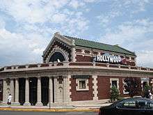
- Montclair Center, centered on the intersection of Bloomfield Avenue, South Fullerton Avenue, Glen Ridge Avenue and Church Street, is the township's main commercial zone. This intersection is also known as Six Corners. It is home to some of Montclair's largest stores and restaurants, and features many upscale restaurants and boutiques near the center of this commercial district. Near the eastern end of this district is Lackawanna Plaza, a shopping center with about ten stores built inside the former Lackawana railway station. There is a post office one block to the north of this area. In 2015, Montclair Center won the Great American Main Street Award from the National Trust for Historic Preservation.[47]
- Upper Montclair, in the north of the town, is the second largest commercial zone. The center is the intersection of Valley Road and Bellevue Avenue, and incorporates the surrounding areas. The Upper Montclair Business District is home to several restaurants and shops. This commercial zone is home to several chain stores such as Starbucks, Talbots, Williams-Sonoma, Gap, Cold Stone Creamery, Supercuts and CVS. Despite the recession, the area in 2009-2010 saw the opening of several new national and local merchants. Upper Montclair also has both a park, Anderson Park, and a railway station, Upper Montclair, nearby. There is a post office here.
- Watchung Plaza is located around the intersection of Watchung Avenue and Park Street, and is on the divide between two Montclair ZIP codes, 07042 and 07043. It is home to many "Mom and Pop Stores" and other small businesses. Watchung Plaza has its own post office. It is served by the Watchung Avenue train station.
- Walnut Street, built around the Walnut Street train station. In the spring, summer, and fall it is home to the Montclair Farmer's Market.
- South End, in the south of town, at the intersection of Cedar Avenue and Orange Road.
- Valley Road, between Chestnut Street and Claremont Avenue, is known locally as "Frog Hollow." This area has some strip-mall style shops on one side of Valley Road, and on the other side window shops with residential apartments on top of them.
Arts and culture
Montclair hosts many art institutions and theaters, and despite its relatively small size, has many art venues. It has its own art museum, the Montclair Art Museum, and several small galleries.
Montclair also hosts two theaters that showcase movies and films. Both were originally live theaters, but are now operated by Clearview Cinemas. While the Bellevue Cinema in Upper Montclair mostly shows mainstream Hollywood films, the Clairidge Cinema on Bloomfield Avenue shows different types of movies from documentaries to small scale indie films. The township hosted its first annual film festival in 2012 to provide a platform for filmmakers from New Jersey, the US and the world.[48][48]
Live theaters include The Montclair Operetta Company, the Wellmont Theatre, Montclair State University's Kasser Theater, Montclair State University's theater in Life Hall, and the Studio Playhouse. On Bloomfield Avenue there is a public stage used for concerts and other events. Dotted around Montclair there are also many art galleries, though most are centered in the Bloomfield Avenue Downtown Area.[49] Concerts are held at the Wellmont Theatre and at several churches and auditoriums sponsored by Outpost in the Burbs, a community-based organization.
Montclair was the setting for some of the stories in the HBO television series The Sopranos, and many Montclair streets, locations and businesses were featured in the show, such as Bloomfield Avenue.[50]
Sports
- Minor league baseball New Jersey Jackals of the Can-Am League. The Jackals play at Yogi Berra Stadium, which has seating for 3,784, plus overflow capacity.[51]
- Floyd Hall Arena, an ice rink which is actually located in Little Falls on the grounds of Montclair State University and is host to its ice hockey club. The facility also hosts other hockey leagues and teams and other on-ice sports.
- Former home to the New Jersey Pride of Major League Lacrosse.
- Montclair Rugby Club, also known as the Norsemen, of USA Rugby Division 2. They play at Codey Field.
- Essex Eagles cricket team, a Division III team in the Cricket League of New Jersey.
- Montclair United Soccer Club.
- Amateur Baseball Association baseball team the Montclair Giants[52]
Parks and recreation
Montclair is home to many parks and nature reserves.
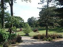
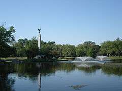
Montclair's parks include Edgemont Memorial Park, Essex Park, Glenfield Park, Nishuane Park, Erie Park, Tuers Park, Rand Park, Graz Park, Canterbury Park, Watchung Park, Eagle Rock Reservation, Brookdale Park, Anderson Park, Yantacaw Brook Park, the Bonsal Nature Reserve, Mountainside Park, the Presby Memorial Iris Gardens, and the Mills Reservation. The parks include many sports fields, and additional parks are school-owned, such as the Essex Park fields or Montclair State University's Sprague Field. In total Montclair has 153.9 acres (0.623 km2) of township park land spread around 18 parks and 123.8 acres (0.501 km2) of county park land consisting of five parks.[53]
The township has 18 public tennis courts, four skating rinks (two of which are indoor), and three public swimming pools: the Mountainside pool, the Nishuane pool, and the Essex pool.[54]
In 2007, township residents advocated for construction of a public skatepark.[55] Community members revitalized the effort in 2010 and lobbied the Parks and Recreation Committee for support. The township council passed a resolution expressing approval of the project, but allocated no funds for it.[56][57][58]
Government
.jpg)
Local government
Since July 1, 1988, Montclair has been governed under the council-manager plan 13 form of municipal government under the Faulkner Act, whose originator was a former mayor of Montclair.[59] The government consists of a mayor and a six-member Township Council. The mayor and council are all elected to four-year terms in concurrent nonpartisan elections. The mayor and two council seats are elected at-large, with four council seats elected from each of four wards.[3] A deputy mayor is selected by the six council members from their members, and this position is largely ceremonial.
Though the Mayor has no executive powers, the Mayor presides over council meetings and has both a voice and vote in its proceedings. The Mayor appoints members to many local governing groups, most notably the board of education.[60]
As of 2016, the Mayor of Montclair is Robert D. Jackson. Members of the Montclair Township Council are Deputy Mayor William L. Hurlock (First Ward), Dr. Renée E. Baskerville (Fourth Ward), Rich McMahon (At-Large), Robert J. Russo (At-Large), Robin Schlager (Second Ward) and Sean Spiller (Third Ward), all of whom serve terms of office that end on June 30, 2020.[4][61][62][63]
In elections held on May 8, 2012, Robert D. Jackson won election as mayor, defeating Karen Turner and Harvey Susswein.[64] Almost all of Jackson's Montclair 2012 slate also won office, with Rich McMahon and former Mayor Robert Russo winning the two at-large seats, Robin Schlager winning the Second Ward and Sean Spiller taking the Third Ward. For Montclair's Bill Hurlock won the First Ward seat and incumbent councilwoman Dr. Renée Baskerville, who ran as an independent, won the Fourth Ward seat. The new council took office on July 1, 2012. Russo was chosen by the council to be deputy mayor, succeeding Kathryn Weller-Demming.[65]
Federal, state and county representation
Montclair is split between the 10th and 11th Congressional Districts[66] and is part of New Jersey's 34th state legislative district.[10][67][68] Prior to the 2010 Census, Montclair had been part of the 8th Congressional District and the 10th Congressional District, a change made by the New Jersey Redistricting Commission that took effect in January 2013, based on the results of the November 2012 general elections.[69] The split that took effect in 2013 placed 26,730 residents living in the township's southern section in the 10th District, while 11,299 residents in the northern portions of the township were placed in the 11th District.[66][70]
New Jersey's Tenth Congressional District is represented by Donald Payne Jr. (D, Newark).[71] New Jersey's Eleventh Congressional District is represented by Rodney Frelinghuysen (R, Harding Township).[72] New Jersey is represented in the United States Senate by Cory Booker (D, Newark, term ends 2021)[73] and Bob Menendez (D, Paramus, 2019).[74][75]
For the 2016–2017 session (Senate, General Assembly), the 34th Legislative District of the New Jersey Legislature is represented in the State Senate by Nia Gill (D, Montclair) and in the General Assembly by Thomas P. Giblin (D, Montclair) and Sheila Oliver (D, East Orange).[76] The Governor of New Jersey is Chris Christie (R, Mendham Township).[77] The Lieutenant Governor of New Jersey is Kim Guadagno (R, Monmouth Beach).[78]
Essex County is governed by a directly-elected County Executive, with legislative functions performed by the Board of Chosen Freeholders.[79] As of 2016, the County Executive is Joseph N. DiVincenzo, Jr.[80] The county's Board of Chosen Freeholders consists of nine members, four elected on an at-large basis and one from each of five wards, who serve three-year terms of office on a concurrent basis, all of which end December 31, 2018.[79][81][82] Essex County's Freeholders are Freeholder President Britnee N. Timberlake (District 3 - East Orange, Newark's West and Central Wards, Orange and South Orange; East Orange)[83] Freeholder Vice President Brendan W. Gill (at large; Montclair),[84] Rufus I. Johnson (at large; Newark),[85] Lebby C. Jones (at large; Irvington),[86] Patricia Sebold (at large; Livingston),[87] Rolando Bobadilla (District 1 - Newark's North and East Wards, parts of Central and West Wards; Newark),[88] Wayne L. Richardson (District 2 - Irvington, Maplewood and Newark's South Ward and parts of West Ward; Newark),[89] Leonard M. Luciano (District 4 - Caldwell, Cedar Grove, Essex Fells, Fairfield, Livingston, Millburn, North Caldwell, Roseland, Verona, West Caldwell and West Orange; West Caldwell),[90] and Cynthia D. Toro (District 5 - Belleville, Bloomfield, Glen Ridge, Montclair and Nutley; Bloomfield).[91][92][93] Constitutional elected countywide are County Clerk Christopher J. Durkin (West Caldwell, 2020),[94] Sheriff Armando B. Fontoura (Fairfield, 2018)[95] and Surrogate Theodore N. Stephens II (2016).[96][81]
Politics
As of March 23, 2011, there were a total of 27,289 registered voters in Montclair, of which 14,782 (54.2%) were registered as Democrats, 2,581 (9.5%) were registered as Republicans and 9,903 (36.3%) were registered as Unaffiliated. There were 23 voters registered to other parties.[97]
In the 2012 presidential election, Democrat Barack Obama received 83.0% of the vote (15,811 cast), ahead of Republican Mitt Romney with 15.9% (3,034 votes), and other candidates with 1.1% (201 votes), among the 19,576 ballots cast by the township's 29,463 registered voters (530 ballots were spoiled), for a turnout of 66.4%.[98][99] In the 2008 presidential election, Democrat Barack Obama received 83.0% of the vote (17,396 cast), ahead of Republican John McCain with 15.7% (3,294 votes) and other candidates with 0.6% (132 votes), among the 20,951 ballots cast by the township's 27,476 registered voters, for a turnout of 76.3%.[100] In the 2004 presidential election, Democrat John Kerry received 78.8% of the vote (15,597 ballots cast), outpolling Republican George W. Bush with 20.2% (3,995 votes) and other candidates with 0.6% (157 votes), among the 19,804 ballots cast by the township's 25,762 registered voters, for a turnout percentage of 76.9.[101]
In the 2013 gubernatorial election, Democrat Barbara Buono received 70.5% of the vote (7,613 cast), ahead of Republican Chris Christie with 28.3% (3,057 votes), and other candidates with 1.2% (131 votes), among the 10,941 ballots cast by the township's 29,768 registered voters (140 ballots were spoiled), for a turnout of 36.8%.[102][103] In the 2009 gubernatorial election, Democrat Jon Corzine received 73.9% of the vote (10,139 ballots cast), ahead of Republican Chris Christie with 18.7% (2,573 votes), Independent Chris Daggett with 5.8% (801 votes) and other candidates with 0.8% (104 votes), among the 13,723 ballots cast by the township's 26,843 registered voters, yielding a 51.1% turnout.[104]
Transportation
Montclair is considered a commuter suburb of New York City. NJ Transit and DeCamp Bus Lines are the providers of public transportation. The average Montclair commute is 38 minutes each way. Twenty-four percent of commuters take mass transit, while 59% drive alone. Twelve times more Montclair commuters take mass transit than the national average.
Roads and highways
As of May 2010, the township had a total of 100.62 miles (161.93 km) of roadways, of which 86.68 miles (139.50 km) were maintained by the municipality and 13.94 miles (22.43 km) by Essex County.[105]
Bus
NJ Transit buses 11, 28, 29, 34, 97, 191 and 705 run through Montclair, most going along the main street, Bloomfield Avenue.[106] The NJ transit bus routes are:
- #11 from Downtown Newark through Verona, Cedar Grove, and Little Falls to Willowbrook Mall in Wayne. The only Montclair street it goes along is Bloomfield Avenue.
- #28 follows the route of #29 on Bloomfield Avenue until halfway through Montclair, where it goes north along Park Street, Watchung Avenue, and Valley Road to Montclair State University, and to Willowbrook Mall on Weekends
- #29 between West Caldwell and Newark, passing through Caldwell, Verona, Montclair, Glen Ridge, and Bloomfield on Bloomfield Avenue. It goes to Parsippany at rush hour. The only Montclair street it goes along is Bloomfield Avenue.
- #34 to Newark through East Orange and Orange on some trips, otherwise it goes to Bloomfield along Orange Road, Elm Street, and Bloomfield Avenue. It goes farther to the Montclair High School during that school's start and end times.
- #97 goes from the Montclair Center south along Orange and Harrison Roads through the Oranges.
- #191 goes from Willowbrook Mall through Little Falls to Montclair State University, then to the Port Authority Bus Terminal in Midtown Manhattan.
- #705 goes from Passaic along Alexander Avenue, Grove Street (for one block), Mt. Hebron Road and through Montclair State University to Willowbrook Mall.
All of these routes except #97, #191, and #705 were trolley lines originally, operated by the Public Service Railway. A trolley garage existed on Bloomfield Avenue. In the 1930s and 1950s the trolleys were destroyed and replaced with buses.
DeCamp Bus Lines routes 33 and 66 run through Montclair to the Port Authority Bus Terminal in New York City, carrying primarily commuters.
- #33 goes along Bloomfield Avenue, with some buses going onto Grove Street
- #66 goes along Orange Road, Park Street, Valley Road, and Mt. Hebron Road
Montclair State University has shuttle buses going around its campus.
The township of Montclair operates a jitney in the evening from the Bay Street train station to the southern end of Montclair.[107]
Rail
Running through Montclair is the Montclair-Boonton Line, serving New York Penn Station via Hoboken Terminal to the east, and Hackettstown to the west. Seven NJ Transit Rail stations serve Montclair: Bay Street, Walnut Street, Watchung Avenue, Upper Montclair, Mountain Avenue, and Montclair Heights in Montclair, and Montclair State University Station in the Great Notch area of Little Falls, New Jersey. Of these seven stations, only Bay Street station has weekend train service.
Montclair has a long history of railroads. The first railroad to Montclair was built in 1856 by the Newark and Bloomfield Railroad. It terminated at a station in Downtown Montclair. First the Morris and Essex Railroad, then the Delaware, Lackawanna and Western Railroad leased the line.
In 1868, the Montclair Railway built another line through Montclair, which caused disputes leading to Montclair's separation from Bloomfield. Shortly afterward it was taken over by the New York and Greenwood Lake Railway, a subsidiary of the Erie Railroad. A third railroad to Morristown was planned in 1860 and construction began, but the Panic of 1873 ended the project. In 1912 the Lackawanna Railroad built a large terminal at the end of their line. The Erie and Lackawanna Railroads later merged, forming the Erie-Lackawanna Railroad, which operated both lines for many decades. They were next operated by Conrail for approximately one year, after which NJ Transit took over passenger operations and Conrail continued freight operations. Meanwhile, the 1912 terminal was closed in 1981 and converted into shops. This station was replaced by the Bay Street station. In 2002, the two railway lines were connected with the construction of the Montclair Connection.[108]
Air and road
Montclair is 13 miles (21 km) from Newark Liberty International Airport, 42 miles (68 km) from JFK Airport and 31 miles (50 km) from LaGuardia Airport. The Garden State Parkway to the east, U.S. Route 46 and New Jersey Route 3 to the north, and New Jersey Route 23 to the west are slightly past the town's borders. The main road through Montclair is Bloomfield Avenue.
There is a taxi stand off of Bloomfield Avenue in eastern Montclair, in front of Lackawanna Plaza, formerly the Montclair train station.
Housing
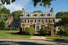
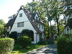
Montclair is noted for its historic architecture. It is home to six historic districts listed on the Register of Historic Places of both the state and country as a whole, 92 individually listed landmarks, and two locally designated commercial districts. Works by significant architects include designs by Van Vleck and Goldsmith, Charles Follen McKim, McKim, Mead, and White, Henry Hudson Holly, Charles A. Platt, Alexander Jackson Davis, Dudley Van Antwerp, Effingham R. North, Montrose Morris, and Frances Nelson, among others.
Montclair has also housed many hotels, such as the defunct Hotel Montclair. In 2013, plans were announced to bring a new hotel to Montclair, featuring 100 rooms and a liquor license.[109]
Education
.jpg)
The Montclair Public Schools serve students in Kindergarten through twelfth grade. As of the 2011-12 school year, the district's 11 schools had an enrollment of 6,625 students.[110] Schools in the district (with 2011-12 enrollment data from the National Center for Education Statistics[111]) are seven elementary schools (K-5, except as noted, with enrollment and magnet program listed in parentheses) — Bradford School[112] (456 students, Magnet Theme: The University Magnet), Charles H. Bullock School[113] (432, Environmental Science), Edgemont Montessori School[114] (304, Montessori), Hillside School[115] (3-5; 626, Gifted and Talented), Nishuane School[116] (K-2; 430, Gifted and Talented), Northeast School[117] (457, Global Studies) and Watchung School[118] (456, Science and Technology) — Glenfield Middle School[119] (717, Visual and Performing Arts), Buzz Aldrin Middle School[120] (548, Science, Technology, Engineering & Math) and Renaissance at Rand[121] (253, Liberal Arts) for grades 6-8, along with Montclair High School[122] (1,946) for grades 9-12.[123][124]
Montclair is home to Montclair State University, which was originally founded in 1908 as the New Jersey State Normal School at Montclair.[125]
The Roman Catholic Archdiocese of Newark supervises the operation of Immaculate Conception High School (coed) and Lacordaire Academy (for girls)at the high school level[126] and Lacordaire Academy Lower Division and St. Cassian School for grades PreK-8.[127] In 2016, St. Cassian School was one of ten schools in New Jersey, and one of four private schools in the state, recognized as a National Blue Ribbon School by the United States Department of Education, a recognition celebrating excellence in academics.[128][129]
Montclair is also home to a host of private and parochial schools, including Montclair Kimberley Academy, Montclair Community Pre-K, Virginia Harkness Sawtelle Learning, Maria Montessori Early Learning, Montclair Cooperative School, Trinity Academy and Deron School II.
Media
Montclair has two local newspapers, the Montclair Dispatch and the Montclair Times. In addition, there is a radio station at 90.3 FM on the campus of Montclair State University, WMSC. Montclair State University is also the major broadcasting site for NJTV in Northern New Jersey. Locals also subscribe to The Star-Ledger of Newark, New Jersey, and The New York Times. The township has a municipal public service television channel, Channel 34, where township council and school board meetings are broadcast. Montclair High School has its own paper the Mountaineer, and Montclair State University has its own student-run paper, the Montclarion.
Sister cities
Montclair has four sister cities, as listed by Sister Cities International:[130]
-
 Barnet, London, United Kingdom[131]
 -
 Cherepovets, Russia
 -
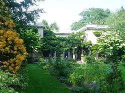
 Graz, Austria[132]
 -
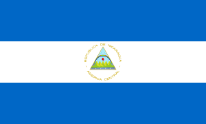 Laguna de Perlas (Pearl Lagoon), Nicaragua[133]
Points of interest
- Montclair Art Museum
- Howard Van Vleck Arboretum
- Presby Memorial Iris Gardens
- Van Vleck House and Gardens
- Crane House and Museum
- The Montclair Historical Society, which consists of:
- Nathaniel Crane House
- Clark House
- Evergreens (House)
- Yogi Berra Stadium and the Yogi Berra Museum and Learning Center
- Parks and dining in Upper Montclair
- Shopping on Bloomfield Avenue and on Church Street
Historic sites

Montclair is home to the following locations on the National Register of Historic Places:
- The Anchorage - 155 Wildwood Avenue (added 1988)
- Anderson Park - SE corner of Bellevue and North Mountain Avenue (added 2009)
- Joseph Bardsley House - 345 Park Street (added 1988)
- Bradner`s Pharmacy - 33 Watchung Plaza (added 1988)
- Carnegie Library - Church Street at Valley Road (added 1988)
- Casa Deldra - 35 Afterglow Way (added 1988)
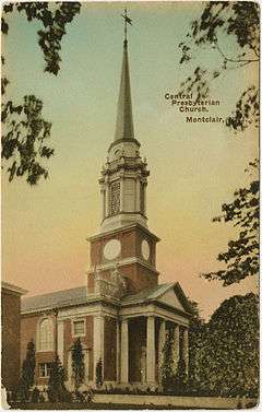
- Central Presbyterian Church - 46 Park Street (added 1986)
- J. M. Chapman House - 10 Rockledge (added 1988)
- Cliffside Hose Company No. 4 - 588 Valley Road (added 1988)
- Congregational Church - 42 S. Fullerton Avenue (added 1988)
- Israel Crane House - 110 Orange Road(added 1973)
- Eastward - 50 Lloyd Road (added 1988)
- Egbert Farm - 128 N. Mountain Avenue (added 1988)
- Henry Fenn House - 208 N. Mountain Avenue (added 1988)
- First Methodist Episcopal Church - 24 N. Fullerton Avenue (added 1988)
- Free Public Library, Upper Montclair Branch - 185 Bellevue Avenue (added 1988)
- Frank Goodwillie House - 17 Wayside Place (added 1988)
- Haskell's Bloomfield Villa - 84 Llewellyn Road (added 1988)
- House at 147 Park Street - 147 Park Street (added 1988)
- The House that Lives - 83 Watchung Avenue (added 1988)
- Marlboro Park Historic District - Roughly along Fairfield Street, Waterbury Road, Montclair Avenue, and Watchung Avenue between N. Fullerton and Grove Streets (added 1988)
- Marsellis House - 190 Cooper Avenue (added 1988)
- Miller Street Historic District - Miller and Fulton Streets between Elmwood Avenue, Elm and New Streets (added 1988)
- George A. Miller House - 275 Claremont Avenue (added 1988)
- Montclair Art Museum - 3 S. Mountain Avenue (added 1986)
- Montclair Railroad Station - Lackawanna Plaza (added 1973)
- Mountain Avenue Station - 451 Upper Mountain Avenue (added 1984)
- Mountain District - Roughly bounded by Highland, Bradford, Upper Mountain and Claremont Avenue (added 1988)
- Mulford House - 207 Union Street (added 1988)
- Pine Street Historic District - Roughly bounded by Glenridge Avenue, the NJ Transit Boonton Line, Pine and Baldwin Streets (added 2000)
- Post Office Building, Upper Montclair - 242-244 Bellevue Avenue (added 1988)
- Presby Memorial Iris Gardens Horticultural Center - 474 Upper Mountain Avenue (added 1980)
- M. F. Reading House - 87 Midland Avenue (added 1988)
- Red Gables - 99 S. Fullerton Avenue (added 1988)
- Charles S. Shultz House - 30 N. Mountain Avenue (added 1979)
- S. C. Smith House - 40 Northview Avenue (added 1988)
- St. Luke's Church - 69 S. Fullerton Avenue (added 1988)
- Stone Eagles - 60 Undercliff Road (added 1988)
- Upper Montclair Station - 275 Bellevue Avenue (added 1984)
- Van Reyper-Bond House - 848 Valley Road (added 1979)
- Von Schmid House - 580 Park Street (added 1988)
- Watchung Avenue Station - Park Street (added 1984)
- Allyn Wight House - 75 Gates Avenue (added 1988)
In popular culture
In the 1948 biographical novel Cheaper by the Dozen, the principal characters Frank Bunker Gilbreth Sr. and Lillian Moller Gilbreth live in Montclair, as the authors did in real life.[134]
Notable people
References
- Notes
- 1 2 3 4 5 6 2010 Census Gazetteer Files: New Jersey County Subdivisions, United States Census Bureau. Accessed May 21, 2015.
- 1 2 US Gazetteer files: 2010, 2000, and 1990, United States Census Bureau. Accessed September 4, 2014.
- 1 2 2012 New Jersey Legislative District Data Book, Rutgers University Edward J. Bloustein School of Planning and Public Policy, March 2013, p. 148.
- 1 2 Mayor & Council, Montclair Township. Accessed August 2, 2016.
- ↑ 2016 New Jersey Mayors Directory, New Jersey Department of Community Affairs. Accessed June 14, 2016.
- ↑ Township Manager, Township of Montclair. Accessed July 4, 2016.
- ↑ Municipal Clerk, Township of Montclair. Accessed July 4, 2016.
- ↑ U.S. Geological Survey Geographic Names Information System: Township of Montclair, Geographic Names Information System. Accessed March 8, 2013.
- 1 2 3 4 5 6 DP-1 - Profile of General Population and Housing Characteristics: 2010 for Montclair township, Monmouth County, New Jersey, United States Census Bureau. Accessed April 5, 2012.
- 1 2 3 4 Municipalities Grouped by 2011-2020 Legislative Districts, New Jersey Department of State, p. 14. Accessed January 6, 2013.
- 1 2 3 Table DP-1. Profile of General Demographic Characteristics: 2010 for Montclair township, New Jersey Department of Labor and Workforce Development. Accessed April 5, 2012.
- 1 2 PEPANNRES - Annual Estimates of the Resident Population: April 1, 2010 to July 1, 2015 - 2015 Population Estimates for New Jersey municipalities, United States Census Bureau. Accessed May 22, 2016.
- 1 2 GCT-PH1 Population, Housing Units, Area, and Density: 2010 - State -- County Subdivision from the 2010 Census Summary File 1 for New Jersey, United States Census Bureau. Accessed October 11, 2012.
- ↑ Look Up a ZIP Code for Montclair, NJ, United States Postal Service. Accessed April 5, 2012.
- ↑ ZIP codes, State of New Jersey. Accessed October 3, 2013.
- ↑ Area Code Lookup - NPA NXX for Montclair, NJ, Area-Codes.com. Accessed October 3, 2013.
- 1 2 American FactFinder, United States Census Bureau. Accessed September 4, 2014.
- ↑ A Cure for the Common Codes: New Jersey, Missouri Census Data Center. Accessed July 8, 2012.
- ↑ US Board on Geographic Names, United States Geological Survey. Accessed September 4, 2014.
- ↑ Table 7. Population for the Counties and Municipalities in New Jersey: 1990, 2000 and 2010, New Jersey Department of Labor and Workforce Development, February 2011. Accessed October 11, 2012.
- ↑ Staff. "N.J.'s population shifting to coast, south", USA Today. Accessed April 5, 2012.
- ↑ History of Montclair, Montclair Township. Accessed August 5, 2007. "When Bloomfield authorities declined to authorize a bond issue to underwrite another railroad, Montclair residents were successful in securing from the State legislature a charter for a separate township. Thus in 1868, the Township of Montclair was created."
- ↑ Snyder, John P. The Story of New Jersey's Civil Boundaries: 1606-1968, Bureau of Geology and Topography; Trenton, New Jersey; 1969. p. 129. Accessed July 6, 2012.
- ↑ Hutchinson, Viola L. The Origin of New Jersey Place Names, New Jersey Public Library Commission, May 1945. Accessed September 7, 2015.
- ↑ Gannett, Henry. The Origin of Certain Place Names in the United States, p. 21. United States Government Printing Office, 1905. Accessed September 7, 2015.
- ↑ Hanley, Robert. "Opponent of Distribution Formula For Federal Aid Steps Up Attack; As South Orange Moves to Become Township, Montclair Aide Calls for Equitable Sharing", The New York Times, August 29, 1977. Accessed September 24, 2015. "MONTCLAIR, Aug. 26 A Town Commissioner here is intensifying his five-year-long campaign to correct what he considers are inequities in the distribution of Federal revenue-sharing money that allows diversion of the grants to New Jersey's townships at the expense of the state's needy cities."
- ↑ "Chapter VI: Municipal Names and Municipal Classification", p. 73. New Jersey State Commission on County and Municipal Government, 1992. Accessed September 24, 2015.
- ↑ "Removing Tiering From The Revenue Sharing Formula Would Eliminate Payment Inequities To Local Governments", Government Accountability Office, April 15, 1982. Accessed September 24, 2015. "In 1978, South Orange Village was the first municipality to change its name to the 'township' of South Orange Village effective beginning in entitlement period 10 (October 1978 to September 1979). The Borough of Fairfield in 1978 changed its designation by a majority vote of the electorate and became the 'Township of Fairfield' effective beginning entitlement period 11 (October 1979 to September 1980).... However, the Revenue Sharing Act was not changed and the actions taken by South Orange and Fairfield prompted the Town of Montclair and West Orange to change their designation by referendum in the November 4, 1980, election. The municipalities of Belleville, Verona, Bloomfield, Nutley, Essex Fells, Caldwell, and West Caldwell have since changed their classification from municipality to a township."
- ↑ Narvaez, Alfonso A. "New Jersey Journal", The New York Times, December 27, 1981. Accessed September 24, 2015. "Under the Federal system, New Jersey's portion of the revenue sharing funds is disbursed among the 21 counties to create three 'money pools.' One is for county governments, one for 'places' and a third for townships. By making the change, a community can use the 'township advantage' to get away from the category containing areas with low per capita incomes."
- ↑ "Hackensack University Health Network and LHP Hospital Group", HackensackUMC Mountainside, July 12, 2012. Accessed October 3, 2013. "HackensackUMC Mountainside, located on the Montclair/Glen Ridge border, is known for providing access to state-of-the-art patient care in a nurturing, community hospital setting."
- ↑ Roll, Erin. "Glen Ridge baby boom: More than 500 births so far in 2013", Glen Ridge Voice, August 1, 2013. Accessed October 3, 2013. "Mountainside is located on the Montclair-Glen Ridge border, and the hospital's mailing address is listed as Montclair. But because the hospital building itself is located in Glen Ridge, every child born at the hospital has Glen Ridge listed as their place of birth."
- ↑ Census Estimates for New Jersey April 1, 2010 to July 1, 2015, United States Census Bureau. Accessed May 22, 2016.
- ↑ Compendium of censuses 1726-1905: together with the tabulated returns of 1905, New Jersey Department of State, 1906. Accessed October 3, 2013.
- ↑ Staff. 1914 Year Book, p. 69. Board of Trade of the City of Newark, 1914. Accessed October 11, 2012.
- ↑ Raum, John O. The History of New Jersey: From Its Earliest Settlement to the Present Time, Volume 1, p. 243, J. E. Potter and company, 1877. Accessed October 3, 2013. "Montclair was formed from Bloomfield, April 15th, 1868. The first mountain forms its boundary on the west, and separates it from Caldwell township. Population in 1870, 2,853."
- ↑ Staff. A compendium of the ninth census, 1870, p. 258. United States Census Bureau, 1872. Accessed October 3, 2013.
- ↑ Porter, Robert Percival. Preliminary Results as Contained in the Eleventh Census Bulletins: Volume III - 51 to 75, p. 98. United States Census Bureau, 1890. Accessed October 3, 2013.
- ↑ Thirteenth Census of the United States, 1910: Population by Counties and Minor Civil Divisions, 1910, 1900, 1890, United States Census Bureau, p. 336. Accessed July 8, 2012. 1890 population for Montclair Township is listed in Footnote 11.
- ↑ Fifteenth Census of the United States : 1930 - Population Volume I, United States Census Bureau, p. 711. Accessed July 8, 2012.
- ↑ Table 6. New Jersey Resident Population by Municipality: 1930 - 1990, New Jersey Department of Labor and Workforce Development. Accessed June 28, 2015.
- 1 2 3 4 5 Census 2000 Profiles of Demographic / Social / Economic / Housing Characteristics for Montclair township, Essex County, New Jersey, United States Census Bureau. Accessed March 26, 2012.
- 1 2 3 4 5 DP-1: Profile of General Demographic Characteristics: 2000 - Census 2000 Summary File 1 (SF 1) 100-Percent Data for Montclair township, Essex County, New Jersey, United States Census Bureau. Accessed October 11, 2012.
- ↑ Goodnough, Abby. "SCHOOLS: REFERENDUM; How to Pick the School Board?", The New York Times, October 22, 1995. Accessed April 5, 2012. "In a town that has always been proud of its diversity -- many residents say it was their primary reason for moving to Montclair -- the difference of opinion has caused considerable strife."
- ↑ Best Places city data for Montclair, BestPlaces.net. Accessed September 2008
- ↑ Where They Weekend: Montclair, NJ, Gawker.com, March 11, 2007. Accessed July 3, 2007.
- ↑ DP03: Selected Economic Characteristics from the 2006-2010 American Community Survey 5-Year Estimates for Montclair township, Essex County, New Jersey, United States Census Bureau. Accessed April 5, 2012.
- ↑ "Montclair Center BID, Montclair, New Jersey: 2015 Great American Main Street Award Winner". National Trust for Historic Preservation. March 29, 2015. Retrieved April 1, 2015.
- 1 2 "Mission | Montclair Film Festival". Montclairfilmfest.org. Retrieved 2013-03-26.
- ↑ Home page, Montclair Museum. September 3, 2009.
- ↑ Segedin, Andrew. "Montclair remembers 'Soprano' days", The Montclair Times, July 1, 2013. Accessed October 3, 2013. "Tierney's is far from the only Montclair establishment in which The Sopranos filmed. According to the Montclair Township Clerk's Office, the show also filmed at Montclair High School, Applegate Farms, the intersection of Bradford and Upper Mountain avenues, Valley Road and Madison Avenue."
- ↑ Yogi Berra Stadium, New Jersey Jackals. Accessed October 3, 2013.
- ↑ Montclair Giants
- ↑ Parks in Montclair, Montclair, New Jersey. Accessed March 30, 2016.
- ↑ Montclair Information, Township of Montclair. Accessed July 4, 2008.
- ↑ "Skateboarder Arrest Fuels New Bid For Skate park", July 31, 2007. Accessed October 3, 2013.
- ↑ Emling, Shelly. "Montclair Town Council To Consider Skate Park Resolution Tuesday", Montclair Patch, August 2, 2010. Accessed October 3, 2013.
- ↑ Emling, Shelly. "Skatepark In Montclair NJ! Ready To Make Its Case", Montclair Patch, July 4, 2010. Accessed October 3, 2013.
- ↑ "Montclair Parents and Skateboarders Rally For Skatepark", Baristanet, June 30, 2010. Accessed October 3, 2013.
- ↑ "The Faulkner Act: New Jersey's Optional Municipal Charter Law", New Jersey State League of Municipalities, July 2007. Accessed October 3, 2013.
- ↑ Montclair's Form of Government, Montclair Township. Accessed July 4, 2016.
- ↑ 2016 Municipal User Friendly Budget, Montclair Township. Accessed July 4, 2016.
- ↑ Essex County Directory, Essex County, New Jersey. Accessed July 1, 2016. Accessed July 1, 2016.
- ↑ 2016 Municipal Election May 10, 2016, Essex County, New Jersey Clerk, updated May 16, 2016. Accessed July 1, 2016.
- ↑ Staff. "Essex County election results: Montclair, Orange get new mayors", The Star-Ledger, May 8, 2012. Accessed July 8, 2012.
- ↑ Herbst, Diane. "New Montclair Township Council sworn in", The Montclair Times, July 1, 2012. Accessed July 8, 2012. "Shortly after they were sworn into office today, Sunday, July 1, members of the Montclair Township Council stand alongside one another at the council dais. From left are 1st Ward Councilman Bill Hurlock, 2nd Ward Councilwoman Robin Schlager, At-large Councilman Rich McMahon, Mayor Robert Jackson, Deputy Mayor and At-large Councilman Robert Russo, 3rd Ward Councilman Sean Spiller, and 4th Ward Councilwoman Renée Baskerville."
- 1 2 Plan Components Report, New Jersey Redistricting Commission, December 23, 2011. Accessed January 6, 2013.
- ↑ 2016 New Jersey Citizen's Guide to Government, p. 61, New Jersey League of Women Voters. Accessed July 20, 2016.
- ↑ Districts by Number for 2011-2020, New Jersey Legislature. Accessed January 6, 2013.
- ↑ 2011 New Jersey Citizen's Guide to Government, p. 61, New Jersey League of Women Voters. Accessed May 22, 2015.
- ↑ New Jersey Congressional Districts 2012-2021: Montclair Map, New Jersey Department of State. Accessed January 6, 2013.
- ↑ Directory of Representatives: New Jersey, United States House of Representatives. Accessed January 5, 2012.
- ↑ Directory of Representatives: New Jersey, United States House of Representatives. Accessed January 5, 2012.
- ↑ About Cory Booker, United States Senate. Accessed January 26, 2015. "He now owns a home and lives in Newark's Central Ward community."
- ↑ Biography of Bob Menendez, United States Senate, January 26, 2015. "He currently lives in Paramus and has two children, Alicia and Robert."
- ↑ Senators of the 114th Congress from New Jersey. United States Senate. Accessed January 26, 2015. "Booker, Cory A. - (D - NJ) Class II; Menendez, Robert - (D - NJ) Class I"
- ↑ Legislative Roster 2016-2017 Session, New Jersey Legislature. Accessed January 17, 2016.
- ↑ "About the Governor". State of New Jersey. Retrieved 2010-01-21.
- ↑ "About the Lieutenant Governor". State of New Jersey. Retrieved 2010-01-21.
- 1 2 General Information, Essex County, New Jersey. Accessed December 13, 2016. "The County Executive, elected from the County at-large, for a four-year term, is the chief political and administrative officer of the County.... The Board of Chosen Freeholders consists of nine members, five of whom are elected from districts and four of whom are elected at-large. They are elected for three-year concurrent terms and may be re-elected to successive terms at the annual election in November."
- ↑ Essex County Executive, Essex County, New Jersey. Accessed December 13, 2016.
- 1 2 County Directory, Essex County, New Jersey. Accessed December 13, 2016.
- ↑ Definition of a Freeholder, Essex County, New Jersey. Accessed December 13, 2016.
- ↑ Britnee N. Timberlake, Freeholder President / District 3, Essex County, New Jersey. Accessed December 13, 2016.
- ↑ Brendan W. Gill, Freeholder Vice President / At-Large, Essex County, New Jersey. Accessed December 13, 2016.
- ↑ Rufus I. Johnson, Freeholder At-Large, Essex County, New Jersey. Accessed December 13, 2016.
- ↑ Lebby C. Jones, Freeholder At-Large, Essex County, New Jersey. Accessed December 13, 2016.
- ↑ Patricia Sebold, Essex County, New Jersey. Accessed December 13, 2016.
- ↑ Rolando Bobadilla, Freeholder District 1, Essex County, New Jersey. Accessed December 13, 2016.
- ↑ Wayne L. Richardson, Freeholder District 2, Essex County, New Jersey. Accessed July 9, 2014.
- ↑ Leonard M. Luciano, Freeholder District 4, Essex County, New Jersey. Accessed December 13, 2016.
- ↑ Cynthia D. Toro, Freeholder District 5, Essex County, New Jersey. Accessed December 13, 2016.
- ↑ Members of the Board, Essex County, New Jersey. Accessed December 13, 2016.
- ↑ Breakdown of Freeholder Districts, Essex County, New Jersey. Accessed December 13, 2016.
- ↑ About, Essex County Clerk. Accessed December 13, 2016.
- ↑ Armando B. Fontoura - Essex County Sheriff, Essex County Sheriff's Office. Accessed December 13, 2016.
- ↑ Essex County Surrogate Theodore N. Stephens, II, Essex County Surrogate's Court. Accessed December 13, 2016.
- ↑ Voter Registration Summary - Essex, New Jersey Department of State Division of Elections, March 23, 2011. Accessed November 5, 2012.
- ↑ "Presidential General Election Results - November 6, 2012 - Essex County" (PDF). New Jersey Department of Elections. March 15, 2013. Retrieved December 24, 2014.
- ↑ "Number of Registered Voters and Ballots Cast - November 6, 2012 - General Election Results - Essex County" (PDF). New Jersey Department of Elections. March 15, 2013. Retrieved December 24, 2014.
- ↑ 2008 Presidential General Election Results: Essex County, New Jersey Department of State Division of Elections, December 23, 2008. Accessed November 6, 2012.
- ↑ 2004 Presidential Election: Essex County, New Jersey Department of State Division of Elections, December 13, 2004. Accessed November 6, 2012.
- ↑ "Governor - Essex County" (PDF). New Jersey Department of Elections. January 29, 2014. Retrieved December 24, 2014.
- ↑ "Number of Registered Voters and Ballots Cast - November 5, 2013 - General Election Results - Essex County" (PDF). New Jersey Department of Elections. January 29, 2014. Retrieved December 24, 2014.
- ↑ 2009 Governor: Essex County, New Jersey Department of State Division of Elections, December 31, 2009. Accessed November 6, 2012.
- ↑ Essex County Mileage by Municipality and Jurisdiction, New Jersey Department of Transportation, May 2010. Accessed July 18, 2014.
- ↑ Essex County Bus / rail connections, NJ Transit, backed up by the Internet Archive as of March 22, 2012. Accessed July 8, 2012.
- ↑ Shuttle Service, Montclair, New Jersey. Accessed October 11, 2012.
- ↑ Galant, Debra. 'JERSEY; Montclair's Connection Has Its Price", The New York Times, September 29, 2002. Accessed October 3, 2013. "On Sept. 20, New Jersey Transit officially terminated service at Mr. Wilson's beloved Benson Street stop, as well as at the Rowe Street stop in Bloomfield and the Arlington stop in Kearny. Those closings were part of the price of progress. Tomorrow, New Jersey Transit is to open the Montclair Connection -- a plan first announced in 1929 to combine the Montclair and Boonton Branch lines."
- ↑ Herbst, Diane. "First new hotel in Montclair in a century in 2014?", The Montclair Times, March 7, 2013. Accessed October 3, 2013. "Next year, an upscale, eight-story hotel with 100-plus rooms and a rooftop bar with views of the Manhattan skyline is expected to break ground in Montclair, the township's first new full-service hotel since the long-defunct Montclair Hotel was built in 1908."
- ↑ District information for Montclair School District, National Center for Education Statistics. Accessed September 15, 2014.
- ↑ School Data for the Montclair Public Schools, National Center for Education Statistics. Accessed September 15, 2014.
- ↑ Bradford School, Montclair Public Schools. Accessed October 3, 2013.
- ↑ Charles H. Bullock School, Montclair Public Schools. Accessed October 3, 2013.
- ↑ Edgemont Montessori School, Montclair Public Schools. Accessed October 3, 2013.
- ↑ Hillside School, Montclair Public Schools. Accessed October 3, 2013.
- ↑ Nishuane School, Montclair Public Schools. Accessed October 3, 2013.
- ↑ Northeast School, Montclair Public Schools. Accessed October 3, 2013.
- ↑ Watchung School, Montclair Public Schools. Accessed October 3, 2013.
- ↑ Glenfield Middle School, Montclair Public Schools. Accessed October 3, 2013.
- ↑ "Buzz Aldrin Middle School". www.montclair.k12.nj.us. Montclair School District. Retrieved 2016-10-12.
- ↑ Renaissance at Rand, Montclair Public Schools. Accessed October 3, 2013.
- ↑ Montclair High School, Montclair Public Schools. Accessed October 3, 2013.
- ↑ Our Schools, Montclair Public Schools. Accessed October 3, 2013.
- ↑ New Jersey School Directory for the Montclair Public Schools, New Jersey Department of Education. Accessed October 3, 2013.
- ↑ At a Glance, Montclair State University. Accessed October 11, 2012.
- ↑ Essex County Catholic High Schools, Roman Catholic Archdiocese of Newark. Accessed July 20, 2016.
- ↑ Essex County Catholic Elementary Schools, Roman Catholic Diocese of Newark. Accessed November 13, 2016.
- ↑ 2016 National Blue Ribbon Schools All Public and Non‐Public, National Blue Ribbon Schools Program. Accessed November 13, 2016.
- ↑ Clark, Adam. "These 10 N.J. schools earn Blue Ribbon honors", NJ Advance Media for NJ.com, September 28, 2016. Accessed November 13, 2016. "The U.S. Department of Education on Wednesday announced that 10 New Jersey schools have been named National Blue Ribbon Schools, a recognition celebrating excellence in academics."
- ↑ Sister Cities International 2015 Membership Directory, p. 42. Sister Cities International. Accessed August 31, 2015.
- ↑ Sister City Exchange With Barnet, England, accessed September 12, 2006.
- ↑ Twin Towns, Graz. Accessed April 7, 2015.
- ↑ Nicaragua Sister City projects
- ↑ Yardley, Jonathan. "Gold by a Couple: 'Cheaper by the Dozen'", The Washington Post, August 25, 203. Accessed March 30, 2016. "They had a 14-room house in the New Jersey bedroom community of Montclair and rode around in a 'gray Pierce Arrow, equipped with two bulb horns and an electric Klaxon, which Dad would try to blow all at the same time when he wanted to pass anyone.'"
External links
| Wikimedia Commons has media related to Montclair, New Jersey. |
| Wikivoyage has a travel guide for Montclair, New Jersey. |
- Township of Montclair Official Website
- Montclair Business Improvement District
- Montclair Historical Society
- Montclair, New Jersey at DMOZ
 |
Little Falls Township | Clifton | Clifton | |
| Verona Township Cedar Grove Township |
|
Bloomfield Township Glen Ridge | ||
| ||||
| | ||||
| West Orange Township | Orange | East Orange |
| County parks | | |
|---|---|---|
| Town parks |
| |
| Reservations |
| |
| Other facilities | ||
Municipalities and communities of Essex County, New Jersey, United States | ||
|---|---|---|
| Cities | 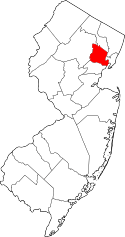 | |
| Boroughs | ||
| Townships | ||
| CDPs and planned communities | ||