Montauk Point State Park
| Montauk Point State Park | |
|---|---|
|
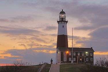
Sunrise over the Montauk Point Light in December 2005. | |
 Location of Montauk Point State Park within New York State | |
| Type | State park |
| Location |
2000 Montauk Highway Montauk, New York[1] |
| Nearest city | Montauk, New York |
| Coordinates | 41°04′12″N 71°51′18″W / 41.07°N 71.855°WCoordinates: 41°04′12″N 71°51′18″W / 41.07°N 71.855°W |
| Area | 862 acres (3.49 km2)[2] |
| Operated by | New York State Office of Parks, Recreation and Historic Preservation |
| Visitors | 816,970 (in 2014)[3] |
| Open | All year |
| Website | Montauk Point State Park |
Montauk Point State Park is a 862-acre (3.49 km2) state park[2] located in the hamlet of Montauk, at the eastern tip of Long Island in the Town of East Hampton, Suffolk County, New York. Montauk Point is the easternmost extremity of the South Fork of Long Island, and thus also of New York State.
History
The park contains the Montauk Point Light, which was authorized by the Second Congress, under President George Washington in 1792. Construction began on June 7, 1796 and was completed on November 5, 1796. The lighthouse and adjacent Camp Hero were heavily fortified with huge guns during World War I and World War II. Those gun emplacements and concrete observation bunkers (which are also at nearby Shadmoor State Park and Camp Hero State Park) are still visible.
The Amistad, a Spanish ship taken over by slaves in 1839, was captured by the USS Washington near Montauk Point. The slaves were allowed to briefly disembark here before being re-imprisoned and taken to New London, Connecticut for trial. The Amistad case was heard before the Supreme Court of the United States, where John Quincy Adams successfully argued that the slaves had been kidnapped. Following the trial, the slaves were permitted to return to Africa. The case fanned the debate over the abolition of slavery.
Park description
Montauk Point State Park features picnic tables, a food concession, playground, fishing, seasonal hunting, and trails for hiking and cross-country skiing.[4]
Suffolk Transit's S94 route also serves the park seasonally connecting it with Montauk Village. The park is located at the end of New York State Route 27.
Image gallery
.jpg)
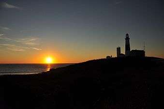 Montauk Light at sunrise
 Montauk Point Light in stormy weather
 Amistad Memorial
See also
References
- ↑ "Montauk Point State Park - Getting There". NYS Office of Parks, Recreation & Historic Preservation. Retrieved August 6, 2015.
- 1 2 "Section O: Environmental Conservation and Recreation, Table O-9". 2014 New York State Statistical Yearbook (PDF). The Nelson A. Rockefeller Institute of Government. 2014. p. 673. Retrieved March 6, 2016.
- ↑ "State Park Annual Attendance Figures by Facility: Beginning 2003". Data.ny.gov. Retrieved August 6, 2015.
- ↑ "Montauk Point State Park". NYS Office of Parks, Recreation & Historic Preservation. Retrieved August 6, 2015.
External links
- New York State Parks: Montauk Point State Park
- Montauklighthouse.com
- National Park Service List of New York Lighthouses