Montague Airport (California)
| Montague Airport-Yreka Rohrer Field Montague Air Force Auxiliary Field | |||||||||||||||
|---|---|---|---|---|---|---|---|---|---|---|---|---|---|---|---|
|
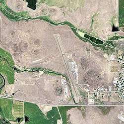
2006 USGS Photo | |||||||||||||||
| IATA: ROF[1] – ICAO: none – FAA LID: 1O5 | |||||||||||||||
| Summary | |||||||||||||||
| Airport type | Public | ||||||||||||||
| Owner | City of Montague, California | ||||||||||||||
| Location | Montague, California | ||||||||||||||
| Elevation AMSL | 2,527 ft / 770 m | ||||||||||||||
| Coordinates | 41°43′49″N 122°32′44″W / 41.73028°N 122.54556°WCoordinates: 41°43′49″N 122°32′44″W / 41.73028°N 122.54556°W | ||||||||||||||
| Map | |||||||||||||||
 ROF Location of Montague Airport | |||||||||||||||
| Runways | |||||||||||||||
| |||||||||||||||
The Montague Airport (IATA: ROF), also known as Yreka Rohrer Field (IATA: ROF, FAA LID: 1O5), is located on the west side of Montague, California.[2] It is owned by the City of Montague.
History
The municipal airport at Montague was created at its present location in 1928. The maintenance hangar and a small weather observatory building were built in 1928. Civilian Conservation Corps funds helped to bring in large quantities of gravel to stabilize the landing area in the early 1930s. Originally the airport was only a north-south dirt strip. A crosswind runway was added in the 1930s. A small amount of paving was added to the south end of the original strip in the 1950s to accommodate drag racing by automobiles, not aircraft.
During World War II, the airport was designated as Montague Air Force Auxiliary Field, and was an auxiliary training airfield for Hamilton Field, California.
The airport returned to civil control in 1945 after the war. The last major improvement consisted of lengthening the runway by six hundred feet to its present 3360 feet in 1982.
See also
- Siskiyou County Airport - also located in Montague
- California World War II Army Airfields
References
![]() This article incorporates public domain material from the Air Force Historical Research Agency website http://www.afhra.af.mil/.
This article incorporates public domain material from the Air Force Historical Research Agency website http://www.afhra.af.mil/.
- ↑ "Airline and Airport Code Search". IATA. Retrieved 6 April 2016.
- ↑ "Montague-Yreka Rohrer Field". Geographic Names Information System. United States Geological Survey. Retrieved 2009-05-04.
External links
- Resources for this airport:
- FAA airport information for 1O5
- AirNav airport information for 1O5
- ASN accident history for RKC
- FlightAware airport information and live flight tracker
- SkyVector aeronautical chart for 1O5
| Airfields |
| .svg.png) |
|---|---|---|
| Units | ||