Mont Gelé (3023 m)
| Mont Gelé | |
|---|---|
|
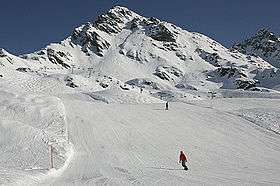
Mont Gelé from the south side | |
| Highest point | |
| Elevation | 3,023 m (9,918 ft) |
| Prominence | 219 m (719 ft) [1] |
| Coordinates | 46°5′48.6″N 7°16′45.4″E / 46.096833°N 7.279278°ECoordinates: 46°5′48.6″N 7°16′45.4″E / 46.096833°N 7.279278°E |
| Geography | |
 Mont Gelé Location in Switzerland | |
| Location | Valais, Switzerland |
| Parent range | Pennine Alps |
| Climbing | |
| Easiest route | Aerial tramway |
Mont Gelé (3,023 m) is a mountain of the Pennine Alps, overlooking Verbier in the Swiss canton of Valais. Located on the range north of Mont Fort, its summit is the tripoint between the municipalities (and valleys) of Bagnes, Riddes and Nendaz. It is one of the two mountains named Mont Gelé in the valley of Bagnes, the other being located on the Italian border.
In winter, Mont-Gelé summit can be reached from Verbier (or Siviez / Nendaz) through aerial cable-car (upper station: 3,002 m). It is also possible to go down the mountain by two official but off-piste ski slopes, for good skiers only.
See also
References
External links
![]() Media related to Mont Gelé (3023m) at Wikimedia Commons
Media related to Mont Gelé (3023m) at Wikimedia Commons
This article is issued from Wikipedia - version of the 5/9/2016. The text is available under the Creative Commons Attribution/Share Alike but additional terms may apply for the media files.