Monroe, Pennsylvania
| Monroe, Pennsylvania Monroeton | |
|---|---|
| Borough | |
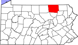
 Map of Bradford County with Monroe highlighted | |
 Monroe Location of Monroe in the state of Pennsylvania | |
| Coordinates: 41°42′46″N 76°28′31″W / 41.71278°N 76.47528°WCoordinates: 41°42′46″N 76°28′31″W / 41.71278°N 76.47528°W | |
| Country | United States |
| State | Pennsylvania |
| County | Bradford |
| Settled | 1828 |
| Incorporated | 1855 |
| Area | |
| • Total | 0.50 sq mi (1.29 km2) |
| • Land | 0.49 sq mi (1.28 km2) |
| • Water | 0.004 sq mi (0.01 km2) |
| Elevation | 1,047 ft (319 m) |
| Population (2010) | |
| • Total | 554 |
| • Density | 1,122/sq mi (433.2/km2) |
| Time zone | Eastern (EST) (UTC-5) |
| • Summer (DST) | EDT (UTC-4) |
| ZIP code | 18832 |
| Area code(s) | 570 |
Monroe (also referred to as Monroeton[1]) is a borough in Bradford County, Pennsylvania, United States. The population was 554 at the 2010 census.[2]
Geography
Monroe is located in south-central Bradford County at 41°42′46″N 76°28′31″W / 41.71278°N 76.47528°W (41.712709, -76.475308),[3] in the valley of Towanda Creek, a tributary of the Susquehanna River. The borough is surrounded by Monroe Township but is separate from it.
U.S. Route 220 passes through the borough, leading north 4 miles (6 km) to Towanda, the county seat, and south 9 miles (14 km) to New Albany. Pennsylvania Route 414 leads west from the borough 21 miles (34 km) to Canton.
According to the United States Census Bureau, the borough has a total area of 0.50 square miles (1.3 km2), of which 0.004 square miles (0.01 km2), or 1.01%, is water.[2]
While the official name of the borough is "Monroe",[4] inhabitants refer to the community as "Monroeton". The U.S. Post Office there is "Monroeton, PA 18832" and the road signs at the borough limits say "Monroeton".
Demographics
| Historical population | |||
|---|---|---|---|
| Census | Pop. | %± | |
| 1860 | 244 | — | |
| 1870 | 293 | 20.1% | |
| 1880 | 383 | 30.7% | |
| 1890 | 496 | 29.5% | |
| 1900 | 385 | −22.4% | |
| 1910 | 403 | 4.7% | |
| 1920 | 405 | 0.5% | |
| 1930 | 414 | 2.2% | |
| 1940 | 428 | 3.4% | |
| 1950 | 466 | 8.9% | |
| 1960 | 502 | 7.7% | |
| 1970 | 627 | 24.9% | |
| 1980 | 627 | 0.0% | |
| 1990 | 540 | −13.9% | |
| 2000 | 514 | −4.8% | |
| 2010 | 554 | 7.8% | |
| Est. 2015 | 528 | [5] | −4.7% |
| Sources:[6][7][8] | |||
As of the census[7] of 2000, there were 514 people, 207 households, and 150 families residing in the borough. The population density was 789.6 people per square mile (305.3/km²). There were 224 housing units at an average density of 344.1 per square mile (133.1/km²). The racial makeup of the borough was 97.08% White, 0.39% African American, 0.39% Native American, 0.58% from other races, and 1.56% from two or more races. Hispanic or Latino of any race were 0.58% of the population.
There were 207 households, out of which 33.8% had children under the age of 18 living with them, 58.9% were married couples living together, 9.7% had a female householder with no husband present, and 27.5% were non-families. 21.7% of all households were made up of individuals, and 9.7% had someone living alone who was 65 years of age or older. The average household size was 2.48 and the average family size was 2.87.
In the borough the population was spread out, with 26.8% under the age of 18, 3.9% from 18 to 24, 27.0% from 25 to 44, 27.4% from 45 to 64, and 14.8% who were 65 years of age or older. The median age was 40 years. For every 100 females there were 100.8 males. For every 100 females age 18 and over, there were 90.9 males.
The median income for a household in the borough was $38,750, and the median income for a family was $43,125. Males had a median income of $35,179 versus $25,625 for females. The per capita income for the borough was $18,242. About 7.1% of families and 12.9% of the population were below the poverty line, including 22.9% of those under age 18 and none of those age 65 or over.
References
- ↑ U.S. Geological Survey Geographic Names Information System: Monroeton
- 1 2 "Geographic Identifiers: 2010 Demographic Profile Data (G001): Monroe borough, Pennsylvania". U.S. Census Bureau, American Factfinder. Retrieved March 13, 2014.
- ↑ "US Gazetteer files: 2010, 2000, and 1990". United States Census Bureau. 2011-02-12. Retrieved 2011-04-23.
- ↑ ""Monroe Borough"". Bradford County official website. Retrieved March 13, 2014.
- ↑ "Annual Estimates of the Resident Population for Incorporated Places: April 1, 2010 to July 1, 2015". Retrieved July 2, 2016.
- ↑ "Census of Population and Housing". U.S. Census Bureau. Retrieved 11 December 2013.
- 1 2 "American FactFinder". United States Census Bureau. Retrieved 2008-01-31.
- ↑ "Incorporated Places and Minor Civil Divisions Datasets: Subcounty Resident Population Estimates: April 1, 2010 to July 1, 2012". Population Estimates. U.S. Census Bureau. Retrieved 11 December 2013.