Monmouth Executive Airport
| Monmouth Executive Airport | |||||||||||||||
|---|---|---|---|---|---|---|---|---|---|---|---|---|---|---|---|
| IATA: BLM – ICAO: KBLM – FAA LID: BLM | |||||||||||||||
| Summary | |||||||||||||||
| Airport type | Public use | ||||||||||||||
| Owner | Wall Herald Corp. | ||||||||||||||
| Serves | Belmar / Farmingdale, New Jersey | ||||||||||||||
| Location | Wall Township, Monmouth County | ||||||||||||||
| Elevation AMSL | 153 ft / 47 m | ||||||||||||||
| Coordinates | 40°11′12″N 074°07′28″W / 40.18667°N 74.12444°WCoordinates: 40°11′12″N 074°07′28″W / 40.18667°N 74.12444°W | ||||||||||||||
| Map | |||||||||||||||
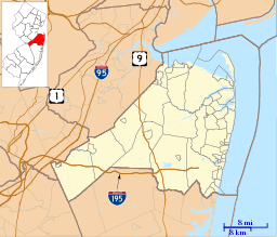 BLM Location in Monmouth County | |||||||||||||||
| Runways | |||||||||||||||
| |||||||||||||||
| Statistics (2010) | |||||||||||||||
| |||||||||||||||
Monmouth Executive Airport (IATA: BLM[2], ICAO: KBLM, FAA LID: BLM) is a privately owned, public use airport in Monmouth County, New Jersey.[1] It is in Wall Township six miles west of Belmar, east of Farmingdale.[1] The National Plan of Integrated Airport Systems for 2011–2015 categorized it as a general aviation reliever airport. Prior to 2003, it was known as Allaire Airport.[3] The airport was sold on December 3, 2013 to a consortium known as Wall Aviation.[4] The new owners intend to evict current renters and upgrade the facility to serve corporate clients.[5]
In an analysis by the Regional Plan Association in 2011, Monmouth Executive scored highly as a potential airport for airline flights to expand capacity and relieve aviation congestion in the New York area.[6]
Facilities
Monmouth Executive Airport covers 850 acres (344 ha) at an elevation of 153 feet (47 m). It has two asphalt runways: 14/32 is 7,371 by 85 feet (2,247 x 26 m) and 3/21 is 3,512 by 50 feet (1,070 x 15 m).[1]
In the year ending January 1, 2010 the airport had 57,229 aircraft operations, average 156 per day: 83% general aviation and 17% air taxi.[1]
Incidents and accidents
On February 15, 2010 a small aircraft, identified as a Cessna 337, crashed on approach to the airport, killing all five people on board. The NTSB accident report indicated that the pilot made an abrupt maneuver while exceeding the operating limitations of the aircraft which caused a structural failure of the right wing.
The National Transportation Safety Board determines the probable cause(s) of this accident as follows: The pilots’ failure to adhere to the airplane’s operating limitations, which resulted in overload failure of the right wing. Findings of the investigation were the adverse effects of multiple supplemental type certificates (STC) to the airframe wing structure that were not evaluated at the time the STCs were installed and the lack of guidance by the Federal Aviation Administration for multiple STC interaction evaluation.
See also
References
- 1 2 3 4 5 FAA Airport Master Record for BLM (Form 5010 PDF). Federal Aviation Administration. Effective November 15, 2012.
- ↑ "IATA Airport Code Search (BLM: Belmar / Monmouth County)". International Air Transport Association. Retrieved October 25, 2013.
- ↑ "KBLM – Allaire Airport". FAA data republished by AirNav. October 3, 2002. Archived from the original on November 7, 2002.
- ↑ Strunsky, Steve (December 8, 2013). "After 75 years in the family, Monmouth Executive Airport is under new management". The Star-Ledger. Retrieved 2013-12-08.
- ↑ Serrano, Ken (Nov 22, 2013). "Monmouth airport's new owners hope to lure more corporate jets". Asbury Park Press. Retrieved 2013-12-08.
- ↑ Zupan, Jeffrey M.; Brone, Richard E.; Lee, Matthew H. (January 2011), Upgrading to World Class The Future of the New York Region's Airports (PDF), Regional Plan Association
External links
- Monmouth Executive Airport (BLM) from New Jersey DOT Airport Directory
- Aviation photos of Monmouth Executive Airport at jetphotos.net
- Aerial image as of March 1995 from USGS The National Map
- FAA Terminal Procedures for BLM, effective December 8, 2016
- Resources for this airport:
- FAA airport information for BLM
- AirNav airport information for KBLM
- ASN accident history for BLM
- FlightAware airport information and live flight tracker
- NOAA/NWS latest weather observations
- SkyVector aeronautical chart, Terminal Procedures