Monein
| Monein | ||
|---|---|---|
|
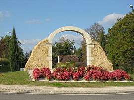
La route de Monein | ||
| ||
 Monein | ||
|
Location within Nouvelle-Aquitaine region  Monein | ||
| Coordinates: 43°19′16″N 0°34′42″W / 43.3211°N 0.5783°WCoordinates: 43°19′16″N 0°34′42″W / 43.3211°N 0.5783°W | ||
| Country | France | |
| Region | Nouvelle-Aquitaine | |
| Department | Pyrénées-Atlantiques | |
| Arrondissement | Oloron-Sainte-Marie | |
| Canton | Monein | |
| Intercommunality | Communauté de communes de Monein | |
| Government | ||
| • Mayor (2008–2014) | Yves Salanave-Péhé | |
| Area1 | 80.84 km2 (31.21 sq mi) | |
| Population (2006)2 | 4,478 | |
| • Density | 55/km2 (140/sq mi) | |
| Time zone | CET (UTC+1) | |
| • Summer (DST) | CEST (UTC+2) | |
| INSEE/Postal code | 64393 / 64360 | |
| Elevation |
109–357 m (358–1,171 ft) (avg. 155 m or 509 ft) | |
| Website | http://www.monein.fr/ | |
|
1 French Land Register data, which excludes lakes, ponds, glaciers > 1 km² (0.386 sq mi or 247 acres) and river estuaries. 2 Population without double counting: residents of multiple communes (e.g., students and military personnel) only counted once. | ||
.svg.png)
Monein is a commune in the Pyrénées-Atlantiques department in south-western France.
Geography
Neighbouring Communes
- North: Lahourcade and Pardies
- West: Lucq-de-Béarn and Cardesse
- South: Estialescq and Lasseube
- East: Aubertin, Lacommande, Arbus, Cuqueron and Parbayse
History
Administration
List of successive mayors of Monein
| Name | Political Party | In office |
|---|---|---|
| Léopold Joly | 1977-1983 | |
| Maurice Bahurlet | PS | 1983-1989 |
| Maurice Bahurlet | PS | 1989-1995 |
| Maurice Bahurlet | PS | 1995-2001 |
| Yves Salanave-Péhé | DVG | 2001–2008 |
| Yves Salanave-Péhé | DVG | 2008–2014 |
Notable people
Gallery
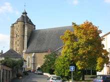 Saint-Girons church in Monein
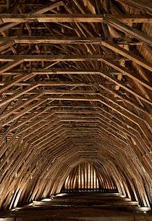
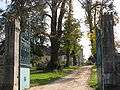 The entrance of le parc du château (the Park of Castle)
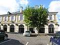 The halls
See also
References
External links
| Wikimedia Commons has media related to Monein. |
This article is issued from Wikipedia - version of the 9/29/2015. The text is available under the Creative Commons Attribution/Share Alike but additional terms may apply for the media files.