Mondavezan
| Mondavezan | |
|---|---|
|
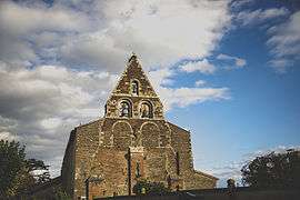
Church of Saint-Michel, in the centre of Mondavezan | |
 Mondavezan | |
|
Location within Occitanie region  Mondavezan | |
| Coordinates: 43°14′25″N 1°02′07″E / 43.2403°N 1.0353°ECoordinates: 43°14′25″N 1°02′07″E / 43.2403°N 1.0353°E | |
| Country | France |
| Region | Occitanie |
| Department | Haute-Garonne |
| Arrondissement | Muret |
| Canton | Cazères |
| Government | |
| • Mayor (2008–2014) | Jacques Gros |
| Area1 | 21.09 km2 (8.14 sq mi) |
| Population (2008)2 | 771 |
| • Density | 37/km2 (95/sq mi) |
| Time zone | CET (UTC+1) |
| • Summer (DST) | CEST (UTC+2) |
| INSEE/Postal code | 31349 / 31220 |
| Elevation |
252–374 m (827–1,227 ft) (avg. 300 m or 980 ft) |
|
1 French Land Register data, which excludes lakes, ponds, glaciers > 1 km² (0.386 sq mi or 247 acres) and river estuaries. 2 Population without double counting: residents of multiple communes (e.g., students and military personnel) only counted once. | |
Mondavezan is a commune in the Haute-Garonne department in southwestern France.
Population
| Historical population | ||
|---|---|---|
| Year | Pop. | ±% |
| 1962 | 467 | — |
| 1968 | 487 | +4.3% |
| 1975 | 466 | −4.3% |
| 1982 | 485 | +4.1% |
| 1990 | 554 | +14.2% |
| 1999 | 643 | +16.1% |
| 2008 | 771 | +19.9% |
See also
References
| Wikimedia Commons has media related to Mondavezan. |
This article is issued from Wikipedia - version of the 10/16/2015. The text is available under the Creative Commons Attribution/Share Alike but additional terms may apply for the media files.