Mohammadpur Thana
| Mohammadpur মোহাম্মদপুর | |
|---|---|
| Thana | |
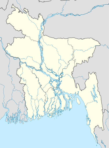 Mohammadpur Location in Bangladesh | |
| Coordinates: 23°45.3′N 90°21.8′E / 23.7550°N 90.3633°ECoordinates: 23°45.3′N 90°21.8′E / 23.7550°N 90.3633°E | |
| Country |
|
| Division | Dhaka Division |
| District | Dhaka District |
| Area | |
| • Total | 11.65 km2 (4.50 sq mi) |
| Population (1991) | |
| • Total | 316,203 |
| • Density | 27,142/km2 (70,300/sq mi) |
| Time zone | BST (UTC+6) |
| Postal code | 1207 |
| Website | Official Map of the Mohammadpur Thana |
Mohammadpur (Bengali: মোহাম্মদপুর) is a thana of Dhaka District in the division of Dhaka, Bangladesh. Though initially Mohammadpur had grown as a residential area, nowadays many commercial places can be found here. Post code of Mohammadpur is 1207.

History
Unlike some parts of Dhaka city, most parts of Mohammadpur was planned in the 1950s. Therefore, it has relatively broad streets and avenues. Saat Masjid, a prominent archaeological structure of Bangladesh, is here. A renowned mosque of Dhaka city called Shia Masjid is also here.
Geography
Mohammadpur is at 23°45′15″N 90°21′45″E / 23.7542°N 90.3625°E. It has 57551 units of households and area 11.65 km².
Mohammadpur is connected to Sadar Ghat and Gabtali by the city protection dam. Mohammadpur borders Shyamoli and Adabor Thana on the north, Sher-E-Bangla Nagar on the east and Dhanmondi and Hazaribagh thanas on the south.
Demographics
As of 1991 Bangladesh census, Mohammadpur has a population of 316,203. Males constitute 55.02% of the population, and females 44.98%. This upazila's population over 18 years of age is 185,413. Mohammadpur has an average literacy rate of 56.2% (7+ years), and the national average of 32.4% literate.[1] Mostly middle-class people live here.
A 2011 census shows that Mohammadpur has a population of 355,843, 55.17% male and 44.83% female.[2]
Points of interest
Residential blocks
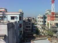
One of the largest apartment blocks in the capital, Japan Garden City is in this neighborhood. Besides, Pisciculture Housing Society, Mohammadia Housing Society, Baitul Aman Housing Society, Chad Miah Housing, Probal Housing and a number of residential areas have grown. This has resulted in a real estate construction boom accompanied with markets and shopping complexes.
Shopping markets
One of the large markets of Bangladesh, Krishi Market, is where one can find vegetables, fruits, household things, and other commodities. Town Hall Market is by the side of Asad Gate.
Geneva Camp
The Geneva Camp for "Stranded Pakistanis" (originally from the Indian state of Bihar who migrated to the then East Pakistan during the Partition of 1947) is in Mohammadpur. Pakistanis have been living there since the end of the 1971 War of Liberation.
Asad Gate
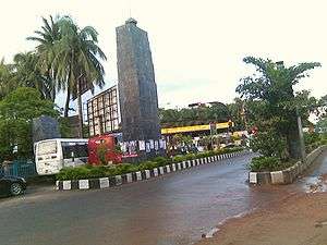
Asad Gate is the monument of the country's liberation war. It was named after an unarmed young man named Asad who was killed by the Pakistani army during protests against the erstwhile military junta of Pakistan, part of Bangladesh's independence movement. This area is in Mohammadpur; Asad Avenue is, too.
Transportation
BRTC, Mega City, Raja City, Rajdhani Express, Rangdhonu, Oneline, ATCL, Moitri, Torongo, Torongo Plus, Midway, Malancha, Arch Paribahan, 13 No. and some other bus transportation companies have facilitated the communication system of the inhabitants of this area.
Education
Schools & Colleges
- Govt.Graphic Arts Institute
- Mohammadpur Government High School
- Mohammadpur Girls' High School
- Mohammadpur Preparatory Higher Secondary School
- St. Joseph Higher Secondary School
- St Francis Xavier's Green Herald International School
- Dhaka Residential Model College
- Mohammadpur Central University College
- Alhaj Mokbul Hossain Bisshobiddalay College
- Mohammadpur Model School & College
- Bengali Medium High School
- Dr. M Mizanur Rahman Professional College
- Dr. M Mizanur Rahman Collegiate School
Universities
See also
References
- ↑ "Population Census Wing, BBS.". Archived from the original on 2005-03-27. Retrieved November 10, 2006.
- ↑ http://www.bbs.gov.bd/WebTestApplication/userfiles/Image/Census2011/Dhaka/Dhaka/Dhaka_C02.pdf