Muadamiyat al-Sham
| Muadamiyat al-Sham قرية معظمية الشام | |
|---|---|
 Muadamiyat al-Sham | |
| Coordinates: 33°28′N 36°11′E / 33.46°N 36.19°E | |
| Country |
|
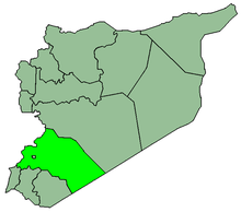
| Governorate | Rif Dimashq Governorate |
| District | Darayya District |
| Nahiyah | Darayya |
| Population (2004 census) | |
| • Total | 52,738 |
| Time zone | EET (UTC+2) |
| • Summer (DST) | EEST (UTC+3) |
Muadamiyat al-Sham (Arabic: قرية معظمية الشام; also spelled Moadamiyet al-Sham, Moadamiya or Moadamiyah) is a town in southern Syria, administratively a part of the Darayya District in the Rif Dimashq Governorate, located ca. 10 kilometers (6.2 mi) southwest of Damascus, within an area called the Western Ghouta.[1] Nearby localities include the centre of Darayya to the east, Jdeidat Artouz and Sahnaya to the south, and Qudsaya to the north.
According to the Syria Central Bureau of Statistics, the town had a population of 52,738 in the 2004 census.[2] The town is "famed for its olive orchards".[3]
Syrian civil war
During the Syrian civil war Moadamiyah was encircled and besieged by pro-government forces from April 2013, and was one of the areas of Damascus hit by a sarin attack on 21 August 2013 (Ghouta chemical attack). When a Wall Street Journal reporter visited the town in October 2013, the population of the still-besieged town was down to an estimated 12,500, and residents said food supplies were exhausted.[3] The rebels in control of the town agreed to surrender to the Syrian Army in September 2016.[4][5] They surrendered the town on 19 October and many chose to leave to Idlib along with over 2000 residents.[6] [7][8]
References
- ↑ "Maadamiyeh/Damaskus - Wikimapia". Wikimapia.
- ↑ General Census of Population and Housing 2004. Syria Central Bureau of Statistics (CBS). Rif Dimashq Governorate. (Arabic)
- 1 2 Sam Dagher, Wall Street Journal, 2 October 2013, Syrian Regime Chokes Off Food to Town That Was Gassed
- ↑ "Syria regime threatens besieged Damascus town with "total war"". Toronto Star. 1 September 2016. Retrieved 2 September 2016.
- ↑ "Another besieged Damascus suburb surrenders". The National. 1 September 2016. Retrieved 2 September 2016.
- ↑ "Another opposition-held Damascus suburb to be evacuated on Wednesday". The New Arab. 19 October 2016.
- ↑ "Syrian forces move rebels and civilians from besieged Damascus suburb". Middle East Eye. 19 October 2016.
- ↑ "Await for the start of a new displacement operation from the Western Ghouta to the Syrian north". Syrian Observatory For Human Rights. 19 October 2016.