Miyashiro, Saitama
| Miyashiro 宮代町 | |||
|---|---|---|---|
| Town | |||
|
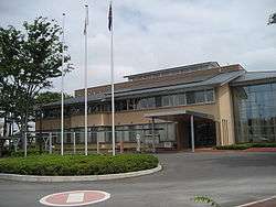
Miyashiro town office | |||
| |||
 Location of Miyashiro in Saitama Prefecture | |||
 Miyashiro
| |||
| Coordinates: 36°1′21.6″N 139°43′21.8″E / 36.022667°N 139.722722°ECoordinates: 36°1′21.6″N 139°43′21.8″E / 36.022667°N 139.722722°E | |||
| Country | Japan | ||
| Region | Kantō | ||
| Prefecture | Saitama Prefecture | ||
| District | Minamisaitama | ||
| Area | |||
| • Total | 15.95 km2 (6.16 sq mi) | ||
| Population (February 2016) | |||
| • Total | 33,927 | ||
| • Density | 2,130/km2 (5,500/sq mi) | ||
| Time zone | Japan Standard Time (UTC+9) | ||
| - Tree | Castanopsis | ||
| - Flower | Magnolia liliiflora | ||
| Phone number | 0480-34-1111 | ||
| Address | 1-4-1 Kasahara, Miyashiro-machi, Minamisaitama-gun, Saitama-ken 345-8504 | ||
| Website | Official website | ||


Miyashiro (宮代町 Miyashiro-machi) is a town located in Minamisaitama District, Saitama Prefecture, in the central Kantō region of Japan. As of 1 February 2016, the town had an estimated population of 33,927 and a population density of 2130 persons per km². Its total area was 15.95 square kilometres (6.16 sq mi).
Geography
Miyashiro is located in central-west Saitama Prefecture.
Surrounding municipalities
History
The villages of Monma and Suka were created within Minamisaitama District, Saitama with the establishment of the municipalities system on April 1, 1889. The two villages were merged on July 20, 1955 to form the town of Miyashiro. Ina was elevated to town status on November 1, 1970. The origin of the town's name comes from the shrines of the largest villages. "Miya" was taken from Himemiya shrine (姫宮神社) in Himemiya village and "shiro" from Konoshiro shrine (身代神社) in Suka village.
Economy
The economy of Miyashiro is primarily agricultural.
Education
- Nippon Institute of Technology
- Miyashiro has four elementary schools, three middle schools, one high school and one special education school.
Transportation
Railway
Highway
Local attractions
- Tōbu Zoo (東武動物公園 Tōbu Dōbutsu Kōen), a zoological-amusement park complex which is owned by the Tōbu Group.
Noted people from Miyashiro
- Mariko Kouda, voice actress
External links
![]() Media related to Miyashiro, Saitama at Wikimedia Commons
Media related to Miyashiro, Saitama at Wikimedia Commons
- Official website (Japanese)
| Wards of Saitama | ||
|---|---|---|
| Core cities | ||
| Special cities | ||
| Cities | ||
| Chichibu District | ||
| Hiki District | ||
| Iruma District | ||
| Kitaadachi District | ||
| Kitakatsushika District | ||
| Kodama District | ||
| Minamisaitama District | ||
| Ōsato District | ||