Misterton with Walcote
| Misterton with Walcote | |
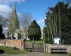 St Leonards Church, Misterton |
|
 Misterton with Walcote |
|
| Population | 486 (2011 Census) |
|---|---|
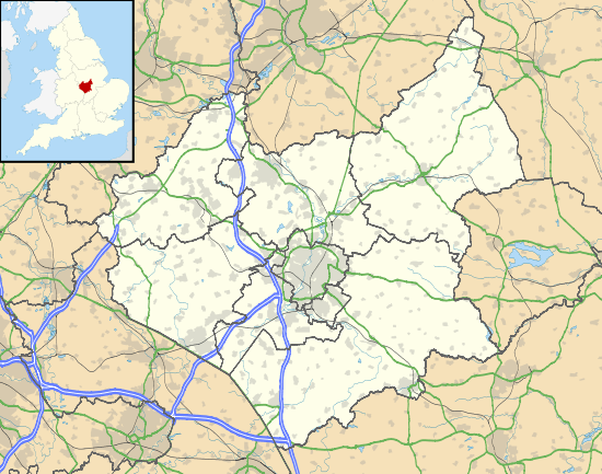
| OS grid reference | SP568841 |
| Civil parish | Misterton with Walcote |
| District | Harborough |
| Shire county | Leicestershire |
| Region | East Midlands |
| Country | England |
| Sovereign state | United Kingdom |
| Post town | LEICESTER |
| Postcode district | LE17 4 |
| Police | Leicestershire |
| Fire | Leicestershire |
| Ambulance | East Midlands |
| EU Parliament | East Midlands |
|
|
Coordinates: 52°27′07″N 1°09′53″W / 52.45193°N 1.16472°W
Misterton with Walcote is a civil parish in the English county of Leicestershire. The population of the civil parish at the 2011 census was 486.[1]
It forms part of the Harborough district. Of its two settlement Walcote is by far the larger, but Misterton has the parish church.
Walcote is on the A4304 road some two miles east if the town of Lutterworth and a mile east of Junction 20 of the M1 motorway. The village now has no public houses, The Black horse is closed down and the Tavern is now a private dwelling.It has a filling station.
A short circular walk linking Walcote and Misterton can be made by following Brook Street and taking the footpath left which joins a track which passes the Misterton Hall and St. Leonards Church. On reaching the main road, turning left onto a cyclepath by the woods of Misterton Park brings you back to Walcote.
References
- ↑ "Civil Parish population 2011". Neighbourhood Statistics. Office for National Statistics. Retrieved 17 June 2016.
External links
| Wikimedia Commons has media related to Misterton with Walcote. |
- Parish Profile
- Parish Council website
- Historic photographs
- Misterton with Walcote Community Trust
- Vision through time