Missouri National Recreational River
| Missouri National Recreational River | |
|---|---|
|
IUCN category III (natural monument or feature) | |
 | |
| Location | Nebraska and South Dakota, USA |
| Nearest city | Yankton, SD |
| Coordinates | 42°51′45″N 97°23′34″W / 42.86250°N 97.39278°WCoordinates: 42°51′45″N 97°23′34″W / 42.86250°N 97.39278°W |
| Area | 33,800 acres (137 km2) |
| Established | November 10, 1978 |
| Governing body | National Park Service |
| Website | Missouri National Recreational River |
The Missouri National Recreational River is located on the border between Nebraska and South Dakota. The designation was first applied in 1978 to a 59-mile section of the Missouri River between Gavins Point Dam and Ponca State Park. In 1991, an additional 39-mile section between Fort Randall Dam and Niobrara, Nebraska, was added to the designation. These two stretches of the Missouri River are the only parts of the river between Montana and the mouth of the Missouri that remain undammed or unchannelized. The last 20 miles of the Niobrara River and 6 miles of Verdigre Creek were also added in 1991.
The Missouri National Recreational River is managed by the National Park Service. It lies in parts of Boyd, Cedar, and Dixon counties in Nebraska, and Bon Homme, Charles Mix, Clay, Union, and Yankton counties in South Dakota. There are visitor centers at Gavins Point Dam and Ponca State Park.
History
People have lived along the river for some 10,000 years.[1] Archeologists have found their tools and weapons, homes, foods, religious, and ceremonial objects.[1] The River is one of three historic east-west corridors, similar to the Oregon and Santa Fe trails. It was a pathway of American Indians, Lewis and Clark, trappers and traders, steamboat captains, and settlers.[1] French and Spanish traders preceded Lewis & Clark's 1804 expedition. The Yellow Stone was the first steamboat to sail this stretch of the river in 1832 on the way to Fort Union Trading Post. The 1858 Treaty with the Yankton Sioux opened the southeastern portion of the Dakota Territory to white settlement. The Homestead Act of 1862 encouraged immigration into the region. [1]
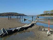
During steamboat era, the Missouri was characterized by shifting channels, numerous braided channels, chutes, sloughs, islands, sandbars, and backwater areas.[1] Well over 300 steamboats sank in the river between 1819 and 1920.[1]
By the mid-20th century, extensive flooding prompted the passage of many flood control measures. The Flood Control Act of 1944, (the Pick-Sloan Plan) created the Fort Randall and Gavins Point dams, causing major changes to the river's hydrology and habitats.[1]
Flora and fauna
Along the river there are two major plant communities. The floodplain forest includes willow and cottonwood. The bluffs are covered by elm and oak. The annual floods create a variation of floodplain vegetation and succession throughout the park.[2] New deposits such as sandbars and accretions adjacent to the riverbanks are covered with the pioneer species: annual weeds, short-lived grasses, sedges, and seedling willow and cottonwood. On higher above the water table, larger willow and cottonwood trees dominate.[2] The floodplain forest includes larger cottonwoods on the highest banks and islands. The understory in the cottonwood forest is primarily dogwood, sumac, wild grape, and poison ivy. The sparse vegetation under the mature cottonwoods consists mostly of scouring rush, Kentucky bluegrass, smooth brome, and other invasive grasses and weeds.[2]

Above the floodplain, there is a mixed forest and agricultural fields. The forests on the adjoining bluffs are primarily hardwoods with the slopes covered by a dense growth of oak, ash, mulberry, and walnut, with burr oak as the dominant species.[2]
Wildlife is plentiful. Since the days of Lewis and Clark the larger mammals have disappeared, including the grizzly bear, bison, and elk. Small mammals, including mice, voles, bats, rats, and ground squirrels make up the bulk of the species within the park. Deer are often seen on private property along the banks.[3]
The American bald eagle has been gradually increasing throughout the park. Two other birds, the piping plover (northern Great Plains population) and the least tern (interior population), are still listed as threatened and endangered respectively. There are over 250 bird species identified within the riverway.[4]
Things to do
Recreational and educational opportunities abound at the Missouri National Recreational River. Fishing is always good, and often the catching is as well. Walleye and catfish are the most popular species. Canoeing and kayaking are growing in popularity, and ranger-guided excursions are scheduled during the summer.
See also
- MNRR Water Trail
- Niobrara National Scenic River
- Niobrara State Park
- Lewis and Clark Lake
- Ponca State Park

References
External links
| Lists |  | |
|---|---|---|
| Geography | ||
| Native American tribes | ||
| History | ||
| Engineering | ||
| Parks and preserves | ||