Mira Mesa, San Diego
| Mira Mesa, San Diego | |
|---|---|
| Neighborhood of San Diego | |
| Mira Mesa | |
| Nickname(s): Manila Mesa[1] | |
 | |
| Coordinates: 32°54′59″N 117°08′39″W / 32.916389°N 117.144167°WCoordinates: 32°54′59″N 117°08′39″W / 32.916389°N 117.144167°W | |
| Country |
|
| State |
|
| County |
|
| City |
|
| Government | |
| • City Council | Chris Cate (R)[2] |
| • State Assembly | Brian Maienschein (R), |
| • State Senate | Marty Block (D), |
| • U.S. House | Scott Peters (D) |
| Area | |
| • Total | 42.49 km2 (16.406 sq mi) |
| Population (2010)[3] | |
| • Total | 72,759 |
| • Density | 1,712/km2 (4,435/sq mi) |
| ZIP Code | 92126 and 92121 |
| Area code(s) | 858 |
| Website | Official website |
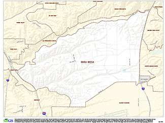
Mira Mesa is a community and neighborhood in the city of San Diego, California. The city-recognized Mira Mesa Community Plan Area is roughly bounded by Interstate 15 on the east, Interstate 805 on the west, the Los Peñasquitos Canyon on the north and Marine Corps Air Station Miramar on the south.[4] Most of the community plan area is referred to as Mira Mesa; the community plan area also includes the neighborhoods of Sorrento Valley and Sorrento Mesa.
The Mira Mesa neighborhood, as defined by the San Diego Police Department's neighborhood map, is roughly bounded by Interstate 15 to the east, Camino Santa Fe to the west, the Los Peñasquitos Canyon to the north and Marine Corps Air Station Miramar to the south.[5]
History

Around the time of World War II the area now called Mira Mesa was used by the United States Army as a test area. Just west of U.S. Route 395 (now Interstate 15) was a Navy auxiliary landing field, known locally as Hourglass Field because the layout of the runways was a single piece of asphalt in the shape of an hourglass. The Navy also used the surrounding area as a bombing range.
Starting in 1969 there was a housing boom in the area that now extends from the I-15 freeway in the east to I-805 in the west and is approximately 10,500 acres (42 km²). This was one of the earliest areas of urban sprawl along the I-15 Corridor. Hourglass Field became the site of San Diego Miramar College and Hourglass Field Community Park. The area was built so quickly that it lacked schools, shopping centers, or other services for its thousands of residents. In 1971 Pete Wilson started his political career running for mayor with the slogan "No more Mira Mesas!" as a promise to stop quick, unplanned growth in San Diego.
Since its inception, Mira Mesa was largely influenced by the military located at the adjacent NAS Miramar. Mira Mesa was the northernmost "real community" of San Diego, and was separated from the rest of the city by NAS Miramar for many years. For nearly 30 years the Navy's Top Gun School was located here, and most of the pilots made their homes in Mira Mesa.
By the late 1990s, the Mira Mesa area had undergone extensive expansion to accommodate the thousands of new residents attracted by its proximity to major employers like UC San Diego, MCAS Miramar, Qualcomm, and dozens of biotech and pharmaceutical companies. Several commercial and industrial centers have been built within the Mira Mesa area.
Mira Mesa has a significant concentration of Asian-American residents. Their presence has added to the diverse shopping available in Mira Mesa, including grocery and shops offered mainly by Filipino and Vietnamese people.
Economy
Established in the 1950s as a residential area to support Naval Air Station Miramar, Mira Mesa has grown into the largest community in San Diego.
The community has business and residential zoned areas, providing shopping and recreational opportunities as well as business buildings with technology facilities and office space. It offers a variety of ethnic cuisines and restaurants, as well as more traditional dining. There are a total of twelve parks; two are community parks and ten are neighborhood parks. There are also teen and senior centers, an ice arena, an aquatic complex, multiple shopping centers, and a state-of-the-art movie theater.
Demographics
The community has approximately 80,000 residents, including students, hi-tech employees, families, and single people.[6] There are over 23,000 homes in the community, averaging 3.09 people per household. The median age is 32.4 years old.[6]
The 2000 census counted: White (not Hispanic or Latino) 40.8%, Asian 37.6% (including 20.7% Filipino and 7.8% Vietnamese), Hispanic or Latino (of any race) 11.1%, African American/Black 5.4%, Native Hawaiian and other Pacific Islander 0.6%, and Native American 0.5%.
Transportation

Public transportation is provided by the San Diego Transit and the Metropolitan Transit System, through buses and DART (Direct Access to Regional Transit) shuttles.
A train station serves Mira Mesa in Sorrento Valley and is served by the Coaster commuter train, of the North County transit district. The Coaster links Mira Mesa to Downtown San Diego, and north to coastal communities like Solana Beach and Oceanside.
Main highways include Interstates 805 and 15.
Main thoroughfares
- Mira Mesa Boulevard runs east to west, and is the main road through Mira Mesa. It is an important link between Interstates 15 and 805. Before the 2006 completion of State Route 56, which runs parallel to and north of Mira Mesa Boulevard, the street carried a heavy volume of traffic and was considered one of the most congested streets in the city.
- Camino Ruiz is a north-south four-lane thoroughfare that runs the whole length of the Mira Mesa area, and links Miramar Road to Mira Mesa Boulevard, to Calle Cristobal. It is a main thoroughfare for military personnel traveling to and from MCAS Miramar and the surrounding area.
- Camino Santa Fe is a north-south four lane thoroughfare that runs the whole length of the Mira Mesa area, and links Miramar Road to Mira Mesa Boulevard, to Calle Cristobal/Sorrento Valley Boulevard.
- Black Mountain Road is a north-south thoroughfare that connects the more southerly portions of San Diego to Mira Mesa, and continues on to Rancho Peñasquitos and Del Mar.
- Calle Cristobal runs east to west, along the northern perimeter of Mira Mesa, through the Los Peñasquitos Canyon..
- Sorrento Valley Boulevard becomes Calle Cristobal at its intersection with Camino Santa Fe.[7]
Business
Mira Mesa contains hundreds of retail and service businesses, including:
Supermarkets and grocery
Retail
- Babies R Us
- Barnes & Noble
- Bed Bath & Beyond
- Best Buy
- Dress Barn
- Edwards Mira Mesa Theaters
- The Home Depot
- Kohl's
- Marshalls
- Petco
- Ross
Restaurants
- Buca di Beppo
- Chick-fil-A
- Chili's
- Denny's
- El Torito
- Fuddruckers
- IHOP
- In-N-Out
- Islands
- L&L Hawaiian Barbecue
- Mimi's Cafe
- On The Border
- O's American Kitchen (before 2011, was Pat & Oscar's)
- Panera Bread
- Red Lobster
- Souplantation
Sports
- The Mira Mesa Youth Baseball League (MMYB) serves boys and girls age 4-16, and is operated entirely by volunteer parents. MMYB is governed by the official rules of Major League Baseball and PONY Baseball rules and regulations.[8]
- Mira Mesa AYSO Region 285 soccer program is open to all children between 4 and 19 years of age.[9]
- Mira Mesa girls' softball, for ages 12 and under, won the state championship in 1999, 2005 and 2006.[10]
- The Mira Mesa Chargers is a non-profit organization that teaches the fundamentals of football and cheer to kids age 5-15.[11] The Chargers Youth Football and Cheer Coach, Roger Dixon, was recognized by the San Diego Chargers with their Community Quarterback Award in 2011, recognizing his "extraordinary dedication to the children in the community."[12]
- Mira Mesa Little League is a non-profit Little League Baseball organization for children.[13]
Community events

- The Mira Mesa Street Fair is held the third Saturday in September on Camino Ruiz on the block just north of Mira Mesa Boulevard. The fair is sponsored by the Mira Mesa Town Council.[14]
- On the Fourth of July, a parade runs through town on Mira Mesa Boulevard, then turns on Camino Ruiz. A Family Fun Day follows in the Mira Mesa Community Park with games, booths and rides for children. In the evening a fireworks display is accompanied by music from the radio station KyXy 96.5. The fireworks are located at Mira Mesa Senior High School.
- Halloween is celebrated at the Mira Mesa Gil Johnson Recreation Center.
- Every Thursday night, groups of motorcycle riders gather just off of Mira Mesa Blvd (Haggen/Home Depot shopping center). This is known as "Mira Mesa Bike Night" (MMBN) and is typically a fairly large gathering, attracting over 100 bikers during warm-weather months.
- Mira Mesa Living,[15] a community newspaper publishing local news and events, started publishing bimonthly in July 2010. The previous community newspaper, the Mira Mesa Scripps Ranch Sentinel, stopped publication in July 2009.
Schools in Mira Mesa
Private schools
- Christ the Cornerstone Academy[16]
- Good Shepherd Catholic School[17]
- Mira Mesa Christian School[18]
- Rainbow Kids Integral Preschool[19]
Elementary schools
- Ericson Elementary School[20]
- Hage Elementary School[21]
- Hickman Elementary School[22]
- Jonas Salk Elementary School (Opening for 2015-2016)[23]
- Mason Elementary School[24]
- Sandburg Elementary School[25]
- Walker Elementary School[26]
Middle schools
High schools
Junior colleges
Public safety

Fire services in Mira Mesa are provided by the San Diego Fire-Rescue Department Fire Station #38 and Fire Station #44. Fire Station #38, which includes Engine 38, Truck 38, and Paramedic 38, is located on New Salem Street near the main Mira Mesa Park and Recreation Center.[31] Fire Station #44 is located at the corner of Black Mountain Road and Maya Linda Road. It includes Engine 44, Truck 44, and HAZMAT 1 and 2.[31]
Mira Mesa is served by the Northeastern division of the San Diego Police Department. A police storefront located adjacent to the Epicentre along Mira Mesa Boulevard serves the local area including Scripps Ranch.[32]
Notable people from Mira Mesa
- Adam Brody - television actor; attended Wangenheim Middle School in Mira Mesa, then Scripps Ranch High School
- Nate Chandler - National Football League player; attended Mira Mesa High School
- Chris Chelios - former National Hockey League player; alternate captain of US hockey team; attended Mira Mesa High School and Mt. Carmel High School
- Teyo Johnson - National Football League player; attended Mira Mesa High School
- Jamie Kime - Grammy Award-winning guitarist and member of Zappa Plays Zappa; attended Mira Mesa High School
- Michael Pittman - National Football League player; attended Mira Mesa High School
- Ray Rowe - National Football League player; attended Mira Mesa High School
- J. R. Tolver - National Football League player; attended Mira Mesa High School
References
- ↑ William B. Sanders. Gangbangs and Drive-Bys: Grounded Culture and Juvenile Gang Violence. Transaction Publishers. p. 154. ISBN 978-0-202-36621-0.
Mark Gottdiener; Ray Hutchison (2006). The New Urban Sociology. Westview Press. p. 118. ISBN 978-0-8133-4318-1.
Kevin L. Nadal Ph. D. (2010). Filipino American Psychology: A Collection of Personal Narratives. AuthorHouse. p. 8. ISBN 978-1-4520-0189-0. - ↑ http://www.sandiego.gov/citycouncil/cd6/staff/index.shtml
- ↑ "News". Mira Mesa Town Council. Retrieved January 13, 2013.
- ↑ "Community Profiles: Mira Mesa". Planning Division. City of San Diego. Retrieved 19 September 2013.
- ↑ "City Wide Neighborhood Map" (PDF). San Diego Police Department. Retrieved 19 September 2013.
- 1 2 "Mira Mesa History". Mira Mesa Dot Com.
- ↑ Mira Mesa Community Plan, City of San Diego
- ↑ Mira Mesa Youth Baseball
- ↑ Mira Mesa AYSO Region 285
- ↑ California District 32 Hall of Champions
- ↑ Mira Mesa Youth Football & Cheer
- ↑ "Community Quarterback Award".
- ↑ "About MMLL". Mira Mesa Little League. Retrieved April 2016. Check date values in:
|access-date=(help) - ↑ Mira Mesa Town Council
- ↑ Mira Mesa Living
- ↑ Christ the Cornerstone Academy
- ↑ Good Shepherd Catholic School
- ↑ Mira Mesa Christian School
- ↑ Rainbow Kids Integral Preschool
- ↑ Ericson Elementary School
- ↑
- ↑
- ↑
- ↑
- ↑
- ↑
- ↑ Challenger Middle School
- ↑ Wangenheim Middle School
- ↑
- ↑ San Diego Miramar College | Miramar College
- 1 2 http://www.sandiego.gov/fire/about/firestations/index.shtml
- ↑ "San Diego Police Department". City of San Diego. Retrieved 25 September 2015.