Mio, Michigan
| Mio, Michigan | |
|---|---|
| Census-designated place (CDP) & Unincorporated community | |
 Location of Mio within Oscoda County, Michigan | |
 Mio, Michigan Location within the state of Michigan | |
| Coordinates: 44°39′08″N 84°7′47″W / 44.65222°N 84.12972°W | |
| Country | United States |
| State | Michigan |
| County | Oscoda |
| Township |
Big Creek Mentor |
| Area | |
| • Total | 8.1 sq mi (21.0 km2) |
| • Land | 7.5 sq mi (19.3 km2) |
| • Water | 0.6 sq mi (1.7 km2) |
| Elevation[1] | 1,020 ft (311 m) |
| Population (2000) | |
| • Total | 2,016 |
| • Density | 270.1/sq mi (104.3/km2) |
| Time zone | Eastern (EST) (UTC-5) |
| • Summer (DST) | EDT (UTC-4) |
| ZIP code | 48647 |
| Area code(s) | 989 Exchange: 826 |
| FIPS code | 26-54660[2] |
| GNIS feature ID | 1620853[1] |
Mio /ˈmaɪ.oʊ/ is an unincorporated community in the U.S. state of Michigan. It is the county seat of Oscoda County[3] and is situated along the boundary between Mentor Township on the east and Big Creek Township on the west.
Mio is also a census-designated place (CDP) used for statistical purposes, but has no legal status as an incorporated municipality. As of the 2000 census, the CDP population was 2,016.
The town was founded in 1881, and was originally called “Mioe”, in honor of the wife of town founder, Henry Deyarmond. Other founders are Colige Comins, Reirlo Fosdick, and John Randall.[4] A post office named Mioe opened May 3, 1882. The name changed to Mio on November 21, 1883.[5] The Mio post office, with ZIP code 48647, also serves the northern portions of Mentor Township and the northeastern part of Big Creek Township, as well as a large area of eastern and southern Elmer Township and smaller portions of western Clinton Township and Comins Township.[6]
State record
On July 13, 1936, the temperature in Mio climbed to 112 °F (44 °C), the highest temperature ever recorded in Michigan. The coldest recorded temperature is −51 °F (−46 °C) at Vanderbilt on February 9, 1934.[7]
Along the AuSable River stands the biggest red cedar tree in Michigan. The tree can be found down a trail along the river between Comins Flatts and M-Dot in Mio.
Geography
According to the United States Census Bureau, the CDP has a total area of 8.1 square miles (21 km2) of which 7.5 square miles (19 km2) is land and 0.6 square miles (1.6 km2) (8.01%) is water.
Geographic features
- Mio is situated in the Au Sable River Valley.
- It is surrounded by the Huron National Forest and near the Rifle River State Recreation Area.
- The area is part of the Au Sable State Forest, specifically the
- Grayling FMU (Alcona, Crawford, Oscoda, and northern Iosco counties).
- Much of the area sits on the Grayling outwash plain.[8]
- The Oscoda County Park is minutes away.[9]
- Mio is part of Northern Michigan.
Education
Mio is home to a public K-12 school, located on M-72. The school is a conjuncture of an Elementary, Middle, and High School.
Mio AuSable Schools offer a challenging curriculum with Advanced Placement classes and has a committed teaching staff. The school board members, support staff, and new technology provide a varied learning environment with fine arts classes, shop classes, and technology courses. The school offers and encourages parents to join PTO and organizations in support of education. The average student/teacher ratio is 19:1.[10]
The current superintendent of Mio AuSable Schools is Gary Wood. He also served as the elementary principal in the school year of 2011-2012 after funding cutbacks.[11] The high school/middle school principal is Jim Gendernalik who is also the supervisor of building and grounds. As of 2012, Mio AuSable School's Board of Education consisted of Paul Call, Penny Irelan, Dawn Stenzel, Kim Wright, Rick Ebert, Charles North, and David Lashley. The Board Meetings are held the second Monday of each month at 6:30 pm in Mio AuSable School's Auditorium.[12]
Mio AuSable Schools has several sports teams. They have teams in girls' volleyball, football, girls' & boys' basketball, wrestling, track & field, softball, and baseball. Mio's Jay Smith ('76-'79) is the MHSAA boys' basketball all-time career scoring leader. He averaged 29.0 points per game in 98 games for a total of 2,841 career points. Mio's Micah Thomey reached 1,000 career points on January 18 against Posen. "He joins the likes of Graham Brown, Ty McGregor, Greg Sidebottom, current Mio coach Dennis Kann and the state of Michigan’s all-time leading scorer Jay Smith among those reaching 1,000 points for the Thunderbolts." Thomey averaged 14 points per game throughout his high school varsity career.[13] Mio has appeared in the boys' basketball state finals twice, girls' basketball once, football once, and has had several state qualifiers in track and wrestling.[14]
Transportation
Demographics
| Largest ancestries (2000) | Percent |
|---|---|
| German | 31.2% |
| English | 14.5% |
| Irish | 10.2% |
| Polish | 7.9% |
| American | 8.9% |
| French | 5.4% |
As of the census[2] of 2000, there were 2,016 people, 826 households, and 537 families residing in the CDP. The population density was 270.1 per square mile (104.3/km2). There were 1,191 housing units at an average density of 159.6 per square mile (61.6/km2). The racial makeup of the CDP was 96.83% White, 0.15% African American, 0.55% Native American, 0.10% Asian, 0.25% from other races, and 2.13% from two or more races. Hispanic or Latino of any race were 1.44% of the population.
Religiously, many Mio residents are either Amish, of Amish descent, Mennonite, or of Mennonite descent – with most being non-Anabaptist Christians.
There were 826 households out of which 30.3% had children under the age of 18 living with them, 49.4% were married couples living together, 11.5% had a female householder with no husband present, and 34.9% were non-families. 28.5% of all households were made up of individuals and 13.4% had someone living alone who was 65 years of age or older. The average household size was 2.44 and the average family size was 2.99.
In the CDP the population was spread out with 26.0% under the age of 18, 8.2% from 18 to 24, 27.8% from 25 to 44, 21.9% from 45 to 64, and 16.1% who were 65 years of age or older. The median age was 38 years. For every 100 females there were 92.6 males. For every 100 females age 18 and over, there were 87.5 males.
The median income for a household in the CDP was $26,831, and the median income for a family was $31,379. Males had a median income of $29,542 versus $20,927 for females. The per capita income for the community was $13,064. About 13.9% of families and 21.3% of the population were below the poverty line, including 33.3% of those under age 18 and 13.4% of those age 65 or over.
Local attractions and activities
The community is centered in the Huron National Forest along the Au Sable River. Wildlife are nearby, including bear, deer, eagles, Kirtland's warblers, and turkeys. Local attractions and activities include:
- Oscoda County Riverfest
- Amish Community with Stores and Bakeries
- Birding
- Boating, paddling (canoe and kayak)
- Coptic Orthodox St. Mina Retreat Center
- Fishing, particularly trout fishing
- Geocaching
- Hiking
- Hunting
- Kirtland Warbler Habitat and Festival: The Kirtland's warbler has its habitat in the area.[15] There is a Kirtland's Warbler Festival, which is sponsored in part by Kirtland Community College.[16]
- Mennonite Relief Expo & Fair
- Michigan Shore to Shore Riding & Hiking Trail passes through Mio. It runs from Empire to Oscoda, and points north and south. It is a 500-mile interconnected system of trails.[17]
- Nordic skiing
- ORV, motor cycle and groomed snowmobile trails.[18]
- Steiner's Museum of pioneer artifacts is in nearby Fairview[19]
- Our Lady of the Woods Catholic Shrine[20]
Local recurring events
There are many recurring local events.[21]
- First Dam Canoe Race (MCRA - Canoe Race)[22]
- Mennonite relief sale[23]
- Michigan Magazine Craft Show[24]
- Mio Mud Bogs & Drags[25]
- Nor Easter Folk Music Festival[26]
- Outdoor Sportsmens Expo
- Oscoda County Fair & Forestry Exposition[27]
Historical markers
There are two historical markers in Mio.
- Mio Hydroelectric Plant was built in 1916 on the lower Au Sable River. William W. Tefft, a Consumers Power civil and hydraulic engineer invented and patented the so-called "conduit spillway", which channels excessive flow through channels built into the plant. This was the first plant to use it, and it is cheaper than other forms of spillways.[28]
- Oscoda County Courthouse was built in 1888.[29][30] It was destroyed by a fire on May 5, 2016.
- Union Corners is an abandoned "town" situated on Valley Road in Mio, Michigan. It was abandoned in 1882 when its county government moved to where downtown Mio is now located today. Originally, it was a small farming community. However, the farmers moved from the area because of the poor soil quality. Today, there are very few remnants of Union Corners besides a plaque where the town used to be located and various grave sites throughout the area. Some of these grave sites belong to members of the Union Corners community.
- Hinchman Acres Resort has been providing a place for families to come for vacation since 1933. Originally the vision of Chapin and Lera Hinchman, Hinchman Acres Resort is a camping ground with access to the AuSable River, with facilities for canoeists, rafters, and kayakers. In 1965 the Hinchmans parted ways with the Hitchman Acres Resort. After purchasing the resort from Ed and Doris Holloway in 1971, Sam & Natalie Giardina have managed the Hitchman Acres Resort for the last 43 years.[31]
Media
The following can be accessed in Mio, Michigan.
Newspapers
- The Oscoda County Herald is a weekly publication available on newsstands every Tuesday and by mail on Wednesday. The paper covers news and sports from all of Oscoda County, as well as other nearby communities. It also serves as the paper of record for all municipalities in Oscoda County, and is the only newspaper recognized by the Michigan Press Association that operates inside of Oscoda County. The Oscoda County Herald is owned by Sunrise Printing & Publishing, which also owns the Ogemaw County Herald and the Arenac County Independent.
Radio
FM
| Call Sign | Frequency | City Broadcast From |
|---|---|---|
| WJOJ | 89.7 | Harrisville |
| WPHN | 90.5 | Gaylord |
| WCML | 91.7 | Alpena |
| WFXD | 92.5 | Atlanta |
| WAVC | 93.9 | Mio |
| WKJZ | 94.9 | Hillman |
| WCMB-FM | 95.7 | Oscoda |
| WUPS | 98.5 | Harrison |
| WATZ | 99.3 | Alpena |
| WGRY | 100.3 | Grayling |
| WMJZ | 101.5 | Gaylord |
| WKJC | 104.7 | Tawas City |
| WHSB | 107.7 | Alpena |
AM
There are no AM Radio Stations in range of Mio, Michigan, although WWJ can be faintly heard during the nighttime..
Media spotlight
For nearly 18 years, Mio was thrust into the local and national media spotlight due to a case involving two Detroit-area hunters that went missing in the fall of 1985. The case was eventually cracked in 2003, when two brothers, both from South Branch, Mi in Iosco County, were convicted of murdering the pair near Mio. Everyone was shocked when they said that they disposed of the bodies by feeding them to pigs. When the two brothers were sentenced to life in prison without parole, Tyll's father said, "They took my son. It doesn't bring him back, but it's something." [32] A true account of the crimes was detailed in a 2006 book by Tom Henderson, titled Darker Than Night.
Notes
- 1 2 U.S. Geological Survey Geographic Names Information System: Mio, Michigan
- 1 2 "American FactFinder". United States Census Bureau. Retrieved 2008-01-31.
- ↑ "Find a County". National Association of Counties. Retrieved 2011-06-07.
- ↑ "Mio Bed and Breakfasts, Michigan Lake to Lake Bed and Breakfast Association - Michigan Lake to Lake Bed and Breakfast Association". laketolake.com. Retrieved 12 December 2014.
- ↑ U.S. Geological Survey Geographic Names Information System: Mio Post Office
- ↑ 48647 5-Digit ZCTA, 486 3-Digit ZCTA - Reference Map - American FactFinder, United States Census Bureau, 2000 census
- ↑ "The Geography of Michigan". netstate.com. Retrieved March 20, 2011.
- ↑ "NPWRC :: Regional Landscape". usgs.gov. Retrieved 12 December 2014.
- ↑ Oscoda County Park
- ↑ "Public School Districts". Public School Districts.
- ↑ "Mio AuSable superintendent to take on elementary principal duties". Oscoda County Herald.
- ↑ "Mio AuSable Schools". Mio AuSable Schools.
- ↑ "Micah Thomey joins Mio basketball legends in the 1,000-point club". mlive.com. Retrieved 12 December 2014.
- ↑ "Boys' Basketball Record Book". MHSAA.
- ↑ Michigan Department of Natural Resources, Kirtland's Warbler Populations Continue to Grow.
- ↑ "Kirtland Warbler Festival and links.".
- ↑ Michigan Shore to Shore Riding and Hiking Trail.
- ↑ Michigan Organizations, Oscoda County Chamber of Commerce.
- ↑ "steinermuseum.org". steinermuseum.org. Retrieved 12 December 2014.
- ↑ "Home". ourladyofthewoodsshrine.org. Retrieved 12 December 2014.
- ↑ Oscoda County Chamber of Commerce, including calendar of events, attractions.
- ↑ "Mio Race Info". miracing.com. Retrieved 12 December 2014.
- ↑ "Quilts and Handrafted Furniture - Auction - Northern Michigan Relief Sale Michigan - Mio, MI". reliefsale.org. Retrieved 12 December 2014.
- ↑ "SKYLINE EVENT CENTER". angelfire.com. Retrieved 12 December 2014.
- ↑ "AuSable Valley Inn". ausablevalleyinn.com. Retrieved 12 December 2014.
- ↑ "Nor-East'r Music & Art Festival". noreastr.net. Retrieved 12 December 2014.
- ↑ Oscoda County Fair & Forestry Exposition.
- ↑ Mio electric Plant historical marker
- ↑ "Web Archives: View Archived Page". cdlib.org. Retrieved 12 December 2014.
- ↑ Mio historical markers
- ↑ "Hinchman Acres Resort History". hinchman.com. Retrieved 12 December 2014.
- ↑ http://www.michigan/sportsman.com/form/achieve/index.php/t/51347.html
External links
- The Oscoda County Herald Online
- Au Sable Valley connection.
- Oscoda County Chamber of Commerce, including calendar of events, attractions.
- Oscoda County Web Site.
- Calendar of Events, Sunrise side.
- Enchanted forest, Northern Michigan source for information, calendars, etc.
- Sunrise side travel and information
Municipalities and communities of Oscoda County, Michigan, United States | ||
|---|---|---|
| Townships | 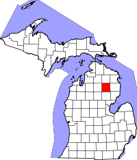 | |
| CDP | ||
| Other unincorporated communities | ||
Coordinates: 44°39′08″N 84°07′47″W / 44.65222°N 84.12972°W