Minneota, Minnesota
| Minneota, Minnesota | |
|---|---|
| City | |
| Nickname(s): Ota | |
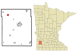 Location of Minneota, Minnesota | |
| Coordinates: 44°33′44″N 95°59′8″W / 44.56222°N 95.98556°W | |
| Country | United States |
| State | Minnesota |
| County | Lyon |
| Government | |
| • Type | Mayor – Council |
| • Mayor | Bill Ufkin |
| Area[1] | |
| • Total | 1.43 sq mi (3.70 km2) |
| • Land | 1.43 sq mi (3.70 km2) |
| • Water | 0 sq mi (0 km2) |
| Elevation | 1,168 ft (356 m) |
| Population (2010)[2] | |
| • Total | 1,392 |
| • Estimate (2012[3]) | 1,376 |
| • Density | 973.4/sq mi (375.8/km2) |
| Time zone | Central (CST) (UTC-6) |
| • Summer (DST) | CDT (UTC-5) |
| ZIP code | 56264 |
| Area code(s) | 507 |
| FIPS code | 27-43126[4] |
| GNIS feature ID | 0647933[5] |
Minneota is a city in Lyon County, Minnesota, United States. The population was 1,392 at the 2010 census.[6]
History
Minneota was platted in 1881 when the railroad was extended to that point.[7] The name Minneota is derived from the Dakota language meaning "much water".[8]
Geography
According to the United States Census Bureau, the city has a total area of 1.43 square miles (3.70 km2), all of it land.[1] The South Branch of the Yellow Medicine River flows through the city.[9]
Demographics
| Historical population | |||
|---|---|---|---|
| Census | Pop. | %± | |
| 1880 | 113 | — | |
| 1890 | 325 | 187.6% | |
| 1900 | 777 | 139.1% | |
| 1910 | 819 | 5.4% | |
| 1920 | 894 | 9.2% | |
| 1930 | 918 | 2.7% | |
| 1940 | 1,065 | 16.0% | |
| 1950 | 1,274 | 19.6% | |
| 1960 | 1,297 | 1.8% | |
| 1970 | 1,320 | 1.8% | |
| 1980 | 1,470 | 11.4% | |
| 1990 | 1,417 | −3.6% | |
| 2000 | 1,449 | 2.3% | |
| 2010 | 1,392 | −3.9% | |
| Est. 2015 | 1,363 | [10] | −2.1% |
2010 census
As of the census[2] of 2010, there were 1,392 people, 582 households, and 365 families residing in the city. The population density was 973.4 inhabitants per square mile (375.8/km2). There were 635 housing units at an average density of 444.1 per square mile (171.5/km2). The racial makeup of the city was 95.8% White, 0.2% African American, 0.1% Native American, 0.3% Asian, 3.2% from other races, and 0.4% from two or more races. Hispanic or Latino of any race were 6.7% of the population.
There were 582 households of which 29.2% had children under the age of 18 living with them, 51.9% were married couples living together, 7.2% had a female householder with no husband present, 3.6% had a male householder with no wife present, and 37.3% were non-families. 33.0% of all households were made up of individuals and 16.5% had someone living alone who was 65 years of age or older. The average household size was 2.29 and the average family size was 2.92.
The median age in the city was 43.5 years. 24.4% of residents were under the age of 18; 5.7% were between the ages of 18 and 24; 21.5% were from 25 to 44; 26.2% were from 45 to 64; and 22.2% were 65 years of age or older. The gender makeup of the city was 45.9% male and 54.1% female.
2000 census
As of the census[4] of 2000, there were 1,449 people, 590 households, and 389 families residing in the city. The population density was 999.5 people per square mile (385.8/km²). There were 614 housing units at an average density of 423.5 per square mile (163.5/km²). The racial makeup of the city was 97.72% White, 0.14% African American, 0.14% Asian, 1.31% from other races, and 0.69% from two or more races. Hispanic or Latino of any race were 3.52% of the population.
There were 590 households out of which 30.7% had children under the age of 18 living with them, 55.6% were married couples living together, 7.6% had a female householder with no husband present, and 33.9% were non-families. 31.5% of all households were made up of individuals and 18.0% had someone living alone who was 65 years of age or older. The average household size was 2.32 and the average family size was 2.91.
In the city the population was spread out with 24.0% under the age of 18, 7.2% from 18 to 24, 24.4% from 25 to 44, 19.3% from 45 to 64, and 25.1% who were 65 years of age or older. The median age was 41 years. For every 100 females there were 88.4 males. For every 100 females age 18 and over, there were 84.7 males.
The median income for a household in the city was $36,375, and the median income for a family was $46,023. Males had a median income of $30,000 versus $21,518 for females. The per capita income for the city was $17,390. About 6.3% of families and 8.3% of the population were below the poverty line, including 9.7% of those under age 18 and 7.6% of those age 65 or over.
Notable natives and residents
- Val Bjornson, Minnesota politician
- Bill Holm, poet
- Les Josephson, professional football - Los Angeles Rams
- James Meger, Wildlife artist
References
- 1 2 "US Gazetteer files 2010". United States Census Bureau. Retrieved 2012-11-13.
- 1 2 "American FactFinder". United States Census Bureau. Retrieved 2012-11-13.
- ↑ "Population Estimates". United States Census Bureau. Retrieved 2013-05-28.
- 1 2 "American FactFinder". United States Census Bureau. Retrieved 2008-01-31.
- ↑ "US Board on Geographic Names". United States Geological Survey. 2007-10-25. Retrieved 2008-01-31.
- ↑ "2010 Census Redistricting Data (Public Law 94-171) Summary File". American FactFinder. United States Census Bureau. Retrieved 27 April 2011.
- ↑ Chicago and North Western Railway Company (1908). A History of the Origin of the Place Names Connected with the Chicago & North Western and Chicago, St. Paul, Minneapolis & Omaha Railways. p. 103.
- ↑ Bright, William (2004). Native American Placenames of the United States. University of Oklahoma Press. p. 287. ISBN 978-0-8061-3598-4.
- ↑ Minnesota Atlas & Gazetteer. Yarmouth, Me.: DeLorme. 1994. p. 28. ISBN 0-89933-222-6.
- ↑ "Annual Estimates of the Resident Population for Incorporated Places: April 1, 2010 to July 1, 2015". Retrieved July 2, 2016.
- ↑ "Census of Population and Housing". Census.gov. Retrieved June 4, 2015.
External links
- City website
- Minneota Mascot, local newspaper
Municipalities and communities of Lyon County, Minnesota, United States | ||
|---|---|---|
| Cities | 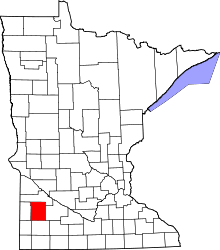 | |
| Townships | ||
| Unincorporated communities | ||
Coordinates: 44°33′32″N 95°59′08″W / 44.55889°N 95.98556°W