Mineral de la Reforma
| Mineral de la Reforma | ||
|---|---|---|
| Municipality | ||
 | ||
| ||
|
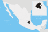
Mineral de la Reforma Location in Mexico | ||
| Coordinates: 20°09′N 98°26′W / 20.150°N 98.433°WCoordinates: 20°09′N 98°26′W / 20.150°N 98.433°W | ||
| Country |
| |
| State | Hidalgo | |
| Municipal seat | Pachuquilla | |
| Area | ||
| • Total | 106 km2 (41 sq mi) | |
| Population (2005) | ||
| • Total | 68,704 | |
| • Density | 648/km2 (1,680/sq mi) | |

Mineral de la Reforma is one of the 84 municipalities of Hidalgo, in central-eastern Mexico. Adjacent to Pachuca in the same built up area, it is one of the fastest growing cities of Hidalgo State. As of 2005, the municipality had a total population of 68,704.[1]
Its population is estimated at 89,509 inhabitants in 2009 (Coplaco). The municipal seat lies at Pachuquilla. The municipality covers an area of 106 km².
Historical facts
In 1531 Pachuquilla foundation established in the early years of the colonial era.
In 1550 Established in this city an important metallurgical center.
In 1862 Lic. Benito Juarez decreed the state of Hidalgo as a second military district of the State of Mexico.
In 1865 Emperor Maximilian divides the country into 50 departments being integrated Tulancingo department to which belonged the town of Mineral de la Reforma (formerly called Azoyatla).
In 1867 With the triumph of republican government it determines again that the state of Hidalgo becomes part of the State of Mexicoand the territorial area of Mineral de la Reforma joins the district of Pachuca.
In 1917 The increased needs of the population favors changes in the district of Pachuca and the new and current municipality of Mineral de la Reforma is created.
In 1920 It was elevated to a municipality being Governor Don Nicolas Flores.
In 1958 State Governor Gral. Alfonso Corona del Rosal issued the decree No. 43 by which the municipal authorities of the town of San Guillermo the people of Pachuquilla changed.[2]
Important people
- Carlos Vargas Ortíz (Poet, Lawyer and Journalist.)
- Guadalupe Escamilla (Politician)
- Manuel Rivera Castelán (Politician)[3]
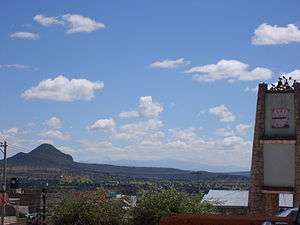
Physical environment
This municipality belongs wing region 1, corresponding to Pachuca. Its coordinates are 20 ° North latitude, 8" and 8" while its west longitude is 98°, 40"and 19", with a latitude of 2.400 mts. 2,800 mts. above sea level.
Mineral de la Reforma also adjoins to: North with the municipality of Mineral del Monte; to the south with the municipality of Zempoala; to the east with the municipality of Epazoyucan, and the West with the municipalities of Pachuca and Zapotlán de Juárez The municipality is located northeast of Mexico City at a distance of 100 km., And to 38 km. Of Tulancingo. The distance binding with the state capital is 9 km.[4]
Weather
The climate is temperate-cold, rainy regimes in the months of June, July, August and September having a rainfall of 392 mm. by year. The hottest months are presented in May, June, July and August. The wind direction is from south to west, low humidity, especially in the months of February, March and April. The average annual temperature is 16 degrees Celsius.[5]
Events
- Mineral de la Reforma Fair
Like many fairs Mexico, is a popular festival of great importance in the region, it is a shopping and entertainment showcase for the region. Each year has a people's theater program where artists and recognized bands delight your audience.[6]
Population
According to the general census of population and housing in 2010 by INEGI Mineral de la Reforma, it is considered the third largest city in the state of Hidalgo, registering 127.404 inhabitants, with an annual average growth of 11.2%.[7]
Administrative control for the municipality of Mineral de la Reforma is integrated as follows:
Pachuquilla (municipal Header) Ranchos: San Lunes, La Pila, La Soledad, San José, La Providencia Chica, Colonies, Verdugo, San Isidro, San Francisco, El Chico, Buenavista, La Cadena, La Providencia, El Chacon, Portezuelo and Sal Silpedes. Main colonies: The Tuzos, Park Los Encinos, July 11, Amaque, Apepelco, Azoyatla, CTM, Pumpkins, Country Villas del Alamo, Carboneras, CEUNI, Chacon, Colinas de Plata, Dos Carlos, El Cerrito, El Roble, El Saucillo, El Venado, Blacksmiths, La Noria, La Higa, Providence, Teaching, Manuel Avila Camacho, Military, Mineral I, Mineral II, Pachuquilla, Paseo de reynas, Palma Gorda, Portezuelo, PRI Chacon, Deprived of San Javier, Pueblo new, Rinconadas San Francisco, San Carlos, San Cristobal, San Fernando, Taxi drivers, Velillo, Villas del Alamo, Chavarria Hacienda, Hacienda Margarita, Fraccionamiento la Reforma, Fraccionamiento Rinconada de los Angeles.[8]
References
- ↑ "Mineral de la Reforma". Enciclopedia de los Municipios de México. Instituto Nacional para el Federalismo y el Desarrollo Municipal. Retrieved December 27, 2008.
- ↑ http://www.hidalgo.gob.mx/?p=296
- ↑ http://www.inafed.gob.mx/work/enciclopedia/EMM13hidalgo/municipios/13051a.html
- ↑ http://www.inafed.gob.mx/work/enciclopedia/EMM13hidalgo/municipios/13051a.html
- ↑ http://www.inafed.gob.mx/work/enciclopedia/EMM13hidalgo/municipios/13051a.html
- ↑ http://www.fiestasdemexico.com/2016/03/feria-mineral-de-la-reforma-2016.html
- ↑ http://www.inegi.org.mx/
- ↑ http://www.mineraldelareforma.gob.mx/