Mineral River
The Mineral River near its mouth at Lake Superior, as viewed upstream

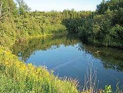
The Mineral River near its mouth at Lake Superior, as viewed downstream
The Mineral River is an 18.7-mile-long (30.1 km)[1] tributary of Lake Superior on the western Upper Peninsula of Michigan in the United States. It flows for its entire length in western Ontonagon County, rising in the Ottawa National Forest and flowing generally northward to meet Lake Superior about 11 miles (18 km) west-southwest of Ontonagon.[2] The United States Board on Geographic Names settled on "Mineral River" as the stream's name in 1976; according to the Geographic Names Information System it has also been known historically as "Beaver Creek".[3]
See also
References
- ↑ U.S. Geological Survey. National Hydrography Dataset high-resolution flowline data. The National Map, accessed February 3, 2012
- ↑ DeLorme (2003). Michigan Atlas & Gazetteer. Yarmouth, Maine: Delore. ISBN 0-89933-335-4
- ↑ U.S. Geological Survey Geographic Names Information System: Mineral River
| Wikimedia Commons has media related to Mineral River. |
Coordinates: 46°50′08″N 89°32′54″W / 46.83550°N 89.54821°W
This article is issued from Wikipedia - version of the 9/11/2016. The text is available under the Creative Commons Attribution/Share Alike but additional terms may apply for the media files.