Mineral County, Nevada
| Mineral County, Nevada | |
|---|---|
| County | |
| Mineral County | |
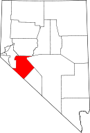 Location in the U.S. state of Nevada | |
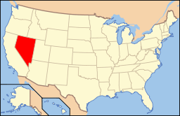 Nevada's location in the U.S. | |
| Founded | 1911 |
| Seat | Hawthorne |
| Largest community | Hawthorne |
| Area | |
| • Total | 3,813 sq mi (9,876 km2) |
| • Land | 3,753 sq mi (9,720 km2) |
| • Water | 60 sq mi (155 km2), 1.6% |
| Population | |
| • (2010) | 4,772 |
| • Density | 1.3/sq mi (1/km²) |
| Congressional district | 4th |
| Time zone | Pacific: UTC-8/-7 |
| Website |
mineralcountynv |

Mineral County is a county located in the U.S. state of Nevada. As of the 2010 census, the population was 4,772,[1] making it the fourth-least populous county in Nevada. Its county seat is Hawthorne.[2]
History
Mineral County was carved out of Esmeralda County in 1911 shortly after the county seat of Esmeralda was moved to Goldfield in 1907. Its name came from the surrounding area, which is heavily mineralized. Hawthorne has always been its county seat. The county is listed as Nevada Historical Marker 16. The marker is located on U.S. Highway 95 at Walker Lake.[3]
Geography
According to the U.S. Census Bureau, the county has a total area of 3,813 square miles (9,880 km2), of which 3,753 square miles (9,720 km2) is land and 60 square miles (160 km2) (1.6%) is water.[4] The highest point in Mineral County is Mount Grant at 11,285 ft (3,440 m).
Major highways
Adjacent counties
- Lyon County - northwest
- Churchill County - north
- Nye County - northeast
- Esmeralda County - southeast
- Mono County, California - southwest
National protected areas
- Inyo National Forest (part)
- Toiyabe National Forest (part)
Demographics
| Historical population | |||
|---|---|---|---|
| Census | Pop. | %± | |
| 1920 | 1,848 | — | |
| 1930 | 1,863 | 0.8% | |
| 1940 | 2,342 | 25.7% | |
| 1950 | 5,560 | 137.4% | |
| 1960 | 6,329 | 13.8% | |
| 1970 | 7,051 | 11.4% | |
| 1980 | 6,217 | −11.8% | |
| 1990 | 6,475 | 4.1% | |
| 2000 | 5,071 | −21.7% | |
| 2010 | 4,772 | −5.9% | |
| Est. 2015 | 4,478 | [5] | −6.2% |
| U.S. Decennial Census[6] 1790-1960[7] 1900-1990[8] 1990-2000[9] 2010-2013[1] | |||
2000 census
As of the census[10] of 2000, there were 5,071 people, 2,197 households, and 1,379 families residing in the county. The population density was 1 person per square mile (1/km²). There were 2,866 housing units at an average density of 1 per square mile (0/km²). The racial makeup of the county was 73.89% White, 4.77% Black or African American, 15.36% Native American, 0.81% Asian, 0.10% Pacific Islander, 2.68% from other races, and 2.39% from two or more races. 8.44% of the population were Hispanic or Latino of any race.
There were 2,197 households out of which 25.40% had children under the age of 18 living with them, 45.20% were married couples living together, 11.50% had a female householder with no husband present, and 37.20% were non-families. 31.60% of all households were made up of individuals and 15.10% had someone living alone who was 65 years of age or older. The average household size was 2.26 and the average family size was 2.78.
In the county the population was spread out with 24.40% under the age of 18, 6.20% from 18 to 24, 22.50% from 25 to 44, 27.10% from 45 to 64, and 19.80% who were 65 years of age or older. The median age was 43 years. For every 100 females there were 101.60 males. For every 100 females age 18 and over, there were 98.30 males.
The median income for a household in the county was $32,891, and the median income for a family was $39,477. Males had a median income of $31,929 versus $25,262 for females. The per capita income for the county was $16,952. About 11.00% of families and 15.20% of the population were below the poverty line, including 17.70% of those under age 18 and 10.70% of those age 65 or over.
2010 census
As of the 2010 United States Census, there were 4,772 people, 2,240 households, and 1,258 families residing in the county.[11] The population density was 1.3 inhabitants per square mile (0.50/km2). There were 2,830 housing units at an average density of 0.8 per square mile (0.31/km2).[12] The racial makeup of the county was 72.5% white, 15.5% American Indian, 4.1% black or African American, 1.1% Asian, 0.1% Pacific islander, 2.1% from other races, and 4.4% from two or more races. Those of Hispanic or Latino origin made up 9.1% of the population.[11] In terms of ancestry, 23.8% were English, 18.5% were German, 13.8% were Irish, 9.3% were Scottish, 5.2% were Portuguese, and 3.7% were American.[13]
Of the 2,240 households, 21.2% had children under the age of 18 living with them, 39.0% were married couples living together, 11.2% had a female householder with no husband present, 43.8% were non-families, and 36.7% of all households were made up of individuals. The average household size was 2.11 and the average family size was 2.70. The median age was 49.2 years.[11]
The median income for a household in the county was $35,446 and the median income for a family was $57,064. Males had a median income of $48,281 versus $33,830 for females. The per capita income for the county was $23,226. About 11.4% of families and 19.1% of the population were below the poverty line, including 11.0% of those under age 18 and 12.6% of those age 65 or over.[14]
Communities

See also
References
- 1 2 "State & County QuickFacts". United States Census Bureau. Retrieved September 23, 2013.
- ↑ "County Explorer". National Association of Counties. Retrieved 2011-06-07.
- ↑ "Nevada Historical Markers". Nevada State Historic Preservation Office. Archived from the original on February 4, 2013. Retrieved 24 February 2013.
- ↑ "2010 Census Gazetteer Files". United States Census Bureau. August 22, 2012. Retrieved December 20, 2014.
- ↑ "County Totals Dataset: Population, Population Change and Estimated Components of Population Change: April 1, 2010 to July 1, 2015". Retrieved July 2, 2016.
- ↑ "U.S. Decennial Census". United States Census Bureau. Retrieved December 20, 2014.
- ↑ "Historical Census Browser". University of Virginia Library. Retrieved December 20, 2014.
- ↑ "Population of Counties by Decennial Census: 1900 to 1990". United States Census Bureau. Retrieved December 20, 2014.
- ↑ "Census 2000 PHC-T-4. Ranking Tables for Counties: 1990 and 2000" (PDF). United States Census Bureau. Retrieved December 20, 2014.
- ↑ "American FactFinder". United States Census Bureau. Retrieved 2008-01-31.
- 1 2 3 "DP-1 Profile of General Population and Housing Characteristics: 2010 Demographic Profile Data". United States Census Bureau. Retrieved 2016-01-21.
- ↑ "Population, Housing Units, Area, and Density: 2010 - County". United States Census Bureau. Retrieved 2016-01-21.
- ↑ "DP02 SELECTED SOCIAL CHARACTERISTICS IN THE UNITED STATES – 2006-2010 American Community Survey 5-Year Estimates". United States Census Bureau. Retrieved 2016-01-21.
- ↑ "DP03 SELECTED ECONOMIC CHARACTERISTICS – 2006-2010 American Community Survey 5-Year Estimates". United States Census Bureau. Retrieved 2016-01-21.
External links
 |
Lyon County | Churchill County | Nye County | |
| |
||||
| ||||
| | ||||
| Mono County, California | Esmeralda County |
Municipalities and communities of Mineral County, Nevada, United States | ||
|---|---|---|
| CDPs | | |
| Unincorporated community | ||
| Indian reservation | ||
| Ghost towns |
| |
Coordinates: 38°32′N 118°26′W / 38.54°N 118.43°W