Perth East, Ontario
| Perth East | |
|---|---|
| Township (lower-tier) | |
| Township of Perth East | |
 | |
 Perth East | |
| Coordinates: 43°28′N 80°57′W / 43.467°N 80.950°WCoordinates: 43°28′N 80°57′W / 43.467°N 80.950°W | |
| Country |
|
| Province |
|
| County | Perth |
| Formed | January 1, 1998 |
| Government | |
| • Mayor | Bob McMillan |
| • Federal riding | Perth—Wellington |
| • Prov. riding | Perth—Wellington |
| Area[1] | |
| • Land | 713.39 km2 (275.44 sq mi) |
| Population (2011)[1] | |
| • Total | 12,028 |
| • Density | 16.9/km2 (44/sq mi) |
| Time zone | EST (UTC-5) |
| • Summer (DST) | EDT (UTC-4) |
| Postal Code | N0K |
| Area code(s) | 519 and 226 |
| Website | www.pertheast.ca |
The Township of Perth East is a municipality in Perth County, Ontario, Canada and situated north of Stratford. It was created in 1998 when the Ontario government amalgamated the village of Milverton with the surrounding former townships of Ellice, Mornington, North Easthope and South Easthope.
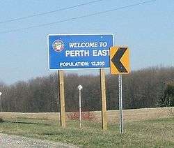
Milverton is the major community of the township, where the municipal administration is based. The mayor is Ian Forrest, who was elected in November, 2006. The population in 2011 was 12,028 in an area of 713.39 km².
History
Ellice Township
In 1829, the first concession in the Township of Ellice was surveyed and opened for settlement. A cairn still stands marking the site of the first home, owned by Andrew Seebach from Bavaria. The Township was named after Edward Ellice, a director of the Canada Company. The local municipal history began in 1842 when John Sebring was appointed to the position of District Councillor.The first separate school in the Township was opened at Millbrook in 1857 and closed in 1907 when it merged with another local school. In 1908 the Ellice Council purchased the abandoned school and moved it to a site on the County Road where it served as the seat of municipal government until 1960. The building was replaced by the present hall which was built in 1961.[2]
Village of Milverton
The first settler in Milverton was Andrew West, a shoemaker who settled on a farm and opened a hotel one year later. Other businesses soon followed and the town began to expand. The first Post Office was established in 1854 and the first schoolhouse in 1856. The first Council meeting of the Village of Milverton was held in 1881.[3]
Mornington Township
The first Township Council meeting was held in 1854. This, and subsequent meetings were held at taverns throughout the municipality. In 1857, only four years after the Township was established, the Township Clerk was fired - Council minutes explain that "the collections roll contained contradicting statements that... money had been collected, the expenditure of which could not be ascertained by the Auditors in a satisfactory manner". In 1876, the Stratford and Huron Railway Company and the Township entered into an agreement to bring the railway into the municipality with two stations.[4]
North Easthope Township
North Easthope Township was named after Sir John Easthope, a Canada Company director. The area was settled around 1832 by two main ethnic groups - Highland Scots and Hessen Darmstadt Deutsch due to the Canada Company's advertisement of the local land in Scottish and German newspapers.[5]
South Easthope Township
The first settler to Southeast Township moved in on Christmas Day in 1828. In 1863, South Easthope was the smallest township in the area with a population of 2,322 and an areas of 9,759 hectares. Council meetings were help in a room leased at a hotel until 1954 when a township hall was opened. In 1959, a Fire Hall was opened housing a volunteer department of 17 men, two fire trucks and a pumper. This department still exists and serves the communities in North and South Easthope.[6]
Municipal Restructuring
As part of provincial initiatives in the late 1990s, the Government of Ontario pursued a policy of municipal amalgamations to rationalize municipal levels of government services and "reduc[e] government entanglement and bureaucracy with an eye to eliminating waste and duplication as well as unfair downloading by the province".[7] On June 26, 1997, an order from the Ontario Minister of Municipal Affairs for the amalgamation of the former Townships of Ellice, Mornington, North Easthope, South Easthope and the Village of Milverton into Perth East Township received Royal assent. The amalgamation came into effect on January 1, 1998.[8]
Geography
Communities
The township comprises the communities of Amulree, Brocksden, Brunner, Burns, Carthage, Dorking, Fernbank, Gads Hill, Hesson, Kinkora, Kuhryville, Mennonite Corner, Millbank, Milverton, Moserville, Newton, Nithburg, Peffers, Poole, Ratzburg, Rostock, Sebastopol, Shakespeare, Topping, Tralee and Wartburg. It also includes a portion of the hamlet of Punkeydoodles Corners, which straddles the municipal boundaries of Perth East, East Zorra – Tavistock and Wilmot.
Milverton was mentioned in the Season 4 episode Old King Clancy of How I Met Your Mother.[9]
Ellice Swamp
Ellice Swamp is a large woodlot in Perth County, Ontario.[10] The swamp covers approximately 856 hectares (2,115 acres). It is located between Stratford and Milverton in the northeastern portion of the Thames River Watershed, between the North Branch of the Thames and the Nith River.[11] Historically, it was known as Ellice Huckleberry Swamp and was part of the Huron Tract administered by the Canada Company. It is primarily owned by the Upper Thames River Conservation Authority.[11]
Demographics
Population
| Historical population | ||
|---|---|---|
| Year | Pop. | ±% |
| 2006 | 11,986 | — |
| 2011 | 12,028 | +0.4% |
| Source: 2006 Census of Canada 2011 Census of Canada | ||
According to the 2011 census, the Township of Perth East had a population of 12,028 people, a 0.4% increase from the 2006 population of 11,986.[12] Children aged 9 and under account for approximately 15.4% of the population, while the percentage at retirement age (65 and over) is approximately 12.8%. The median age is 36.1 years of age.[12]
According to the 2011 National Household Survey, 6.2% of the population have immigrant status. The most common countries immigrants come from are Mexico (28.5%), followed by the Netherlands (16.3%) and Germany (10.8%).[13]
According to the 2011 National Household Survey, the majority of residents of Perth East are members of a Christian faith and account for 87.5% of the population. Less than 1% of the population is Sikh or "Other religion" with the remaining population (11.8%) reporting no religious affiliation. Of the Christian population, the largest religious affiliation is Roman Catholic (18.5%) followed by Lutheran (15.2%), United Church (11.8%), Presbyterian (1.6%), Anglican (2.4%), Pentecostal (1.4%), Baptist (1.3%) and other Christian (42%).[13]
Economy
According to the 2011 National Household Survey, the largest economic sectors by number of workers employed are manufacturing (910 workers); construction (710 workers); health care and social assistance (645 workers) and retail trade (600 workers). Other industries in the region employing more than 200 workers are wholesale trade; transportation and warehousing; administrative and support, waste management and remediation services; accommodation and food services; and public administration.[13]
The average income reported in the 2011 National Household Survey was $37,303 with an average after-tax income of $32,356.[13]
Government
Local Government
Perth East Township is governed by a Township Council composed of seven members including a Mayor, Deputy Mayor and five Councillors. Council positions are held for a four-year term. Councillors represent the wards of Ellice, Milverton, Mornington, North Easthope and South Easthope.[14]
Township operations are overseen by the Chief Administrator's Office and municipal departments include Building, Clerk's Office, Finance, Fire Services, Library Services, Planning, Public Works, and Recreation.[15]
Township Council 2014-2018[16]
| Position | Name |
|---|---|
| Mayor | Bob McMillan |
| Deputy Mayor | Rhonda Ehgoetz |
| Councillor - Ellice | Don Brunk |
| Councillor - Milverton | Jerry Smith |
| Councillor - Mornington | Helen Dowd |
| Councillor - North Easthope | Jeff Cressman |
| Councillor - South Easthope | Andrew B. MacAlpine |
County Government
Because the Perth East is part of the upper-tier municipality Perth County, Ontario, it has representation on the County Council. The Perth County Council is determined by a restructuring order that came into force on January 1, 1998. Under this order, the Perth East has three members appointed to the County Council.[17] Perth East Mayor Bob McMillan, Deputy Mayor Rhonda Ehgoetz, and Councillor Helen Dowd serve as Perth East's representatives on County Council.[18]
Provincial Government
Perth—Wellington is a provincial electoral district in Ontario, Canada, that has been represented in the Legislative Assembly of Ontario since the 2007 provincial election. It was created in 2003 from parts of Dufferin—Peel—Wellington—Grey,Perth—Middlesex and Waterloo—Wellington ridings.
It consists of the County of Perth, and the Town of Minto and the townships of Mapleton and Wellington North in the County of Wellington.[19] As of October 6, 2011, the MPP for the riding is Randy Pettapiece.[20]
| Perth—Wellington | ||||
|---|---|---|---|---|
| Assembly | Years | Member | Party | |
| Riding created from Dufferin—Peel—Wellington—Grey, Perth—Middlesex and Waterloo—Wellington | ||||
| 39th | 2007–2011 | John Wilkinson | Liberal | |
| 40th | 2011–2014 | Randy Pettapiece | Progressive Conservative | |
| 41st | 2014–Present | |||
Federal Government
Perth—Wellington is a federal electoral district in Ontario, Canada, that has been represented in the House of Commons of Canada since 2004. It was created in 2003 from parts of Dufferin—Peel—Wellington—Grey,Perth—Middlesex and Waterloo—Wellington ridings.
It consists of the County of Perth, the City of Stratford, the Town of St. Mary's and the Town of Minto and the townships of Mapleton and Wellington North in the County of Wellington.[21]
| Parliament | Years | Member | Party | |
|---|---|---|---|---|
| Perth—Wellington Riding created from Dufferin—Peel—Wellington—Grey, Perth—Middlesex and Waterloo—Wellington |
||||
| 38th | 2004–2006 | Gary Schellenberger | Conservative | |
| 39th | 2006–2008 | |||
| 40th | 2008–2011 | |||
| 41st | 2011–Present | |||
See also
References
- 1 2 "Perth East, Ontario (Code 3531030) census profile". 2011 Census of Population. Statistics Canada. Retrieved 2012-08-10.
- ↑ "Ellice - Perth East Township". www.pertheast.ca. Retrieved 2015-08-21.
- ↑ "Milverton - Perth East Township". www.pertheast.ca. Retrieved 2015-08-21.
- ↑ "Mornington - Perth East Township". www.pertheast.ca. Retrieved 2015-08-21.
- ↑ "North Easthope - Perth East Township". www.pertheast.ca. Retrieved 2015-08-21.
- ↑ "South Easthope - Perth East Township". www.pertheast.ca. Retrieved 2015-08-21.
- ↑ Progressive Conservative Party of Ontario. 1994. The Common Sense Revolution. Toronto: Progressive Conservative Party of Ontario.
- ↑ "Municipal Restructuring Activity Summary Table". www.mah.gov.on.ca. Retrieved 2015-08-16.
- ↑ http://how-i-met-your-mother.hypnoweb.net/episodes-/saison-4/resume-l-episode-418/script-vo-418.63.1027/
- ↑ "Swamp Friends". Retrieved November 22, 2010.
- 1 2 "Ellice Swamp | UTRCA: Inspiring A Healthy Environment". thamesriver.on.ca. Retrieved 2015-08-20.
- 1 2 "Census Profile". www12.statcan.gc.ca. Retrieved 2015-08-17.
- 1 2 3 4 "National Household Survey (NHS) Profile, 2011". www12.statcan.gc.ca. Retrieved 2015-08-17.
- ↑ "Council - Perth East Township". www.pertheast.ca. Retrieved 2015-08-21.
- ↑ "http://www.pertheast.ca/en/councilstaff/departments.asp?_mid_=7877". www.pertheast.ca. Retrieved 2015-08-21. External link in
|title=(help) - ↑ "Profiles - Perth East Township". www.pertheast.ca. Retrieved 2015-08-21.
- ↑ "Perth County • Cultivating Opportunity • Council Composition". www.perthcounty.ca. Retrieved 2015-08-17.
- ↑ "Perth County • Cultivating Opportunity • Council". www.perthcounty.ca. Retrieved 2015-08-17.
- ↑ "Perth-Wellington". www.elections.on.ca. Retrieved 2015-08-17.
- ↑ "Legislative Assembly of Ontario | Members (MPPs) | Current MPPs | Randy Pettapiece, MPP (Perth—Wellington)". www.ontla.on.ca. Retrieved 2015-08-17.
- ↑ "Perth–Wellington | Maps Corner | Elections Canada Online". elections.ca. Retrieved 2015-08-17.
- "Topographic Map sheets 40P6, 40P7, 40P10 & 40P11". Atlas of Canada. Natural Resources Canada. 2006-02-06. Retrieved 2008-12-21.
- "Map/Directions". Township of Perth East. Retrieved 2008-12-21.
External links
 |
North Perth | Mapleton | | |
| West Perth | |
Wellesley Wilmot | ||
| ||||
| | ||||
| Perth South, Stratford, Zorra | East Zorra-Tavistock |