Milton-Freewater, Oregon
| Milton-Freewater, Oregon | |
|---|---|
| City | |
|
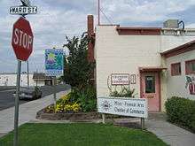
Golf course in Milton-Freewater | |
| Nickname(s): Muddy Frogwater Country | |
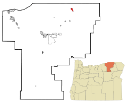 Location in Oregon | |
| Coordinates: 45°56′11″N 118°23′27″W / 45.93639°N 118.39083°WCoordinates: 45°56′11″N 118°23′27″W / 45.93639°N 118.39083°W | |
| Country | United States |
| State | Oregon |
| County | Umatilla |
| Incorporated | 1950 |
| Government | |
| • Mayor | Lewis Key |
| Area[1] | |
| • Total | 1.99 sq mi (5.15 km2) |
| • Land | 1.99 sq mi (5.15 km2) |
| • Water | 0 sq mi (0 km2) |
| Elevation | 1,071 ft (326 m) |
| Population (2010)[2] | |
| • Total | 7,050 |
| • Estimate (2012[3]) | 7,110 |
| • Density | 3,542.7/sq mi (1,367.8/km2) |
| Time zone | Pacific (UTC-8) |
| • Summer (DST) | Pacific (UTC-7) |
| ZIP code | 97862 |
| Area code(s) | 458 and 541 |
| FIPS code | 41-48600[2] |
| GNIS feature ID | 1167716[4] |
| Website | www.milton-freewater-or.gov |

Milton-Freewater is a city in Umatilla County, Oregon, United States. The city received its current name in 1951 when the neighboring rival cities of Milton and Freewater voted to merge. The population was 7,050 at the 2010 census. It is part of the Pendleton–Hermiston Micropolitan Statistical Area. Milton-Freewater is home to a growing wine industry.
History
First settled in 1868, the community was incorporated as Milton by 1873. It is uncertain how the name was chosen; perhaps in hopes of building a mill, perhaps in honor of English poet John Milton.
Freewater received its name from the offer of free residential water rights to attract new settlers. Before that name was chosen other proposed names had been New Walla Walla and Wallaette. The town was located to the north of and directly adjacent to Milton.
In the 1960s, Milton-Freewater billed itself as the pea capital of the world. There were several pea canneries in town. It held an annual festival and parade in May, known as the "Pea Festival". In the late 1970s, agricultural practices and crop prices changed the dynamics of the local economy, and peas were no longer grown as abundantly as they previously had been. One by one the canneries closed down. The town dropped the title and the festival. At the time, Milton-Freewater had a popular August event called the "Corn Roast" (started by local resident Thomas Dodd when he was Chamber President in the early 1970s), and the decision was made to increase the festival to a weekend-long celebration which, in 1981, became known as the Muddy Frogwater Festival (the city had sometimes been referred to as Muddy-Frogwater). The festival is now a three-day event held the third weekend in August each year. Festival activities have included frog-jumping contests, concerts, karaoke competitions, the corn roast, and a dance. The Friends of the Library have held a large outdoor book sale at the festival each year since 1993. On the Sunday morning of the festival there is an outdoor interdenominational church service.[5] The city also has sponsored the creation of more than 50 chainsaw sculpture frogs at local businesses to help market itself as a "fun town" with a quirky nickname.
Geography
According to the United States Census Bureau, the city has a total area of 1.99 square miles (5.15 km2), all of it land.[1]
Climate
Milton-Freewater has a steppe climate (BSk) according to the Köppen climate classification system.
| Climate data for Milton Freewater | |||||||||||||
|---|---|---|---|---|---|---|---|---|---|---|---|---|---|
| Month | Jan | Feb | Mar | Apr | May | Jun | Jul | Aug | Sep | Oct | Nov | Dec | Year |
| Record high °F (°C) | 70 (21) |
78 (26) |
81 (27) |
90 (32) |
99 (37) |
105 (41) |
109 (43) |
111 (44) |
100 (38) |
92 (33) |
82 (28) |
71 (22) |
111 (44) |
| Average high °F (°C) | 41.1 (5.1) |
47.1 (8.4) |
56.5 (13.6) |
64.5 (18.1) |
72.8 (22.7) |
80.1 (26.7) |
89.3 (31.8) |
87.5 (30.8) |
78.4 (25.8) |
65.4 (18.6) |
50.5 (10.3) |
42.8 (6) |
64.7 (18.2) |
| Average low °F (°C) | 26.8 (−2.9) |
31.2 (−0.4) |
37.1 (2.8) |
42 (6) |
48.2 (9) |
54.1 (12.3) |
59.9 (15.5) |
58.5 (14.7) |
51.4 (10.8) |
42.3 (5.7) |
34.1 (1.2) |
29.2 (−1.6) |
42.9 (6.1) |
| Record low °F (°C) | −17 (−27) |
−17 (−27) |
6 (−14) |
15 (−9) |
25 (−4) |
38 (3) |
39 (4) |
40 (4) |
28 (−2) |
13 (−11) |
−12 (−24) |
−24 (−31) |
−24 (−31) |
| Average precipitation inches (mm) | 1.67 (42.4) |
1.24 (31.5) |
1.52 (38.6) |
1.34 (34) |
1.43 (36.3) |
1.17 (29.7) |
0.37 (9.4) |
0.45 (11.4) |
0.67 (17) |
1.18 (30) |
1.71 (43.4) |
1.79 (45.5) |
14.52 (368.8) |
| Average snowfall inches (cm) | 4.9 (12.4) |
1.9 (4.8) |
0.6 (1.5) |
0 (0) |
0 (0) |
0 (0) |
0 (0) |
0 (0) |
0 (0) |
0 (0) |
0.8 (2) |
3 (8) |
11.4 (29) |
| Average precipitation days | 11 | 9 | 10 | 8 | 8 | 6 | 2 | 3 | 4 | 7 | 11 | 11 | 90 |
| Source: [6] | |||||||||||||
Demographics
| Historical population | |||
|---|---|---|---|
| Census | Pop. | %± | |
| 1960 | 4,110 | — | |
| 1970 | 4,105 | −0.1% | |
| 1980 | 5,086 | 23.9% | |
| 1990 | 5,533 | 8.8% | |
| 2000 | 6,470 | 16.9% | |
| 2010 | 7,050 | 9.0% | |
| Est. 2015 | 7,035 | [7] | −0.2% |
At the 2010 census, there were 7,050 people, 2,479 households and 1,689 families residing in the city. The population density was 3,542.7 inhabitants per square mile (1,367.8/km2). There were 2,742 housing units at an average density of 1,377.9 per square mile (532.0/km2). The racial makeup of the city was 70.9% White, 0.6% African American, 0.8% Native American, 0.6% Asian, 24.7% from other races, and 2.5% from two or more races. Hispanic or Latino of any race were 43.1% of the population.[2]
There were 2,479 households of which 40.1% had children under the age of 18 living with them, 48.4% were married couples living together, 13.0% had a female householder with no husband present, 6.7% had a male householder with no wife present, and 31.9% were non-families. 27.0% of all households were made up of individuals and 12.5% had someone living alone who was 65 years of age or older. The average household size was 2.82 and the average family size was 3.42.[2]
The median age was 31.5 years. 30.4% of residents were under the age of 18; 11% were between the ages of 18 and 24; 24.4% were from 25 to 44; 21.2% were from 45 to 64; and 13.1% were 65 years of age or older. The population was 49.4% male and 50.6% female.[2]
The Rocks AVA
The Milton-Freewater area is renowned for its wine. Until February 2015, it was part of the Walla Walla Valley AVA, when The Rocks District of Milton–Freewater American Viticultural Area (The Rocks AVA) was established.
Education
Schools in Milton-Freewater are under the jurisdiction of the Milton-Freewater Unified School District and include McLoughlin High School, Central Middle School, Freewater Elementary, Ferndale Elementary School, Grove Elementary School, and Pleasant View School.
Notable people
- Oscar Harstad, former major league baseball pitcher
- George Flower, actor, writer and producer
Sister cities
References
- 1 2 "US Gazetteer files 2010". United States Census Bureau. Retrieved 2012-12-21.
- 1 2 3 4 5 "American FactFinder". United States Census Bureau. Retrieved December 21, 2012.
- ↑ "Population Estimates". United States Census Bureau. Retrieved 2013-06-02.
- ↑ "US Board on Geographic Names". United States Geological Survey. 2007-10-25. Retrieved 2008-01-31.
- ↑ City of Milton-Freewater, Oregon
- ↑ "Milton Freewater, OR (355593)". Western Regional Climate Center. Retrieved November 26, 2015.
- ↑ "Annual Estimates of the Resident Population for Incorporated Places: April 1, 2010 to July 1, 2015". Retrieved July 2, 2016.
- ↑ "Census of Population and Housing". Census.gov. Retrieved June 4, 2015.
- ↑ http://www.mfat.govt.nz/Countries/North-America/United-States.php
- ↑ http://en.db-city.com/United-States--Oregon--Umatilla--Milton-Freewater
- ↑ http://www.finaldestination.herobo.com/?media=List_of_twin_towns_and_sister_cities_in_the_South_Island
External links
| Wikimedia Commons has media related to Milton-Freewater, Oregon. |
Municipalities and communities of Umatilla County, Oregon, United States | ||
|---|---|---|
| Cities |  | |
| CDPs | ||
| Other unincorporated communities | ||
| Indian reservation | ||
| Ghost towns | ||