Milton, Cherwell
Not to be confused with Milton, Vale of White Horse.
| Milton | |
 St. John the Evangelist parish church |
|
 Milton |
|
| Area | 3.28 km2 (1.27 sq mi) |
|---|---|
| Population | 192 (2011 census)[1] |
| – density | 59/km2 (150/sq mi) |
| OS grid reference | SP4535 |
| Civil parish | Milton |
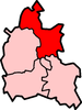
| District | Cherwell |
| Shire county | Oxfordshire |
| Region | South East |
| Country | England |
| Sovereign state | United Kingdom |
| Post town | Banbury |
| Postcode district | OX15 |
| Dialling code | 01295 |
| Police | Thames Valley |
| Fire | Oxfordshire |
| Ambulance | South Central |
| EU Parliament | South East England |
| UK Parliament | Banbury |
|
|
Coordinates: 52°00′40″N 1°20′38″W / 52.011°N 1.344°W
Milton is a village in the civil parish of Adderbury about 2.5 miles (4 km) south of Banbury in Oxfordshire, placed on the Milton road in between the villages of Adderbury and Bloxham:
- The Church of England parish church of Saint John the Evangelist[2] was built in 1856 by the Gothic Revival architect William Butterfield.[3]
- Milton has one public house, the Black Boy Inn, that was a gastropub,[4] owned by chef Marco Pierre White, who now no longer owns it. The public house has an outdoor garden and children's climbing equipment.
- The former Banbury and Cheltenham Direct Railway, part of the Great Western Railway, was completed in 1881. The GWR opened a small railway station, Milton Halt, in 1908 on the northern edge of the village near Manor Farm. British Railways closed the halt in 1951 and closed the railway to freight traffic in 1964. The track was removed in 1965.
- The village is built near an affluent of the River Cherwell, and has many nature spots and footpaths surrounding it and leading from it.
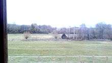
Milton, Cherwell North-west view of Milton's countryside.
- From 2008 until 2010, the village had a small, amateur tabloid newspaper, The Milton Mercury, published monthly.
- The village holds an annual fireworks display, as well as an annual barn dance.
References
- ↑ Parish: Key Statistics: Population. (2011 census Retrieved 2016-05-04.
- ↑ "Church of St John the Evangelist". National Heritage List for England. English Heritage. Retrieved 8 April 2012.
- ↑ Sherwood, Jennifer; Pevsner, Nikolaus (1974). Oxfordshire. The Buildings of England. Harmondsworth: Penguin Books. p. 705. ISBN 0-14-071045-0.
- ↑ The Black Boy Inn
External links
![]() Media related to Milton, Cherwell at Wikimedia Commons
Media related to Milton, Cherwell at Wikimedia Commons
This article is issued from Wikipedia - version of the 5/4/2016. The text is available under the Creative Commons Attribution/Share Alike but additional terms may apply for the media files.