Millrise, Calgary
| Millrise | |
|---|---|
| Neighbourhood | |
 Millrise Location of Millrise in Calgary | |
| Coordinates: 50°55′06″N 114°05′05″W / 50.91833°N 114.08472°WCoordinates: 50°55′06″N 114°05′05″W / 50.91833°N 114.08472°W | |
| Country |
|
| Province |
|
| City |
|
| Quadrant | SW |
| Ward | 13 |
| Established | 1982 |
| Annexed | 1961 |
| Government[1] | |
| • Mayor | Naheed Nenshi |
| • Administrative body | Calgary City Council |
| • Councillor | Diane Colley-Urquhart |
| Area | |
| • Total | 1.8 km2 (0.7 sq mi) |
| Elevation | 1,080 m (3,540 ft) |
| Population (2006)[2] | |
| • Total | 6,509 |
| • Average Income | $70,870 |
| Website | Millrise Community Association |
Millrise is a suburban residential neighbourhood in the south-west quadrant of Calgary, Alberta. It is located south of Fish Creek Provincial Park, and is bounded by 146 Avenue S to the north, Macleod Trail to the east, Shawnessy Boulevard to the south and James McKevitt Road to the west.
The land was annexed to the City of Calgary in 1961 and Millrise was established in 1982. It is represented in the Calgary City Council by the Ward 13 councillor.[1]
The community is served by the Fish Creek-Lacombe station of the C-Train LRT system.
Demographics
In the City of Calgary's 2012 municipal census, Millrise had a population of 6,892 living in 2,635 dwellings, a 2.6% increase from its 2011 population of 6,717.[3] With a land area of 1.8 km2 (0.69 sq mi), it had a population density of 3,830/km2 (9,920/sq mi) in 2012.[3][4]
Residents in this community had a median household income of $70,870 in 2000, and there were 7.6% low income residents living in the neighbourhood.[5] As of 2000, 19.8% of the residents were immigrants. A proportion of 7.5% of the buildings were condominiums or apartments, and 8.5% of the housing was used for renting.[2]
Education
The community is served by Our Lady of Peace Elementary & Junior High (catholic school).
See also
References
- 1 2 "Calgary Elections". City of Calgary. October 21, 2013. Retrieved October 22, 2013.
- 1 2 City of Calgary (2006). "Millrise Community Statistics" (PDF). Retrieved 2007-05-13.
- 1 2 "2012 Civic Census Results" (PDF). City of Calgary. 2012. Retrieved February 4, 2013.
- ↑ "Community Boundaries" (Esri shapefile). City of Calgary. Retrieved February 5, 2013.
- ↑ City of Calgary (2004). "Ward 13 Profile" (PDF). Retrieved 2007-05-13.
Pictures
Millrise, Calgary, Alberta:
 Apr. 26, 2003 Millpark Way
 Feb. 8, 2008 Millpark Way
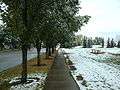 Sep. 16, 2003 Millrise Way
External links
 |
Shawnee Slopes | Fish Creek Provincial Park | | |
| Evergreen | |
Midnapore | ||
| ||||
| | ||||
| Shawnessy |