Midelt
| Midelt ميدلت | |
|---|---|
|
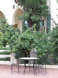
Jbel Ayachi looms over the old French quarter of Midelt | |
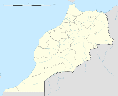 Midelt Location in Morocco | |
| Coordinates: 32°40′48″N 4°43′48″W / 32.68000°N 4.73000°WCoordinates: 32°40′48″N 4°43′48″W / 32.68000°N 4.73000°W | |
| Country |
|
| Region | Drâa-Tafilalet |
| Province | Midelt |
| Elevation | 1,508 m (4,948 ft) |
| Population (2004) | |
| • Total | 44,780 |
| Time zone | WET (UTC+0) |
| • Summer (DST) | WEST (UTC+1) |

Midelt (Berber: ⴰⵡⵟⴰⵟ) (Arabic: ميدلت) is a town in central Morocco, in the high plains between the Middle Atlas and High Atlas mountain ranges. With an estimated population of 44,780, Midelt serves as the commercial center of a large agricultural hinterland. It is also one of Morocco's principal cities for the mining of several minerals.
Geography
Midelt is situated on the main road between Fes and Meknes to the north and Errachidia to the south. Geographically, it is situated in the high plains surrounding the Moulouya River, between the Middle and High Atlas mountain ranges.
The city's elevation is 1,508 metres (4,948 ft), making it one of the highest large towns in Morocco.
Climate
Midelt features Alpine climate. The elevation of Midelt and its relative proximity to the North Atlantic Ocean cools the daily temperatures to make Midelt one of the most temperate of the inland towns. However, many coastal towns have milder temperatures, warmer in winter and cooler in summer.
Every winter, when a cold damp air coming from the north west influence Western Europe and Morocco, temperatures can fall dramatically well below -10 degrees Celsius in Midelt. However, these extreme conditions don't last for more than 5 continuous days.
Temperature averages, from the years 1961 to 1990, yield daily maximum/minimum temperatures for January as 12.3 / 0.6 degrees Celsius and for July as 32.6 / 16.3 degrees Celsius.[1] Snow is common in winter, and precipitation continues throughout the year at moderate levels. However, the principal water source of the region is a spring at the foot of Jbel Ayachi, 10 kilometres (6 mi) south of Midelt.
A dam moderating the flow from the spring was destroyed by a flood in early 2006 following heavy snows the previous winter, damaging the nearby village of Tattiwin.
| Climate data for Midelt (1961–1990, extremes 1930–1963 and 1965–present)[lower-alpha 1] | |||||||||||||
|---|---|---|---|---|---|---|---|---|---|---|---|---|---|
| Month | Jan | Feb | Mar | Apr | May | Jun | Jul | Aug | Sep | Oct | Nov | Dec | Year |
| Record high °C (°F) | 24.0 (75.2) |
26.1 (79) |
29.0 (84.2) |
32.0 (89.6) |
34.8 (94.6) |
37.4 (99.3) |
43.1 (109.6) |
43.2 (109.8) |
38.7 (101.7) |
31.9 (89.4) |
28.0 (82.4) |
24.0 (75.2) |
43.2 (109.8) |
| Average high °C (°F) | 12.3 (54.1) |
13.8 (56.8) |
16.3 (61.3) |
18.1 (64.6) |
22.2 (72) |
27.2 (81) |
32.6 (90.7) |
32.2 (90) |
27.3 (81.1) |
21.2 (70.2) |
15.7 (60.3) |
12.5 (54.5) |
20.9 (69.6) |
| Daily mean °C (°F) | 6.5 (43.7) |
7.9 (46.2) |
9.9 (49.8) |
11.7 (53.1) |
15.5 (59.9) |
19.8 (67.6) |
24.5 (76.1) |
24.2 (75.6) |
20.1 (68.2) |
15.0 (59) |
10.1 (50.2) |
6.8 (44.2) |
14.3 (57.7) |
| Average low °C (°F) | 0.6 (33.1) |
2.0 (35.6) |
3.5 (38.3) |
5.3 (41.5) |
8.7 (47.7) |
12.4 (54.3) |
16.3 (61.3) |
16.2 (61.2) |
12.9 (55.2) |
8.7 (47.7) |
4.4 (39.9) |
1.2 (34.2) |
7.7 (45.9) |
| Record low °C (°F) | −14.0 (6.8) |
−16.0 (3.2) |
−8.0 (17.6) |
−3.8 (25.2) |
−1.0 (30.2) |
3.0 (37.4) |
7.6 (45.7) |
2.8 (37) |
0.0 (32) |
−5.0 (23) |
−7.0 (19.4) |
−13.5 (7.7) |
−16.0 (3.2) |
| Average precipitation mm (inches) | 15.1 (0.594) |
18.4 (0.724) |
17.8 (0.701) |
31.9 (1.256) |
31.4 (1.236) |
18.6 (0.732) |
5.1 (0.201) |
7.0 (0.276) |
17.1 (0.673) |
17.4 (0.685) |
20.2 (0.795) |
8.2 (0.323) |
208.2 (8.197) |
| Average precipitation days | 5.0 | 5.8 | 6.1 | 7.2 | 7.1 | 4.7 | 3.4 | 4.3 | 6.2 | 5.8 | 5.7 | 4.6 | 65.9 |
| Average relative humidity (%) | 73 | 71 | 74 | 76 | 73 | 67 | 58 | 56 | 69 | 72 | 76 | 70 | 70 |
| Mean monthly sunshine hours | 229.9 | 222.5 | 266.0 | 273.2 | 299.0 | 308.1 | 318.6 | 286.7 | 256.4 | 253.0 | 221.6 | 227.7 | 3,162.7 |
| Source #1: NOAA[2] | |||||||||||||
| Source #2: Deutscher Wetterdienst (record highs for February to March only, record lows, and humidity),[3] Meteo Climat (all other record highs and lows)[4] | |||||||||||||
History
Midelt grew in the first half of the 20th century around a French administrative post by the same name. Previously, villages and ksour had dotted the fertile surroundings. The French established their post to facilitate the mining of lead, gypsum, other minerals, and fossils in the nearby Ahouli and Mibladen mines and elsewhere. The development of these mines led to the construction of a railroad from Midelt to the Mediterranean coast and the electrification of Midelt in 1930. In Morocco, only Casablanca received electricity earlier.
After Moroccan independence in 1956, control reverted to the Moroccan government. Midelt is currently the provincial capital of Midelt Province.
People
Midelt is a largely Berber (Amazigh) city . Berber residents speak the Central Atlas Tamazight (Ait Ayache) language but most can also use the dialect of Darija. Educated residents also speak Standard Arabic as well as French, which are used throughout Morocco in mass media, education, and government.
Because Midelt is a new city, almost all Mideltis can trace their roots either to one of the nearby villages or to elsewhere in Morocco. The city also lacks the sharply defined neighborhood divisions and traditional souqs of older Moroccan cities.
Very few non-natives live in Midelt. Of these, the longest established are a community of Franciscan nuns and Cistercian monks (namely Trappists) living at the Abbey of Our Lady of Atlas in a nearby village. The nuns work with local women and girls to develop handcrafts and teach hygiene, French language, and other skills.
Economy

Midelt functions as the market for an agricultural area extending from the Moulouya River to Jbel Ayachi, bounded on the east and west by dry plains. This region is best known for apples; other produce includes walnuts, apricots, plums, pomegranates, wheat, corn, and a wide variety of garden vegetables.
Nomads and sedentary farmers from the surrounding area also raise sheep and goats for slaughter and for wool. Both of these are sold in Midelt, but largely for local consumption. Locally gathered evidence indicates that the local price of meat is inversely related to rainfall: in wet years, nomads can keep their herds alive through the summer and do not bring them to market; in dry years, animals are better sold than lost to draught.
Midelt's industrial sector is largely related to the nearby mines, of which only Mibladen continues to operate at high capacity. Lead, gypsum, and a host of lesser-known minerals are extracted for sale to industry and for household decorations.
Tourism continues to grow as an important source of revenue for Midelt. The climate attracts many visitors, mostly Moroccans from lower climes and émigrés to Europe. These support several small hotels as well as two larger establishments catering to Europeans. In addition to visitors, local handcrafts - especially carpets and blankets in the roughhewn nomadic style - are sold through cooperatives and merchants both locally and in Morocco's larger cities.
Notes
- ↑ The record highs and lows are based on the Deutscher Wetterdienst link for the period 1930–1963 while records beyond 1965 come from the Meteo Climat link. As a result, the most extreme values from either source are used.
References
- ↑ "Climatological Info. for Midelt, Morocco", Hong Kong Observatory, 2003, webpage: HKO-Midelt.
- ↑ "Midelt Climate Normals 1961–1990". National Oceanic and Atmospheric Administration. Retrieved March 16, 2015.
- ↑ "Klimatafel von Midelt / Marokko" (PDF). Baseline climate means (1961–1990) from stations all over the world (in German). Deutscher Wetterdienst. Retrieved October 14, 2016.
- ↑ "Station Midelt" (in French). Météo Climat. Retrieved October 14, 2016.
External links
Capital: Errachidia | ||
| Provinces | 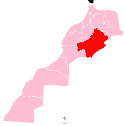 | |
| Cities | ||