Merrick Road
| Merrick Boulevard | |
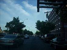 Merrick Boulevard in South Jamaica, Queens | |
| Maintained by | NYCDOT, Nassau County, and NYSDOT |
|---|---|
| Length | 21.8 mi[1] (35.1 km) |
| Location | Queens, Nassau, and Suffolk counties, New York |
| Coordinates | 40°40′26.9″N 73°43′39.8″W / 40.674139°N 73.727722°W |
| West end |
|
| East end |
|
Merrick Road, known as Merrick Boulevard inside New York City, is an east–west urban arterial in Queens, Nassau, and Suffolk counties, New York, United States. It runs east from the Queens neighborhood of Jamaica through Merrick past the county line between Nassau and Suffolk into Amityville, where it becomes Montauk Highway at the Amityville–Copiague village/hamlet line. The easternmost portion of Merrick Road, from Carman Mill Road to its eastern terminus, signed as part of New York State Route 27A (NY 27A). At one time, the entire length of Merrick Road was signed as NY 27A; currently, the entire portion within Nassau County is currently designated as the unsigned County Route 27 (CR 27).[2] Merrick Road travels along an old right-of-way that was one of the original paths across southern Long Island, stretching from Queens to Montauk Point.
Route description
Merrick Boulevard begins at NY 25 (Hillside Avenue) as a two-lane, one-way street heading eastbound (compass south at this point), which continues north of Hillside Avenue as 166th Street. Two blocks to the south of Hillside Avenue, Merrick Boulevard passes by the Central Branch of the Queens Library and the 165th Street Bus Terminal. A block to its east, 168th Street provides for westbound traffic. Just south of Liberty Avenue, the two directions join together to form a four-lane, divided Merrick Boulevard.[1] There is also a subway located along here. Among the parks that the road passes are Proctor-Hopson Circle, St. Albans Park, and Roy Wilkins Park.

Merrick Boulevard gradually turns southeast and east, passing through Springfield Gardens, Laurelton and crossing the Belt Parkway before leaving Queens into Nassau County, where it becomes Merrick Road. Merrick Road here is one of the old roads along the southern side of Long Island; it has since been replaced by Sunrise Highway (NY 27) for most through traffic.[1]
At Rockville Centre, bridges take it over NY 27, with four directional ramps forming a partial interchange. Further east, it serves as the southern end for state roads such as NY 107, NY 110, and the Seaford–Oyster Bay Expressway (NY 135 ).[1]
NY 27A begins as a split from NY 27 in East Massapequa, where NY 27 leaves the original Sunrise Gold Circle, which is now Old Sunrise Highway (unsigned NY 900D) east of the split. NY 27A quickly turns south off Old Sunrise Highway onto Carman Mill Road, which ends at Merrick Road. Merrick Road from that point east continues through Massapequa over the Nassau/Suffolk border into Amityville, Suffolk County, where it becomes Montauk Highway at the Amityville/Copiague village/hamlet line.[1] Amityville is the only town in Suffolk County where southernmost major road is known as Merrick Road (it is known as Montauk Highway in every other settlement along the South Shore of Suffolk County.
Both the Meadowbrook State Parkway and the Wantagh State Parkway have interchanges with Merrick Road. A truck needing to make a delivery to the barrier beaches along Ocean Parkway may enter either parkway southbound at this road and at no point further north.[1]
Major intersections
| County | Location | mi[1] | km | Destinations | Notes |
|---|---|---|---|---|---|
| Queens | Jamaica | 0.00 | 0.00 | ||
| 0.30 | 0.48 | Jamaica Avenue | |||
| St. Albans | 1.60 | 2.57 | Linden Boulevard | ||
| 3.30 | 5.31 | Springfield Boulevard | |||
| Laurelton | 4.10 | 6.60 | Francis Lewis Boulevard | ||
| 4.40 | 7.08 | Access via Brookville Boulevard; exit 24B (Cross Island Parkway) | |||
| Nassau | Rockville Centre | 8.90 | 14.32 | Same-directional movements only | |
| Freeport | 13.60 | 21.89 | Exit M9 (Meadowbrook Parkway) | ||
| Wantagh | 16.70 | 26.88 | Exit W6 (Wantagh Parkway); some movements via local roads | ||
| Seaford | 17.70 | 28.49 | Southern terminus of NY 135, exit 1 (NY 135) | ||
| Massapequa | 18.60 | 29.93 | Southern terminus of NY 107 | ||
| East Massapequa | 21.00 | 33.80 | NY 27A joins Merrick Road | ||
| Suffolk | Amityville–Copiague village/hamlet line | 21.80 | 35.08 | Continuation east | |
1.000 mi = 1.609 km; 1.000 km = 0.621 mi
| |||||
See also
References
- 1 2 3 4 5 6 7 Google (May 30, 2015). "Merrick Boulevard / Road" (Map). Google Maps. Google. Retrieved May 30, 2015.
- ↑ "Merrick Road - Nassau CR 27". Greater New York Roads. Retrieved April 1, 2010.
External links
- Merrick Road at Alps' Roads