Meitō-ku, Nagoya
| Meitō 名東区 | |
|---|---|
| Ward | |
| Meitō Ward | |
|
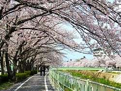
Kanare River | |
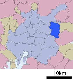 Location of Meitō-ku in Nagoya | |
 Meitō
| |
| Coordinates: 35°10′33″N 137°0′37″E / 35.17583°N 137.01028°ECoordinates: 35°10′33″N 137°0′37″E / 35.17583°N 137.01028°E | |
| Country | Japan |
| Region |
Tōkai region Chūbu region |
| Prefecture | Aichi |
| City | Nagoya |
| Area | |
| • Total | 19.44 km2 (7.51 sq mi) |
| Population (November 2011) | |
| • Total | 161,416 |
| • Density | 8,300/km2 (21,000/sq mi) |
| Time zone | Japan Standard Time (UTC+9) |
| - Tree | Zelkova serrata [1] |
| - Flower | Dianthus |
| Phone number | 052-773-1111 |
| Address | 2-15 Kamisha, Meitō-ku, Nagoya-shi, Aichi-ken 464-8644 |
| Website |
www |
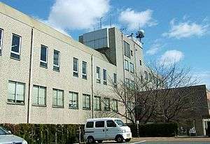
Meitō-ku Ward Office
Meitō-ku (名東区 Meitō-ku) is one of the 16 wards of the city of Nagoya in Aichi Prefecture, Japan. As of 2011, the ward had an estimated population of 161,416 and a population density of 8,300 persons per km². The total area was 19.44 km².
Geography
Meitō Ward is located in eastern Nagoya city.
Surrounding municipalities
History
The area of present Meitō-ku was formerly part of Aichi District and Higashikasugai District. Incorporated into the city of Nagoya by 1955 and divided between Chikusa Ward and Showa Ward, it became a separate ward on February 1, 1975.
Education
Transportation
Railroads
- Aichi Rapid Transit Company - Linimo
- Nagoya Municipal Subway – Higashiyama Line
- Issha - Kamiyashiro - Hongō - Fujigaoka
Highways
- Tōmei Expressway
- Nagoya Dai-ni Kanjo Expressway
- Route 2 (Nagoya Expressway)
- Japan National Route 302
- Japan National Route 363
Noted people from Meitō-ku, Nagoya
- Shibata Katsuie – Samurai during the Sengoku period
- Mao Asada – professional figure skater
- Mai Asada – professional figure skater, model, actress
- Tetsuo Nakanishi – professional soccer player
- Kayo Satoh – model, actress
References
External links
- / Official website (Japanese)
| Wikimedia Commons has media related to Meitō-ku, Nagoya. |
| Wards of Nagoya | ||
|---|---|---|
| Core cities | ||
| Special cities | ||
| Cities | ||
| Aichi District | ||
| Ama District | ||
| Chita District | ||
| Kitashitara District | ||
| Nishikasugai District | ||
| Niwa District | ||
| Nukata District | ||
This article is issued from Wikipedia - version of the 12/15/2015. The text is available under the Creative Commons Attribution/Share Alike but additional terms may apply for the media files.