Meiners Oaks, California
| Meiners Oaks | |
|---|---|
| census-designated place | |
 Location in Ventura County and the state of California | |
| Coordinates: 34°26′59″N 119°16′31″W / 34.44972°N 119.27528°WCoordinates: 34°26′59″N 119°16′31″W / 34.44972°N 119.27528°W | |
| Country |
|
| State |
|
| County | Ventura |
| Government | |
| • Senate | Hannah-Beth Jackson (D) |
| • Assembly | Das Williams (D) |
| • U. S. Congress | Julia Brownley (D)[1] |
| Area[2] | |
| • Total | 1.408 sq mi (3.647 km2) |
| • Land | 1.408 sq mi (3.647 km2) |
| • Water | 0 sq mi (0 km2) 0% |
| Elevation | 741 ft (226 m) |
| Population (2010) | |
| • Total | 3,751 |
| • Density | 2,700/sq mi (1,000/km2) |
| Time zone | PST (UTC-8) |
| • Summer (DST) | PDT (UTC-7) |
| ZIP code | 93023 |
| Area code(s) | 805 |
| FIPS code | 06-46702 |
| GNIS feature ID | 1661004 |
Meiners Oaks is a unincorporated community lying west of the city of Ojai in Ventura County, California, United States. For statistical purposes, the United States Census Bureau has defined Meiners Oaks as a census-designated place (CDP). The census definition of the area may not precisely correspond to local understanding of the area with the same name.[3] The population was 3,571 at the 2010 census.
History
German native John Meiners had immigrated to America in 1848 and established a successful brewing operation in Milwaukee. In the 1870s, he acquired the land that would become Meiners Oaks as payment for a debt. When a friend and business associate, Edward D. Holton, travelled through California and investigated the land, Meiners learned that he had acquired one of the largest oak groves on flat ground in southern California. Upon arriving in person, Meiners also found the climate agreeable, and established a ranch. Several hundred acres, north of the oak grove, were used quite successfully to grow lemons, oranges, plums, apricots and apples, as well as oats, wheat, barley and more. Meiners lived on his ranch intermittently until his death in 1898.[4]
Geography
Meiners Oaks is in the mid-northern section of the Ojai Valley, and is bordered by the community of Mira Monte to the south, and the City of Ojai to the east.[5] Meiners Oaks is in the heart of the Ojai Valley, very close to the Ventura River, where there are several hiking trails.[6]
The community is 70 miles (110 km) north of Los Angeles.[7]
Demographics
2010
The 2010 United States Census[8] reported that Meiners Oaks had a population of 3,571. This reflects a decrease in population of 4.8%, as compared with the 2000 census (not a difference of "one person" as noted above). The population density was 2,535.8 people per square mile (979.1/km²). The racial makeup of Meiners Oaks was 2,789 (78.1%) White, 14 (0.4%) African American, 58 (1.6%) Native American, 51 (1.4%) Asian, 1 (0.0%) Pacific Islander, 549 (15.4%) from other races, and 109 (3.1%) from two or more races. Hispanic or Latino of any race were 1,068 persons (29.9%).
The Census reported that 3,565 people (99.8% of the population) lived in households, 6 (0.2%) lived in non-institutionalized group quarters, and 0 (0%) were institutionalized.
There were 1,283 households, out of which 460 (35.9%) had children under the age of 18 living in them, 607 (47.3%) were opposite-sex married couples living together, 178 (13.9%) had a female householder with no husband present, 81 (6.3%) had a male householder with no wife present. There were 101 (7.9%) unmarried opposite-sex partnerships, and 11 (0.9%) same-sex married couples or partnerships. 311 households (24.2%) were made up of individuals and 130 (10.1%) had someone living alone who was 65 years of age or older. The average household size was 2.78. There were 866 families (67.5% of all households); the average family size was 3.24.
The population was spread out with 851 people (23.8%) under the age of 18, 300 people (8.4%) aged 18 to 24, 845 people (23.7%) aged 25 to 44, 1,116 people (31.3%) aged 45 to 64, and 459 people (12.9%) who were 65 years of age or older. The median age was 40.2 years. For every 100 females there were 92.4 males. For every 100 females age 18 and over, there were 91.4 males.
There were 1,396 housing units at an average density of 991.3 per square mile (382.7/km²), of which 798 (62.2%) were owner-occupied, and 485 (37.8%) were occupied by renters. The homeowner vacancy rate was 1.1%; the rental vacancy rate was 6.7%. 2,200 people (61.6% of the population) lived in owner-occupied housing units and 1,365 people (38.2%) lived in rental housing units.
2000
As of the census[9] of 2000, there were 3,750 people, 1,288 households, and 941 families residing in the CDP. The population density was 2,748.0 people per square mile (1,064.6/km²). There were 1,325 housing units at an average density of 971.0 per square mile (376.2/km²). The racial makeup of the CDP was 83.12% White, 0.43% African American, 1.09% Native American, 0.91% Asian, 0.08% Pacific Islander, 10.77% from other races, and 3.60% from two or more races. Hispanic or Latino of any race were 23.09% of the population.
There were 1,288 households out of which 42.2% had children under the age of 18 living with them, 53.0% were married couples living together, 14.6% had a female householder with no husband present, and 26.9% were non-families. 21.0% of all households were made up of individuals and 7.7% had someone living alone who was 65 years of age or older. The average household size was 2.90 and the average family size was 3.32.
In the CDP the population was spread out with 29.9% under the age of 18, 8.0% from 18 to 24, 28.4% from 25 to 44, 23.5% from 45 to 64, and 10.2% who were 65 years of age or older. The median age was 36 years. For every 100 females there were 97.3 males. For every 100 females age 18 and over, there were 93.7 males.
The median income for a household in the CDP was $51,811, and the median income for a family was $56,778. Males had a median income of $49,083 versus $28,839 for females. The per capita income for the CDP was $23,152. About 8.1% of families and 11.9% of the population were below the poverty line, including 17.3% of those under age 18 and 6.6% of those age 65 or over.
Education
Schools in Meiners Oaks are served by the Ojai Unified School District, including Meiners Oaks Elementary School. There are also several private schools located in Meiners Oaks.
Libraries
Public Libraries: Ventura County Library - 14 locations with three branches in the Ojai Valley: Meiners Oaks Library,[10] Ojai Library,[11] and Oak View Library.[12]
References
- ↑ "California's 26th Congressional District - Representatives & District Map". Civic Impulse, LLC. Retrieved October 5, 2014.
- ↑ "2010 Census U.S. Gazetteer Files – Places – California". United States Census Bureau.
- ↑ "Boundary Map and Geodata for the CDP of Meiners Oaks in California, U.S.A.". MapTechnica.com. Retrieved August 7, 2015
- ↑ Wenig, Ed. "Meiners Oaks". Ojai History. Retrieved 7 August 2015.
- ↑ "US Gazetteer files: 2010, 2000, and 1990". United States Census Bureau. 2011-02-12. Retrieved 2011-04-23.
- ↑ staff (June 9, 2014). "Ojai land conservancy wins $843,000 to buy Meiners Oaks site". Ventura County Star.
- ↑ Rist, Curtis. "Hitting Bottom." People. May 13, 1996. Volume 45, No. 19. Retrieved on May 26, 2013.
- ↑ "2010 Census Interactive Population Search: CA - Meiners Oaks CDP". U.S. Census Bureau. Retrieved July 12, 2014.
- ↑ "American FactFinder". United States Census Bureau. Archived from the original on September 11, 2013. Retrieved 2008-01-31.
- ↑ "Meiners Oaks Library | Ventura County Library". www.vencolibrary.org. Retrieved 2016-09-10.
- ↑ "Ojai Library | Ventura County Library". www.vencolibrary.org. Retrieved 2016-09-10.
- ↑ "Oak View Library | Ventura County Library". www.vencolibrary.org. Retrieved 2016-09-10.
See also
Municipalities and communities of Ventura County, California, United States | ||
|---|---|---|
| Cities | 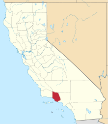 | |
| CDPs | ||
| Unincorporated communities | ||
| Footnotes | ‡This populated place also has portions in an adjacent county or counties | |