Mazraat En Nahr
| Mazraat En Nahr مزرعة النهر | |
|---|---|
| Village | |
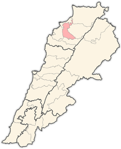
 Mazraat En Nahr Location within Lebanon | |
| Coordinates: 34°15′07″N 35°53′54″E / 34.25194°N 35.89833°ECoordinates: 34°15′07″N 35°53′54″E / 34.25194°N 35.89833°E | |
| Country |
|
| Governorate | North Governorate |
| District | Zgharta District |
| Population (2010) | |
| • Total | 378 |
| Time zone | EET (UTC+2) |
| • Summer (DST) | EEST (UTC+3) |
| Postal code | 33227 |
| Dialing code | +961 |
| Website | http://mazraatennahr.weebly.com/ |
|
Family Names
| |
Mazraat En Nahr also spelt Mazret Al Nahr, Mazraat El Nahr or Mazraat Al Nahr; Arabic: مزرعة النهر is a village located on the border line of the Zgharta District and the Bsharri District in the North Governorate of Lebanon. It is situated in the Valley of Qadisha, which is considered a holy and spiritual place in Eastern Christianity.
The Lebanese hailing from Mazraat En Nahr number 20,000 worldwide. 98% of them live outside Lebanon, mainly in Australia, the United States and Canada.
The population is Maronite Christian.[1]
General information
Mazraat En Nahr is a small village in Zgharta, Lebanon which is situated in-between two major villages Tourza and Sereel. The name Mazraat Al Nahr is a Lebanese word meaning “Planting by the river” because of the agriculture that consist of potatoes, onions, fruits and vegetables all by the side river of El Karya and El Ghar Spring. The people of Mazraat En Nahr on the other hand make up a population of about 378 people but no official census has been taken lately. Most of the inhabitants of Mazraat En Nahr were a mixture of many peoples. The majority were Canaanites, Phoenician and Aramiin, who later became known as the Syriac.
Agriculture: Potatoes, Onions, Fruits and Vegetables.
Water Source: El Karya spring and El Ghar spring.
Celebrations: The feast of Mar Youssef, 19 March.
Directions
Distance from Beirut: 98 km. Distance from Tripoli: 24 km. Distance from Zgharta: 19 km. Altitude: 567 m.
▪Roads To Get There: Tripoli - Zgharta - Kfar Hata - Aarjis - Kfar Fou - Karm Seddeh - Sereel - Mazraat En Nahr. Or Via: Ehden - Sereel - Mazraat En Nahr.
Closest Hotels
Saqiyat al `Abd - 2 km or 2 miles
Saqiet el Abd - 2 km or 2 miles
Mgharet Abou Aali - 4 km or 3 miles
Magharat Abu `Ali - 4 km or 3 miles
Dahr Abou Taiya - 6 km or 4 miles
Dahr Abu Tayyah - 6 km or 4 miles
Ed Doueir - 6 km or 4 miles
Saqiet el Aakre - 2 km or 1 miles
Saqiyat al `Akirah - 2 km or 1 miles
Harf el Aalem - 5 km or 3 miles
Harf al `Alam - 5 km or 3 miles
Al `Aqabah - 2 km or 2 miles
El Aaqabe - 2 km or 2 miles
Qada' `Alayh - 3 km or 2 miles
Al Baruk - 6 km or 4 miles
References
- ↑ "Municipal and ikhtiyariah elections in Northern Lebanon" (PDF). The Monthly. March 2010. p. 23. Retrieved 29 October 2016.
External links
Capital: Zgharta | ||
| Towns and villages |
|  |
| Notable landmarks | ||
| History | ||
| Notable people |
| |
| Society |
| |