Maywood, New Jersey
| Maywood, New Jersey | |
|---|---|
| Borough | |
| Borough of Maywood | |
|
NYSW train at the Maywood Station Museum | |
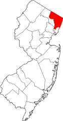
 Map highlighting Maywood's location within Bergen County. Inset: Bergen County's location within New Jersey | |
 Census Bureau map of Maywood, New Jersey | |
| Coordinates: 40°54′10″N 74°03′48″W / 40.902885°N 74.063457°WCoordinates: 40°54′10″N 74°03′48″W / 40.902885°N 74.063457°W[1][2] | |
| Country |
|
| State |
|
| County | Bergen |
| Incorporated | June 29, 1894 |
| Government[3] | |
| • Type | Borough |
| • Body | Borough Council |
| • Mayor | Adrian J. Febre (R, term ends December 31, 2019)[4][5] |
| • Administrator | Roberta Stern[6] |
| • Clerk | Jean M. Pelligra[7] |
| Area[1] | |
| • Total | 1.287 sq mi (3.335 km2) |
| • Land | 1.286 sq mi (3.332 km2) |
| • Water | 0.001 sq mi (0.004 km2) 0.11% |
| Area rank |
475th of 566 in state 60th of 70 in county[1] |
| Elevation[8] | 89 ft (27 m) |
| Population (2010 Census)[9][10][11] | |
| • Total | 9,555 |
| • Estimate (2015)[12] | 9,805 |
| • Rank |
249th of 566 in state 39th of 70 in county[13] |
| • Density | 7,428.0/sq mi (2,868.0/km2) |
| • Density rank |
53rd of 566 in state 14th of 70 in county[13] |
| Time zone | Eastern (EST) (UTC-5) |
| • Summer (DST) | Eastern (EDT) (UTC-4) |
| ZIP code | 07607[14][15] |
| Area code(s) | 201[16] |
| FIPS code | 3400344880[1][17][18] |
| GNIS feature ID | 0885294[1][19] |
| Website |
www |

Maywood is a borough in Bergen County, New Jersey, United States. As of the 2010 United States Census, the borough's population was 9,555,[9][10][11] reflecting an increase of 32 (+0.3%) from the 9,523 counted in the 2000 Census, which had in turn increased by 50 (+0.5%) from the 9,473 counted in the 1990 Census.[20]
Maywood was incorporated as a borough on June 29, 1894, from portions of Midland Township, based on the results of a referendum held that day.[21] The borough was formed during the "Boroughitis" phenomenon then sweeping through Bergen County, in which 26 boroughs were formed in the county in 1894 alone.[22] The borough's name came from the name of a station established in the area by the New Jersey Midland Railroad.[23]
Geography
According to the United States Census Bureau, the borough had a total area of 1.287 square miles (3.335 km2), including 1.286 square miles (3.332 km2) of land and 0.001 square miles (0.004 km2) of water (0.11%).[1][2]
The borough borders the Bergen County municipalities of Hackensack, Lodi, Paramus and Rochelle Park.[24]
Demographics
| Historical population | |||
|---|---|---|---|
| Census | Pop. | %± | |
| 1900 | 536 | — | |
| 1910 | 889 | 65.9% | |
| 1920 | 1,618 | 82.0% | |
| 1930 | 3,398 | 110.0% | |
| 1940 | 4,052 | 19.2% | |
| 1950 | 8,667 | 113.9% | |
| 1960 | 11,460 | 32.2% | |
| 1970 | 11,087 | −3.3% | |
| 1980 | 9,895 | −10.8% | |
| 1990 | 9,473 | −4.3% | |
| 2000 | 9,523 | 0.5% | |
| 2010 | 9,555 | 0.3% | |
| Est. 2015 | 9,805 | [12][25] | 2.6% |
| Population sources: 1900-1920[26] 1900-1910[27] 1910-1930[28] 1900-2010[29][30][31] 2000[32][33] 2010[9][10][11] | |||
2010 Census
At the 2010 United States Census, there were 9,555 people, 3,649 households, and 2,591 families residing in the borough. The population density was 7,428.0 per square mile (2,868.0/km2). There were 3,769 housing units at an average density of 2,930.0 per square mile (1,131.3/km2). The racial makeup of the borough was 74.78% (7,145) White, 5.34% (510) Black or African American, 0.18% (17) Native American, 10.98% (1,049) Asian, 0.02% (2) Pacific Islander, 6.16% (589) from other races, and 2.54% (243) from two or more races. Hispanics or Latinos of any race were 18.68% (1,785) of the population.[9]
There were 3,649 households, of which 29.7% had children under the age of 18 living with them, 55.4% were married couples living together, 12.1% had a female householder with no husband present, and 29.0% were non-families. 24.0% of all households were made up of individuals, and 11.8% had someone living alone who was 65 years of age or older. The average household size was 2.61 and the average family size was 3.14.[9]
In the borough, 21.0% of the population were under the age of 18, 6.6% from 18 to 24, 27.2% from 25 to 44, 29.5% from 45 to 64, and 15.7% who were 65 years of age or older. The median age was 41.7 years. For every 100 females there were 90.4 males. For every 100 females age 18 and over, there were 87.6 males.[9]
The Census Bureau's 2006-2010 American Community Survey showed that (in 2010 inflation-adjusted dollars) median household income was $82,792 (with a margin of error of +/- $3,759) and the median family income was $97,776 (+/- $5,312). Males had a median income of $62,450 (+/- $4,738) versus $54,471 (+/- $7,2865) for females. The per capita income for the borough was $36,461 (+/- $2,475). About 3.4% of families and 4.8% of the population were below the poverty line, including 5.9% of those under age 18 and 3.2% of those age 65 or over.[34]
Same-sex couples headed 32 households in 2010, an increase from the 24 counted in 2000.[35]
2000 Census
As of the 2000 United States Census[17] there were 9,523 people, 3,710 households, and 2,626 families residing in the borough. The population density was 7,326.2 people per square mile (2,828.3/km2). There were 3,777 housing units at an average density of 2,905.7 per square mile (1,121.8/km2). The racial makeup of the borough was 84.57% White, 2.79% African American, 0.07% Native American, 7.16% Asian, 0.01% Pacific Islander, 3.31% from other races, and 2.08% from two or more races. Hispanic or Latino of any race were 11.71% of the population.[32][33]
There were 3,710 households out of which 29.1% had children under the age of 18 living with them, 56.3% were married couples living together, 11.0% had a female householder with no husband present, and 29.2% were non-families. 24.9% of all households were made up of individuals and 13.3% had someone living alone who was 65 years of age or older. The average household size was 2.56 and the average family size was 3.09.[32][33]
In the borough the population was spread out with 21.1% under the age of 18, 6.2% from 18 to 24, 30.8% from 25 to 44, 24.4% from 45 to 64, and 17.5% who were 65 years of age or older. The median age was 40 years. For every 100 females there were 86.9 males. For every 100 females age 18 and over, there were 83.5 males.[32][33]
The median income for a household in the borough was $62,113, and the median income for a family was $73,419. Males had a median income of $49,566 versus $38,193 for females. The per capita income for the borough was $28,117. About 2.5% of families and 3.3% of the population were below the poverty line, including 4.6% of those under age 18 and 3.3% of those age 65 or over.[32][33]
Economy
The central business district of the borough is located on West Pleasant Avenue from the intersection of Maywood Avenue to Lincoln Avenue, and is where most of the local restaurants and shops reside. The business district of Maywood was renovated through a "Streetscapes" grant used to fix up the sidewalks, streets and lighting.[36]
The Outlets at Bergen Town Center, formerly known as the Bergen Mall, is primarily located in Paramus, with portions of the mall in Maywood.[37]
Coca-Cola uses a coca leaf extract prepared by a Stepan Company plant in Maywood as in ingredient.[38] The facility, which had been known as the Maywood Chemical Works (and is also a known Superfund site[39]), was purchased by Stepan in 1959.[40] The plant is the only commercial entity in the country authorized by the Drug Enforcement Administration to import coca leaves, which come primarily from Peru. The non-narcotic extract is sold to Coke, while the active ingredient is sold to a pharmaceutical firm for medicinal purposes.[41]
Fake Chapter Records is an independent record label that was founded by Michael Gilligan in 1996.[42]
Myron Corp, a manufacturer of personalized business gifts, is headquartered in Maywood.[43]
Parks and recreation
Maywood's Memorial Park is across the street from Memorial School on Grant Avenue and is open to anyone. The park includes multiple baseball fields and a vast open field for soccer, football, running, etc. Further back is a multi-hoop concrete basketball court and two jungle gyms with swings. Around the circumference of the park is a 1/2-mile long bike path.[44]
Government
Local government
Maywood is governed under the Borough form of New Jersey municipal government. The governing body consists of a Mayor and a Borough Council comprising six council members, with all positions elected at-large on a partisan basis as part of the November general election. A Mayor is elected directly by the voters to a four-year term of office. The Borough Council consists of six members elected to serve three-year terms on a staggered basis, with two seats coming up for election each year in a three-year cycle.[3] The Borough form of government used by Maywood, the most common system used in the state, is a "weak mayor / strong council" government in which council members act as the legislative body with the mayor presiding at meetings and voting only in the event of a tie. The mayor can veto ordinances subject to an override by a two-thirds majority vote of the council. The mayor makes committee and liaison assignments for council members, and most appointments are made by the mayor with the advice and consent of the council.[45][46]
As of 2016, the Mayor of Maywood is Republican Adrian Febre, serving a term of office ending December 31, 2019. Members of the Borough Council are Council President Frank Morrone (R, 2018; who switched parties from Democrat to Republican in 2015), Rickie A. DeHeer (R, 2017), Michael Gervino (R, 2016), Thomas Lindenau (R, 2016), Francis J. "Frank" Messar, III (R, 2017) and Claire Padovano (R, 2018).[4][47][48][49][50][51]
Adrian Febre was appointed to serve the remaining term of office vacated by former Mayor Gregg Padovano who resigned upon his appointment to a seat on the New Jersey Superior Court. In turn, Michael Gervino was appointed in February 2015 to serve the remaining months of the council tern term vacated by Febre.[52] Gervino won election in November 2015 to serve the balance of the term.[49]
In elections held on November 4, 2013, Republican incumbent Adrian Febre and Republican newcomer Thomas Lindenau defeated Democratic incumbent Erich Fleischmann and Democratic newcomer Jonathan King, shifting the council from a 3-3 tie in 2013 to a majority of four Republicans versus two Democrats.[53]
Federal, state and county representation
Maywood is located in the 5th Congressional District[54] and is part of New Jersey's 38th state legislative district.[10][55][56] Prior to the 2011 reapportionment following the 2010 Census, Maywood had been in the 37th state legislative district.[57] Prior to the 2010 Census, Maywood had been part of the 9th Congressional District, a change made by the New Jersey Redistricting Commission that took effect in January 2013, based on the results of the November 2012 general elections.[57]
New Jersey's Fifth Congressional District is represented by Scott Garrett (R, Wantage Township).[58] New Jersey is represented in the United States Senate by Cory Booker (D, Newark, term ends 2021)[59] and Bob Menendez (D, Paramus, 2019).[60][61]
For the 2016–2017 session (Senate, General Assembly), the 38th Legislative District of the New Jersey Legislature is represented in the State Senate by Robert M. Gordon (D, Fair Lawn) and in the General Assembly by Tim Eustace (D, Maywood) and Joseph Lagana (D, Paramus).[62] The Governor of New Jersey is Chris Christie (R, Mendham Township).[63] The Lieutenant Governor of New Jersey is Kim Guadagno (R, Monmouth Beach).[64]
Bergen County is governed by a directly elected County Executive, with legislative functions performed by a seven-member Board of Chosen Freeholders.[65] As of 2015, the County Executive is James J. Tedesco III (D, Paramus; term ends December 31, 2018).[66] The seven freeholders are elected at-large in partisan elections on a staggered basis, with two or three seats coming up for election each year, with a Chairman, Vice Chairman and Chairman Pro Tempore selected from among its members at a reorganization meeting held each January.[67] Bergen County's Freeholders are Freeholder Chairwoman Joan Voss (D, 2017; Fort Lee),[68] Vice Chairman Steve Tanelli (D, 2015; North Arlington)[69] Chairman Pro Tempore John A. Felice (R, 2016; River Edge),[70] David L. Ganz (D, 2017; Fair Lawn),[71] Maura R. DeNicola (R, 2016; Franklin Lakes)[72] Thomas J. Sullivan Jr., (D, Montvale, 2015; serving the unexpired term of office that had been occupied by James Tedesco before he was sworn in as County Executive)[73][74] and Tracy Silna Zur (D, 2015; Franklin Lakes).[75][76] Countywide constitutional officials are County Clerk John S. Hogan (D, Northvale),[77] Sheriff Michael Saudino (R)[78] and Surrogate Michael R. Dressler (D, Cresskill).[79][80][65]
Politics
As of March 23, 2011, there were a total of 5,711 registered voters in Maywood, of which 1,872 (32.8% vs. 31.7% countywide) were registered as Democrats, 1,066 (18.7% vs. 21.1%) were registered as Republicans and 2,767 (48.5% vs. 47.1%) were registered as Unaffiliated. There were 6 voters registered to other parties.[81] Among the borough's 2010 Census population, 59.8% (vs. 57.1% in Bergen County) were registered to vote, including 75.7% of those ages 18 and over (vs. 73.7% countywide).[81][82]
In the 2012 presidential election, Democrat Barack Obama received 2,513 votes (56.3% vs. 54.8% countywide), ahead of Republican Mitt Romney with 1,877 votes (42.1% vs. 43.5%) and other candidates with 47 votes (1.1% vs. 0.9%), among the 4,462 ballots cast by the borough's 6,047 registered voters, for a turnout of 73.8% (vs. 70.4% in Bergen County).[83][84] In the 2008 presidential election, Democrat Barack Obama received 2,564 votes (54.0% vs. 53.9% countywide), ahead of Republican John McCain with 2,087 votes (43.9% vs. 44.5%) and other candidates with 49 votes (1.0% vs. 0.8%), among the 4,752 ballots cast by the borough's 5,992 registered voters, for a turnout of 79.3% (vs. 76.8% in Bergen County).[85][86] In the 2004 presidential election, Democrat John Kerry received 2,293 votes (50.5% vs. 51.7% countywide), ahead of Republican George W. Bush with 2,184 votes (48.1% vs. 47.2%) and other candidates with 43 votes (0.9% vs. 0.7%), among the 4,540 ballots cast by the borough's 5,752 registered voters, for a turnout of 78.9% (vs. 76.9% in the whole county).[87]
In the 2013 gubernatorial election, Republican Chris Christie received 61.0% of the vote (1,708 cast), ahead of Democrat Barbara Buono with 37.6% (1,052 votes), and other candidates with 1.4% (39 votes), among the 2,898 ballots cast by the borough's 5,850 registered voters (99 ballots were spoiled), for a turnout of 49.5%.[88][89] In the 2009 gubernatorial election, Democrat Jon Corzine received 1,352 ballots cast (46.4% vs. 48.0% countywide), ahead of Republican Chris Christie with 1,340 votes (46.0% vs. 45.8%), Independent Chris Daggett with 165 votes (5.7% vs. 4.7%) and other candidates with 26 votes (0.9% vs. 0.5%), among the 2,911 ballots cast by the borough's 5,850 registered voters, yielding a 49.8% turnout (vs. 50.0% in the county).[90]
Education
The Maywood Public Schools serve students in pre-Kindergarten through eighth grade. As of the 2011-12 school year, the district's two schools had an enrollment of 910 students and 65.2 classroom teachers (on an FTE basis), for a student–teacher ratio of 13.96:1.[91] Schools in the district (with 2011-12 enrollment from the National Center for Education Statistics[92]) are Memorial School[93] (PreK-3; 433 students) and Maywood Avenue School[94] (4-8; 477).[95][96]
The district offers a wide variety of after school activities ranging from cheerleading to chess club, and where all students have the opportunity to contribute to their school newspaper, The Hawk (Grades 6-8), and the school's new newspaper,The Mini Hawk (Grades 4 and 5), and eighth graders may assist with their yearbook. For the 1996-97 school year, Memorial School was formally recognized with the National Blue Ribbon School Award of Excellence, the highest honor that an American school can achieve.[97]
After graduating from Maywood Avenue School, students in public school for ninth through twelfth grades attend Hackensack High School in Hackensack, as part of a sending/receiving relationship with the Hackensack Public Schools, together with students from Rochelle Park and South Hackensack. In 2011, the district announced that it was considering switching its students to Paramus High School in the face of rising tuition costs charged by the Hackensack district.[98][99]
Public school students from the borough, and all of Bergen County, are eligible to attend the secondary education programs offered by the Bergen County Technical Schools, which include the Bergen County Academies in Hackensack, and the Bergen Tech campus in Teterboro or Paramus. The district offers programs on a shared-time or full-time basis, with admission based on a selective application process and tuition covered by the student's home school district.[100][101]
Emergency services
The Maywood Police Department was founded in 1894. The police station is located at 15 Park Avenue. Comprised of 22 sworn officers (of the 24 maximum set by borough ordinance), they respond to all calls for service 24/7. Maywood Police Communications is staffed by certified EMD Telecommunicators who handle all local 9-1-1 emergency calls and dispatches all emergency services.[102] Maywood also has sworn Class 1 Special Law Enforcement Officers who assist with traffic control and park patrols.
Maywood First Aid and Emergency Squad is comprised of all volunteers, manning two basic life support units. During the weekdays two paid EMTs staff the unit. Maywood FA&ES is a member of the 24th district New Jersey First Aid Council.
Maywood has an all-volunteer fire department. There are two fire stations in Maywood. Station 1 (T17-E18) is located on Park Avenue and Station 2 (E19-R23) is located on West Hunter Avenue. Maywood also houses a Fire Police department that was founded in 1926. The Fire Police assist both fire and police departments.[103]
Religion
Maywood is home to Our Lady Queen of Peace Roman Catholic Church, First Presbyterian Church, Lutheran Church of the Redeemer, Zion Lutheran Church, St. Martin's Episcopal Church, and Temple Beth Israel, a Reconstructionist synagogue established in 1928, which moved to its current location in 1931.[104]
Transportation
Roads and highways
As of May 2010, the borough had a total of 24.91 miles (40.09 km) of roadways, of which 21.06 miles (33.89 km) were maintained by the municipality, 3.54 miles (5.70 km) by Bergen County and 0.31 miles (0.50 km) by the New Jersey Department of Transportation.[105]
Route 17 passes through Maywood. Main roads in Maywood include Maywood Avenue, Central Avenue, Passaic Street, and Spring Valley Road.
Public transportation
NJ Transit bus routes 144, 145, 148, 162, 163 and 164 serve the Port Authority Bus Terminal in Midtown Manhattan; The 175 route serves the George Washington Bridge Bus Terminal; and the 712, 751, 752, 753, 755, 758 and 770 provide local service in New Jersey.[106][107]
The borough provides a shuttle three days a week operating from the senior center.[108]
Historic sites
The Maywood Train Station was restored after a proposal was made by the borough in 2002 to consider demolishing the landmark.[109] It has been listed on the National Register of Historic Places since 2003 as Building #03000487.[110] The station was restored by the all-volunteer, non-profit Maywood Station Historical Committee, who now operate the historic site as the Maywood Station Museum.[111]
Notable people
People who were born in, residents of, or otherwise closely associated with Maywood include:
- Beverly Armstrong (born 1934), pitcher for Rockford Peaches.[112]
- Regina Carter (born 1966), jazz violinist.[113]
- Tim Eustace (born 1956), member of the New Jersey General Assembly since 2011 who served as mayor of Maywood from 2008 to 2012.[114]
- Alvester Garnett (born 1970), jazz drummer.[115]
- Henry Jager (born 1879 - ?), politician who was elected to the New York State Assembly as a Socialist, until he was removed from office based on his being a resident of Maywood.[116]
- James J. Maher, President of Niagara University.[117]
- Walter G. Schroeder (born 1927), politician who was a member of the Oregon House of Representatives from 1985 to 1993.[118]
- William Lee Stoddart (1868-1940), architect.[119]
- Justin Trattou (born 1988), defensive end who has played in the NFL for the New York Giants and Minnesota Vikings.[120]
- Alex Vincent (born 1981), known for his roles as a child actor in the Child's Play movies.[121]
References
- 1 2 3 4 5 6 2010 Census Gazetteer Files: New Jersey County Subdivisions, United States Census Bureau. Accessed May 21, 2015.
- 1 2 US Gazetteer files: 2010, 2000, and 1990, United States Census Bureau. Accessed September 4, 2014.
- 1 2 2012 New Jersey Legislative District Data Book, Rutgers University Edward J. Bloustein School of Planning and Public Policy, March 2013, p. 157.
- 1 2 Mayor and Council, Borough of Maywood. Accessed May 17, 2016.
- ↑ 2016 New Jersey Mayors Directory, New Jersey Department of Community Affairs. Accessed June 14, 2016.
- ↑ Borough Administrator, Borough of Maywood. Accessed May 17, 2016.
- ↑ Borough Clerk's Office, Borough of Maywood. Accessed May 17, 2016.
- ↑ U.S. Geological Survey Geographic Names Information System: Borough of Maywood, Geographic Names Information System. Accessed March 8, 2013.
- 1 2 3 4 5 6 DP-1 - Profile of General Population and Housing Characteristics: 2010 for Maywood borough, Bergen County, New Jersey, United States Census Bureau. Accessed December 19, 2011.
- 1 2 3 4 Municipalities Grouped by 2011-2020 Legislative Districts, New Jersey Department of State, p. 15. Accessed January 6, 2013.
- 1 2 3 Table DP-1. Profile of General Demographic Characteristics: 2010 for Maywood borough, New Jersey Department of Labor and Workforce Development. Accessed December 19, 2011.
- 1 2 PEPANNRES - Annual Estimates of the Resident Population: April 1, 2010 to July 1, 2015 - 2015 Population Estimates for New Jersey municipalities, United States Census Bureau. Accessed May 22, 2016.
- 1 2 GCT-PH1 Population, Housing Units, Area, and Density: 2010 - State -- County Subdivision from the 2010 Census Summary File 1 for New Jersey, United States Census Bureau. Accessed September 15, 2012.
- ↑ Look Up a ZIP Code for Maywood, NJ, United States Postal Service. Accessed December 19, 2011.
- ↑ Zip Codes, State of New Jersey. Accessed August 28, 2013.
- ↑ Area Code Lookup - NPA NXX for Maywood, NJ, Area-Codes.com. Accessed August 28, 2013.
- 1 2 American FactFinder, United States Census Bureau. Accessed September 4, 2014.
- ↑ A Cure for the Common Codes: New Jersey, Missouri Census Data Center. Accessed July 18, 2012.
- ↑ US Board on Geographic Names, United States Geological Survey. Accessed September 4, 2014.
- ↑ Table 7. Population for the Counties and Municipalities in New Jersey: 1990, 2000 and 2010, New Jersey Department of Labor and Workforce Development, February 2011. Accessed July 18, 2012.
- ↑ Snyder, John P. The Story of New Jersey's Civil Boundaries: 1606-1968, Bureau of Geology and Topography; Trenton, New Jersey; 1969. p. 81. Accessed July 18, 2012.
- ↑ Harvey, Cornelius Burnham. Genealogical History of Hudson and Bergen Counties, New Jersey, p. 11, New Jersey Genealogical Publishing Company, 1900. Accessed September 1, 2013. "For a period of sixteen years following the passage of this act few boroughs were organized in the State, only three of them being in Bergen County.... As it was twenty-six boroughs were in the county from January 23, 1894, to December 18, of the same year."
- ↑ The History of Maywood, Maywood Historical Committee. Accessed September 5, 2015. "In 1871 the New Jersey Midland Railroad, now known as the New York Susquehanna and Western, was constructed and through the help of property owners, a railroad station was erected at a country road crossing and given the name 'Maywood.'"
- ↑ Areas touching Maywood, MapIt. Accessed January 7, 2015.
- ↑ Census Estimates for New Jersey April 1, 2010 to July 1, 2015, United States Census Bureau. Accessed May 22, 2016.
- ↑ Compendium of censuses 1726-1905: together with the tabulated returns of 1905, New Jersey Department of State, 1906. Accessed August 13, 2013.
- ↑ Thirteenth Census of the United States, 1910: Population by Counties and Minor Civil Divisions, 1910, 1900, 1890, United States Census Bureau, p. 335. Accessed July 18, 2012.
- ↑ Fifteenth Census of the United States : 1930 - Population Volume I, United States Census Bureau, p. 714. Accessed December 19, 2011.
- ↑ Table 6. New Jersey Resident Population by Municipality: 1930 - 1990, New Jersey Department of Labor and Workforce Development. Accessed December 19, 2011.
- ↑ Bergen County Data Book 2003, Bergen County, New Jersey. Accessed August 13, 2013.
- ↑ Historical Population Trends in Bergen County (1990-2010), Bergen County Department of Planning & Economic Development, 2011. Accessed June 28, 2015.
- 1 2 3 4 5 Census 2000 Profiles of Demographic / Social / Economic / Housing Characteristics for Maywood borough, New Jersey, United States Census Bureau. Accessed July 16, 2012.
- 1 2 3 4 5 DP-1: Profile of General Demographic Characteristics: 2000 - Census 2000 Summary File 1 (SF 1) 100-Percent Data for Maywood borough, Bergen County, New Jersey, United States Census Bureau. Accessed July 16, 2012.
- ↑ DP03: Selected Economic Characteristics from the 2006-2010 American Community Survey 5-Year Estimates for Maywood borough, Bergen County, New Jersey, United States Census Bureau. Accessed January 22, 2012.
- ↑ Lipman, Harvy; and Sheingold, Dave. "North Jersey sees 30% growth in same-sex couples", The Record (Bergen County), August 14, 2011, backed up by the Internet Archive as of February 3, 2013. Accessed September 3, 2014.
- ↑ Clark, Susan Joy. "Maywood Council looks to do work on retail district", Community News, November 20, 2014. "Maywood has $150,000 in grant money to use toward a streetscapes project for the retail district on the south side of Maywood."
- ↑ Clark, Susan Joy. "Richards out as administrator in Maywood", Community News, January 12, 2012. Accessed December 5, 2014. "Richards looked back at the time that Bergen Town Center was being developed.... When Vornado took over, I went over several times and convinced them to develop the Maywood side of the mall. When you drive past it now, you see there are new buildings going up now."
- ↑ Benson, Drew. "Coca kick in drinks spurs export fears", The Washington Times, April 20, 2004. Accessed June 14, 2007. "Coke dropped cocaine from its recipe around 1900, but the secret formula still calls for a cocaine-free coca extract produced at a Stepan Co. factory in Maywood, N.J. Stepan buys about 100 metric tons of dried Peruvian coca leaves each year, said Marco Castillo, spokesman for Peru's state-owned National Coca Co."
- ↑ FUSRAP Maywood Superfund Site, Accessed November 12th, 2009.
- ↑ History, Stepan Company. Accessed June 14, 2007.
- ↑ May, Clifford D. "How Coca-Cola Obtains Its Coca", The New York Times, July 1, 1988. Accessed January 22, 2012. "A Stepan laboratory in Maywood, N.J., is the nation's only legal commercial importer of coca leaves, which it obtains mainly from Peru and, to a lesser extent, Bolivia. Besides producing the coca flavoring agent for Coca-Cola, Stepan extracts cocaine from the coca leaves, which it sells to Mallinckrodt Inc., a St. Louis pharmaceutical manufacturer that is the only company in the United States licensed to purify the product for medicinal use."
- ↑ Holman, Tonya. "Record company has been going strong for 15 years", Community News, June 30, 2011. Accessed December 5, 2014. "Fake Chapter Records of Maywood will be marking its 15 anniversary on Nov. 11.... The president of Fake Chapter Records goes by the name Gilligan, and said he started the company when he was 18."
- ↑ Careers at Myron, Myron Corp. Accessed December 5, 2014. "We are headquartered in Maywood, NJ, convenient to routes 17, 80 & 4, the Garden State Parkway, NJ Turnpike and just 20 minutes from Manhattan. 205 Maywood Avenue, Maywood, NJ 07607"
- ↑ Maywood Memorial Park, Maywood NJ, NJ Playgrounds. Accessed December 5, 2014.
- ↑ Cerra, Michael F. "Forms of Government: Everything You've Always Wanted to Know, But Were Afraid to Ask", New Jersey State League of Municipalities. Accessed November 30, 2014.
- ↑ "Forms of Municipal Government in New Jersey", p. 6. Rutgers University Center for Government Studies. Accessed June 3, 2015.
- ↑ 2015 Municipal Data Sheet, Borough of Maywood. Accessed May 17, 2016.
- ↑ 2016 County and Municipal Directory, Bergen County, New Jersey. Accessed May 17, 2016.
- 1 2 Bergen County Statement of Vote November 3, 2015 General Election, Bergen County, New Jersey Clerk, December 2, 2015. Accessed March 21, 2016.
- ↑ Bergen County Statement of Vote BER_20141104_E, Bergen County Clerk, December 16, 2014. Accessed January 7, 2014.
- ↑ Bergen County Statement of Vote General Election 2013, Bergen County Clerk, November 14, 2013. Accessed December 5, 2014.
- ↑ Clark, Susan Joy. "New councilman joins governing body in Maywood", Community News, March 4, 2015. Accessed March 8, 2015. "Republican Mike Gervino was sworn in as a new councilman in Maywood at a Feb. 24 public meeting. Former Mayor Gregg Padovano stepped down from the council to take a job as a Superior Court judge. The council voted Councilman Adrian Febre as the new mayor and this left a vacancy on the council that Gervino is filling."
- ↑ Clark, Susan. "Republicans win council seats in Maywood", Community News, November 5, 2013. Accessed December 5, 2014. "Republicans won two seats for three-year terms on the council in Maywood. Incumbent Republican Councilman Adrian Febre (1,325) and his running mate, Republican Thomas J. Lindenau (1,328) defeated Democrats Incumbent Councilman Erich Fleischmann (1,216) and his running mate, Jonathan B. King, (1,056)."
- ↑ Plan Components Report, New Jersey Redistricting Commission, December 23, 2011. Accessed January 6, 2013.
- ↑ 2016 New Jersey Citizen's Guide to Government, p. 60, New Jersey League of Women Voters. Accessed July 20, 2016.
- ↑ Districts by Number for 2011-2020, New Jersey Legislature. Accessed January 6, 2013.
- 1 2 2011 New Jersey Citizen's Guide to Government, p. 60, New Jersey League of Women Voters. Accessed May 22, 2015.
- ↑ Directory of Representatives: New Jersey, United States House of Representatives. Accessed January 5, 2012.
- ↑ About Cory Booker, United States Senate. Accessed January 26, 2015. "He now owns a home and lives in Newark's Central Ward community."
- ↑ Biography of Bob Menendez, United States Senate, January 26, 2015. "He currently lives in Paramus and has two children, Alicia and Robert."
- ↑ Senators of the 114th Congress from New Jersey. United States Senate. Accessed January 26, 2015. "Booker, Cory A. - (D - NJ) Class II; Menendez, Robert - (D - NJ) Class I"
- ↑ Legislative Roster 2016-2017 Session, New Jersey Legislature. Accessed January 17, 2016.
- ↑ "About the Governor". State of New Jersey. Retrieved 2010-01-21.
- ↑ "About the Lieutenant Governor". State of New Jersey. Retrieved 2010-01-21.
- 1 2 2014 Bergen County Directory, p. 10, Bergen County, New Jersey. Accessed May 26, 2015.
- ↑ County Executive, Bergen County, New Jersey. Accessed May 26, 2015.
- ↑ Freeholders, Bergen County, New Jersey. Accessed May 26, 2015.
- ↑ Chairwoman Joan M. Voss, Bergen County, New Jersey. Accessed May 26, 2015.
- ↑ Vice Chairman Steven Tanelli, Bergen County, New Jersey. Accessed May 26, 2015.
- ↑ Chairman Pro Tempore John A. Felice, Bergen County, New Jersey. Accessed May 26, 2015.
- ↑ Freeholder David L. Ganz, Bergen County, New Jersey. Accessed May 26, 2015.
- ↑ Freeholder Maura R. DeNicola, Bergen County, New Jersey. Accessed May 26, 2015.
- ↑ Freeholder Thomas J. Sullivan, Bergen County, New Jersey. Accessed May 26, 2015.
- ↑ Ensslin, John C. "Labor leader Thomas J. Sullivan Jr. takes oath to fill Bergen County freeholder vacancy", The Record (Bergen County), January 28, 2015. Accessed January 28, 2015. "Bergen County’s newest freeholder, labor leader Thomas J. Sullivan Jr., was sworn in Wednesday, vowing to 'listen to everyone’s voice'.... He would next have to run in the November election to serve the last remaining year on Tedesco’s three-year term."
- ↑ Tracy Silna Zur, Bergen County, New Jersey. Accessed May 26, 2015.
- ↑ Freeholder Board, Bergen County, New Jersey. Accessed May 26, 2015.
- ↑ About the Clerk, Bergen County Clerk. Accessed May 26, 2015.
- ↑ About Sheriff Michael Saudino, Bergen County Sheriff's Office. Accessed May 26, 2015.
- ↑ Michael R. Dressler, Bergen County Surrogate's Court. Accessed May 26, 2015.
- ↑ Constitutional Officers, Bergen County, New Jersey. Accessed May 26, 2015.
- 1 2 Voter Registration Summary - Bergen, New Jersey Department of State Division of Elections, March 23, 2011. Accessed December 10, 2013.
- ↑ GCT-P7: Selected Age Groups: 2010 - State -- County Subdivision; 2010 Census Summary File 1 for New Jersey, United States Census Bureau. Accessed December 10, 2013.
- ↑ Presidential November 6, 2012 General Election Results - Bergen County, New Jersey Department of State Division of Elections, March 15, 2013. Accessed December 14, 2013.
- ↑ Number of Registered Voters and Ballots Cast November 6, 2012 General Election Results - Bergen County, New Jersey Department of State Division of Elections, March 15, 2013. Accessed December 14, 2013.
- ↑ 2008 Presidential General Election Results: Bergen County, New Jersey Department of State Division of Elections, December 23, 2008. Accessed December 10, 2013.
- ↑ "2008 General Election Results for Maywood", The Record (Bergen County). Accessed September 6, 2011.
- ↑ 2004 Presidential Election: Bergen County, New Jersey Department of State Division of Elections, December 13, 2004. Accessed December 10, 2013.
- ↑ "Governor - Bergen County" (PDF). New Jersey Department of Elections. January 29, 2014. Retrieved December 24, 2014.
- ↑ "Number of Registered Voters and Ballots Cast - November 5, 2013 - General Election Results - Bergen County" (PDF). New Jersey Department of Elections. January 29, 2014. Retrieved December 24, 2014.
- ↑ 2009 Governor: Bergen County, New Jersey Department of State Division of Elections, December 31, 2009. Accessed December 10, 2013.
- ↑ District information for Maywood School District, National Center for Education Statistics. Accessed August 7, 2014.
- ↑ School Data for Maywood Public Schools, National Center for Education Statistics. Accessed August 5, 2014.
- ↑ Memorial School, Maywood Public Schools. Accessed August 13, 2013.
- ↑ Maywood Avenue School, Maywood Public Schools. Accessed August 13, 2013.
- ↑ Schools, Maywood Public Schools. Accessed August 13, 2013.
- ↑ New Jersey School Directory for the Maywood Public Schools, New Jersey Department of Education. Accessed August 13, 2013.
- ↑ Blue Ribbon Schools Program: Schools Recognized 1982-1983 through 1999-2002 (PDF), United States Department of Education. Accessed September 5, 2015.
- ↑ Alvarado, Monsy. "Maywood to study sending high schoolers to Paramus over Hackensack", The Record (Bergen County), January 14, 2011. Accessed August 13, 2013. "A study to see if it would be financially and educationally beneficial for the borough to send its public high school students to Paramus is underway. The school district has sent its students to Hackensack High School for decades, but borough school officials say they can no longer afford Hackensack's growing per student tuition costs, and annual tuition rate adjustments.... Besides 250 students from Maywood, Hackensack High School also serves about 120 students from Rochelle Park and 80 students from South Hackensack."
- ↑ Clark, Susan Joy. "District evaluating Hackensack agreement", Community News, January 27, 2011. Accessed December 5, 2014. "There is no high school in Maywood and students now go to Hackensack. The Maywood School District is looking at Paramus High School for a possible sending relationship due to tuition hikes at Hackensack High School."
- ↑ About Us, Bergen County Technical Schools. Accessed December 10, 2013.
- ↑ Admissions, Bergen County Technical Schools. Accessed December 10, 2013.
- ↑ Home Page, Maywood Police Department. Accessed May 27, 2015.
- ↑ Home Page, Maywood Fire Department. Accessed May 27, 2015.
- ↑ Who are we?, Synagogue website. Accessed February 23, 2009.
- ↑ Bergen County Mileage by Municipality and Jurisdiction, New Jersey Department of Transportation, May 2010. Accessed December 1, 2013.
- ↑ Bergen County Bus / Rail Connections, NJ Transit, Backed up by the Internet Archive as of October 23, 2010. Accessed December 19, 2011.
- ↑ Bergen County System Map, NJ Transit. Accessed September 14, 2016.
- ↑ Shuttle Bus Schedule, Borough of Maywood. Accessed May 17, 2016.
- ↑ History, Maywood Station Historical Committee. Accessed May 17, 2016. "Faced with a pending order of demolition by the Borough of Maywood in early 2002 due to the deteriorating conditions of the station, a volunteer, 501C3 non-profit group named the Maywood Station Historical Committee Division of the New York, Susquehanna & Western Technical & Historical Society, Inc. was formed on May 29, 2002 with a plan to restore the station and turn it into a museum."
- ↑ NEW JERSEY - Bergen County, National Register of Historic Places. Accessed November 11, 2007.
- ↑ About Us, Maywood Station Museum. Accessed March 11, 2008.
- ↑ Heaphy, Leslie A.; and May, Mel Anthony. Encyclopedia of women and baseball, p. 276. McFarland & Company, 2006. ISBN 0-7864-2100-2. Accessed February 10, 2011.
- ↑ Steinberg, David. "Jazz and all that", Albuquerque Journal, July 13, 2012. Accessed May 17, 2016. "'Once I became a jazz musician, I wanted to do a world-music record, but the label felt there was no outlet, if you will, for those types of records. But I still wanted to do it,' Carter said in a phone interview from her home in Maywood, N.J."
- ↑ Assemblyman Timothy J. Eustace (D), New Jersey Legislature. Accessed December 10, 2013.
- ↑ Varty, Alexander. "Regina Carter digs at the deep roots of her family tree", The Georgia Straight, April 16, 2014. Accessed May 17, 2016. "'I'm 73 percent West African, 13 percent Finnish, and the rest is from other European areas,' she explains, on the line from the Maywood, New Jersey, home she shares with her drummer husband, Alvester Garnett."
- ↑ Staff. "JAGER PRISON TERM IS ASSEMBLY ISSUE; Witnesses Swear That Socialist Elected From Brooklyn Lived in Maywood, N.J. CALLED WILSON 'MURDERER' Got Six Months in 1917 for Attack on President--Board to Rule on Fitness.", The New York Times, February 19, 1921. Accessed December 10, 2013.
- ↑ Freedman, Michael. "Father Maher, NU Alumni Attend Mets Game, Meet Terry Collins", NU News, July 30, 2014. Accessed August 7, 2014. "Visitors to Father Maher's office on Monteagle Ridge will discover numerous Mets mementos, commemorating a fandom that has endured since his days growing up in Maywood, N.J."
- ↑ "Extension Oral History Project - Walt Schroeder – Part 1", Oregon Digital, October 28, 2007. Accessed May 17, 2016. "And at a young age we moved to another little town close to Hackensack called Maywood, or in the Dutch term, Maien Valdt which was a little Dutch settlement pretty much and quite a few Germans and others there. I went to school in Maywood; we did not have a high school in that town of Maywood, so all our tenth grade kids after we graduated from ninth grade went over to Bogota High School and they had about the same size population as we had and so we made a full high school - 120 in my graduating class."
- ↑ Staff. "Two Letters From His Wife", The Sun (New York), 1909. Accessed September 5, 2015. "Stoddart, who is a member of the National Arts Club, is 41 years old, and his wife is 33. They were married in Georgia in 1893 and Mrs. Stoddart left her husband last July, soon after they had moved to the city from Maywood.N. J., where they had lived for several years."
- ↑ Salomone, Dan. "Giants vs. Vikings: Making the Connection", New York Giants, October 16, 2013. Accessed December 10, 2013. "DE Justin Trattou - Born in Maywood, N.J., and attended Don Bosco Prep High School."
- ↑ Byrd, Veronica. "Chucking It Away; He Battled Chucky, the Killer Doll in Child's Play, but Alex Vincent Saw No Horror in Leaving Hollywood", People (magazine), January 14, 2002. Accessed September 15, 2012. "So instead of pursuing an acting career after starring in Child's Play 2 in 1990, Vincent left L.A. and returned to his Maywood, N.J., home with his family."
Related reading
- Municipal Incorporations of the State of New Jersey (according to Counties) prepared by the Division of Local Government, Department of the Treasury (New Jersey); December 1, 1958.
- Clayton, W. Woodford; and Nelson, William. History of Bergen and Passaic Counties, New Jersey, with Biographical Sketches of Many of its Pioneers and Prominent Men., Philadelphia: Everts and Peck, 1882.
- Harvey, Cornelius Burnham (ed.), Genealogical History of Hudson and Bergen Counties, New Jersey. New York: New Jersey Genealogical Publishing Co., 1900.
- Kaminski, Edward S. (2010). Maywood - The Borough, The Railroad, and The Station., Arcadia Publishing, ISBN 978-0-7385-7234-5.
- Van Valen, James M. History of Bergen County, New Jersey. New York: New Jersey Publishing and Engraving Co., 1900.
- Westervelt, Frances A. (Frances Augusta), 1858-1942, History of Bergen County, New Jersey, 1630-1923, Lewis Historical Publishing Company, 1923.
External links
- Maywood official website
- Maywood Public Schools
- Maywood Public Schools's 2014–15 School Report Card from the New Jersey Department of Education
- Data for Maywood Public Schools, National Center for Education Statistics
- Hackensack High School
- Statistical data on Maywood
- FUSRAP Maywood Superfund Site
- Maywood First Aid Squad at the World Trade Center 9/11/2001 - 9/12/2001
- Maywood Station Museum